TopoQuest Logo
Do you find TopoQuest useful?
Help keep TopoQuest running and adding new maps/features by donating!
Bitcoin:  19c7KJd3qBynnjoSw5npx9KScwjBe4ifkT
Litecoin:  LXs6TkuXGGXo1vDsWCkWVdjQX94eUKd6ui
Home View Maps Find Maps Find Places Resources & Links


Mount Brigham, Utah Topographic Map

USGS Map Title: Mount Brigham, UT
USGS Map MRC: 38112D3
DRG (GeoTIFF) Download: o38112d3.tif


Neighboring USGS Topographic Map Quads:


  Trail Mountain, UT  
38112E4
 

  Marysvale Canyon, UT  
38112E3
 

  Antelope Range, UT  
38112E2
 

  Mount Belknap, UT  
38112D4
 

  Mount Brigham, UT  
38112D3
 

  Marysvale, UT  
38112D2
 

  Shelly Baldy Peak, UT  
38112C4
 

  Delano Peak, UT  
38112C3
 

  Piute Reservoir, UT  
38112C2


Map MRC Location:

N39°
W113°
N39°
W112°
H8 H7 H6 H5 H4 H3 H2 H1
G8 G7 G6 G5 G4 G3 G2 G1
F8 F7 F6 F5 F4 F3 F2 F1
E8 E7 E6 E5 E4 E3 E2 E1
D8 D7 D6 D5 D4 D3 D2 D1
C8 C7 C6 C5 C4 C3 C2 C1
B8 B7 B6 B5 B4 B3 B2 B1
A8 A7 A6 A5 A4 A3 A2 A1
N38°
W113°
N38°
W112°

Mount Brigham, UT USGS 1:24K Topographic Map Preview:
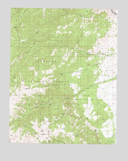
Mount Brigham, UT USGS Topographic Map
Click on map above to begin viewing in our Map Viewer.

This topographic map contains these locations and features:
Feature Name Type Latitude Longitude GNIS ID View Map
Bear HollowValleyN38.4941°W112.3091°1438476View Map
Beaver Creek Recreation SiteLocaleN38.4619°W112.2908°1448121View Map
Beecher RidgeRidgeN38.4261°W112.3210°1438560View Map
Bullion CanyonValleyN38.4180°W112.2996°1439305View Map
Bullion FallsPopulated PlaceN38.4097°W112.3385°1439306View Map
Bullion TrailTrailN38.3966°W112.3655°1439308View Map
Butler Beck CabinLocaleN38.4780°W112.3441°1439388View Map
California GulchValleyN38.4280°W112.2846°1439432View Map
Cascade CreekStreamN38.4100°W112.3385°1439504View Map
Copper Belt PeakSummitN38.4250°W112.3569°1454594View Map
Copper Belt TrailTrailN38.4286°W112.2994°1439943View Map
Deer Creek Guard StationLocaleN38.4672°W112.3649°1440373View Map
Deer Creek TrailTrailN38.4889°W112.3244°1440377View Map
Deer FlatFlatN38.4178°W112.2680°1440378View Map
Deer FlatFlatN38.4978°W112.2860°1440380View Map
Deer Trail MineMineN38.3886°W112.2716°1440402View Map
Deer Trail MountainSummitN38.3839°W112.3069°1440403View Map
Edna PeakSummitN38.3861°W112.3302°1438134View Map
Flood GulchValleyN38.4108°W112.3522°1441146View Map
Gray HillsRangeN38.4778°W112.2952°1448441View Map
Hennessy PointSummitN38.3991°W112.3183°1441707View Map
Horse HeavenSummitN38.3780°W112.3038°1441874View Map
Indian HollowValleyN38.4630°W112.2971°1442004View Map
Jareds ForkStreamN38.4664°W112.3691°1442106View Map
Little MeadowFlatN38.3955°W112.3202°1442739View Map
Mount BrighamSummitN38.3861°W112.3380°1439113View Map
Pete Ritts HollowValleyN38.4875°W112.3341°1444294View Map
Rainbow MineMineN38.4397°W112.3133°1455471View Map
Revenue GulchValleyN38.4575°W112.2633°1444874View Map
Silver King MineMineN38.4814°W112.3710°1455510View Map
Snowslide GulchValleyN38.4319°W112.3730°1445754View Map
South Edna PeakSummitN38.3833°W112.3324°1455520View Map
South Fork Pine CreekStreamN38.3997°W112.3594°1445865View Map
Spring GulchValleyN38.4689°W112.3627°1446030View Map
Staley PastureFlatN38.4608°W112.3710°1451360View Map
Staley PastureFlatN38.4580°W112.3658°1446093View Map
Taylor DitchCanalN38.4422°W112.2630°1455543View Map
The PocketBasinN38.3819°W112.3713°1455464View Map
Threemile CreekStreamN38.4230°W112.2910°1446577View Map
Tie FlatFlatN38.4503°W112.3135°1446593View Map
Town of MarysvaleCivilN38.4383°W112.2545°2412961View Map
Twomile CreekStreamN38.4219°W112.2919°1446819View Map
Warnick GulchValleyN38.4116°W112.3347°1446994View Map

Note: Coordinates in the location and feature list above are referenced to NAD83 datum.


Copyright (C) 2008-2024 Ryan Niemi / Sunset Dynamics ... All Rights Reserved