TopoQuest Logo
Do you find TopoQuest useful?
Help keep TopoQuest running and adding new maps/features by donating!
Bitcoin:  19c7KJd3qBynnjoSw5npx9KScwjBe4ifkT
Litecoin:  LXs6TkuXGGXo1vDsWCkWVdjQX94eUKd6ui
Home View Maps Find Maps Find Places Resources & Links


Mooers, New York Topographic Map

USGS Map Title: Mooers, NY
USGS Map MRC: 44073H5
DRG (GeoTIFF) Download: o44073h5.tif


Neighboring USGS Topographic Map Quads:


  Altona, NY  
44073H6
 

  Mooers, NY  
44073H5
 

  Champlain, NY  
44073H4
 

  Jericho, NY  
44073G6
 

  West Chazy, NY  
44073G5
 

  Beekmantown, NY  
44073G4


Map MRC Location:

N45°
W74°
N45°
W73°
H8 H7 H6 H5 H4 H3 H2 H1
G8 G7 G6 G5 G4 G3 G2 G1
F8 F7 F6 F5 F4 F3 F2 F1
E8 E7 E6 E5 E4 E3 E2 E1
D8 D7 D6 D5 D4 D3 D2 D1
C8 C7 C6 C5 C4 C3 C2 C1
B8 B7 B6 B5 B4 B3 B2 B1
A8 A7 A6 A5 A4 A3 A2 A1
N44°
W74°
N44°
W73°

Mooers, NY USGS 1:24K Topographic Map Preview:
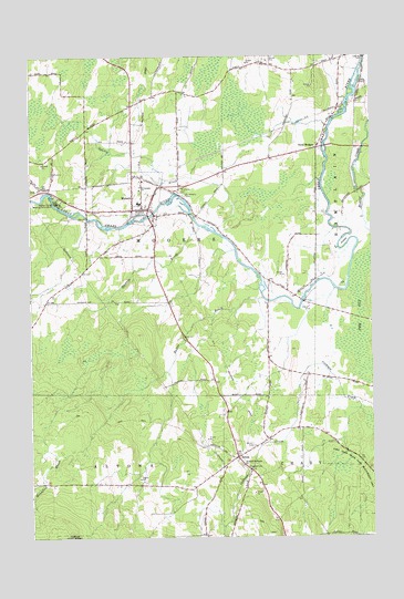
Mooers, NY USGS Topographic Map
Click on map above to begin viewing in our Map Viewer.

This topographic map contains these locations and features:
Feature Name Type Latitude Longitude GNIS ID View Map
Bullis BrookStreamN44.9370°W73.5393°969928View Map
Dragoon CemeteryCemeteryN44.8934°W73.5475°948629View Map
Jennett CemeteryCemeteryN44.8985°W73.5436°953989View Map
Lake Alice State Game Management AreaParkN44.8964°W73.5029°970273View Map
Larato FarmsLocaleN44.9508°W73.5919°2703137View Map
Mills CemeteryCemeteryN44.9931°W73.5031°957348View Map
MooersPopulated PlaceN44.9634°W73.5874°957577View Map
Mooers Camp Meeting AssociationLocaleN44.9623°W73.6146°957578View Map
Mooers Census Designated PlaceCensusN44.9638°W73.5878°2389503View Map
Mooers Elementary SchoolSchoolN44.9620°W73.5850°2597544View Map
Mooers Free LibraryBuildingN44.9607°W73.5821°2598616View Map
Mooers Post OfficePost OfficeN44.9606°W73.5963°2598575View Map
Mooers QuarryMineN44.9197°W73.5833°2559283View Map
Mooers United Methodist ChurchChurchN44.9603°W73.5804°2597567View Map
Mooers Wesleyan ChurchChurchN44.9687°W73.5870°2597568View Map
OxbowBendN44.9517°W73.5096°959707View Map
Riverside CemeteryCemeteryN44.9594°W73.5864°962591View Map
Riverside CemeteryCemeteryN44.9648°W73.5707°962593View Map
Saint Josephs CemeteryCemeteryN44.9646°W73.5700°963742View Map
Saint Josephs ChurchChurchN44.9661°W73.5843°963753View Map
Saint Louis de France ChurchChurchN44.8939°W73.5474°963815View Map
SciolaPopulated PlaceN44.8959°W73.5493°964651View Map
Shedden BrookStreamN44.9559°W73.5626°964990View Map
Sperry BrookStreamN44.9548°W73.5565°965995View Map
Stone CemeteryCemeteryN44.8758°W73.5613°966492View Map
The VlySwampN44.9328°W73.5037°967352View Map
Twin BridgesLocaleN44.9761°W73.5196°968032View Map

Note: Coordinates in the location and feature list above are referenced to NAD83 datum.


Copyright (C) 2008-2024 Ryan Niemi / Sunset Dynamics ... All Rights Reserved