TopoQuest Logo
Do you find TopoQuest useful?
Help keep TopoQuest running and adding new maps/features by donating!
Bitcoin:  19c7KJd3qBynnjoSw5npx9KScwjBe4ifkT
Litecoin:  LXs6TkuXGGXo1vDsWCkWVdjQX94eUKd6ui
Home View Maps Find Maps Find Places Resources & Links


Mistletoe, Kentucky Topographic Map

USGS Map Title: Mistletoe, KY
USGS Map MRC: 37083C5
DRG (GeoTIFF) Download: o37083c5.tif


Neighboring USGS Topographic Map Quads:


  Booneville, KY  
37083D6
 

  Cowcreek, KY  
37083D5
 

  Canoe, KY  
37083D4
 

  Oneida, KY  
37083C6
 

  Mistletoe, KY  
37083C5
 

  Buckhorn, KY  
37083C4
 

  Barcreek, KY  
37083B6
 

  Big Creek, KY  
37083B5
 

  Hyden West, KY  
37083B4


Map MRC Location:

N38°
W84°
N38°
W83°
H8 H7 H6 H5 H4 H3 H2 H1
G8 G7 G6 G5 G4 G3 G2 G1
F8 F7 F6 F5 F4 F3 F2 F1
E8 E7 E6 E5 E4 E3 E2 E1
D8 D7 D6 D5 D4 D3 D2 D1
C8 C7 C6 C5 C4 C3 C2 C1
B8 B7 B6 B5 B4 B3 B2 B1
A8 A7 A6 A5 A4 A3 A2 A1
N37°
W84°
N37°
W83°

Mistletoe, KY USGS 1:24K Topographic Map Preview:
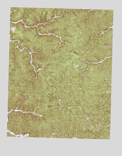
Mistletoe, KY USGS Topographic Map
Click on map above to begin viewing in our Map Viewer.

This topographic map contains these locations and features:
Feature Name Type Latitude Longitude GNIS ID View Map
Bald Head HollowValleyN37.3339°W83.5691°510366View Map
Barbecue BranchStreamN37.2862°W83.5619°510387View Map
Bargers KnobSummitN37.2661°W83.5302°2416548View Map
Barn BranchStreamN37.2729°W83.5913°510406View Map
Beatty ForkStreamN37.3045°W83.5657°510483View Map
Betty Baker BranchStreamN37.3011°W83.5591°2745385View Map
Big BranchStreamN37.3115°W83.5360°510617View Map
Big BranchStreamN37.3277°W83.5677°510619View Map
Big Dan BranchStreamN37.2734°W83.5930°510647View Map
Bill Oak BranchStreamN37.3354°W83.5657°510716View Map
Billy BranchStreamN37.3165°W83.5877°510726View Map
Blue John HollowValleyN37.3256°W83.5134°510804View Map
Board BranchStreamN37.3598°W83.6173°2416550View Map
Brier BranchStreamN37.3270°W83.5644°510918View Map
Bunches BranchStreamN37.3420°W83.6141°511063View Map
Cabin BranchStreamN37.3501°W83.5719°511118View Map
Cherry Tree BranchStreamN37.2837°W83.5869°511323View Map
Cherry Tree KnobSummitN37.2800°W83.5747°2091977View Map
Cherry Tree KnobSummitN37.2815°W83.5677°2416558View Map
Cherry Tree Lookout TowerTowerN37.2798°W83.5754°2543053View Map
Collins BranchStreamN37.2529°W83.5988°511471View Map
Cortland CemeteryCemeteryN37.3489°W83.5460°2416562View Map
Cortland ForkStreamN37.3476°W83.5644°511558View Map
Cortland Post OfficePost OfficeN37.3474°W83.5640°2416563View Map
Cortland SchoolSchoolN37.3498°W83.5460°511559View Map
Couch Fork Neighborhood (historical)Populated PlaceN37.3057°W83.5947°2416564View Map
Couch Town Neighborhood (historical)Populated PlaceN37.3135°W83.5915°2416565View Map
Cowcreek DivisionCivilN37.3742°W83.5996°1936954View Map
DalesburgPopulated PlaceN37.3429°W83.5321°511703View Map
Davis BranchStreamN37.3162°W83.5860°511736View Map
Deep GapGapN37.2912°W83.5121°511766View Map
Deer LickStreamN37.3010°W83.5591°2416567View Map
DoorwayPopulated PlaceN37.2959°W83.5394°511866View Map
Doorway Post Office (historical)Post OfficeN37.2959°W83.5393°2557257View Map
Doorway Post Office (historical)Post OfficeN37.2849°W83.5498°2416355View Map
Downey BranchStreamN37.3237°W83.5130°511882View Map
Drench BranchStreamN37.2712°W83.5844°511884View Map
Drowned BranchStreamN37.3151°W83.5935°511893View Map
Dusty ForkStreamN37.2806°W83.5069°511965View Map
Enoch ForkStreamN37.3240°W83.5305°512078View Map
Falls of BuffaloFallsN37.3497°W83.5454°2416573View Map
Gabbard Post OfficePost OfficeN37.3610°W83.6210°2416575View Map
Gabriel ForkStreamN37.3093°W83.5766°512272View Map
Gay BranchStreamN37.2695°W83.5363°512292View Map
Ground Hog HollowValleyN37.3257°W83.5625°512469View Map
Guy Camp BranchStreamN37.3620°W83.6096°512488View Map
Harrison BranchStreamN37.3312°W83.5996°512572View Map
Highland SchoolSchoolN37.3290°W83.5974°512698View Map
Horn Hill CemeteryCemeteryN37.3720°W83.5838°512787View Map
Jeff BranchStreamN37.2712°W83.5835°512982View Map
Jeff BranchStreamN37.3712°W83.5599°512983View Map
Jesse BranchStreamN37.3493°W83.5771°513002View Map
Joe HollowValleyN37.2861°W83.5313°513020View Map
Joyce ForkStreamN37.3506°W83.5580°513085View Map
Keith BranchStreamN37.2759°W83.6185°513105View Map
Laurel ForkStreamN37.3576°W83.5946°513254View Map
Leatherwood SchoolSchoolN37.2634°W83.5027°517547View Map
Lick BranchStreamN37.3154°W83.5838°513385View Map
Little Bullskin SchoolSchoolN37.2762°W83.6171°513456View Map
Little McJonkin BranchStreamN37.2918°W83.5688°513504View Map
Locust GapGapN37.3745°W83.5782°513563View Map
Long BranchStreamN37.2520°W83.6135°513606View Map
Long ForkStreamN37.2912°W83.5416°513621View Map
Loose Angel CemeteryCemeteryN37.3190°W83.5407°513636View Map
Lower Allen BranchStreamN37.3593°W83.5907°516627View Map
Lower Twin BranchStreamN37.2801°W83.5507°513720View Map
Luck Fork Post Office (historical)Post OfficeN37.3672°W83.5698°2416362View Map
Lucky ForkPopulated PlaceN37.3676°W83.5699°513727View Map
Lucky ForkStreamN37.3576°W83.5946°513728View Map
Lucky Fork SchoolSchoolN37.3676°W83.5649°513729View Map
McJonkin BranchStreamN37.2909°W83.5702°513871View Map
Meadow BranchStreamN37.2754°W83.6130°513887View Map
Meadow ForkStreamN37.2984°W83.5377°513892View Map
Meadow ForkStreamN37.3240°W83.5624°513893View Map
Merill BranchStreamN37.3023°W83.5746°513904View Map
Middle Allen BranchStreamN37.3601°W83.5863°513917View Map
Middle Squabble (historical)Populated PlaceN37.3226°W83.5273°2557333View Map
Middle Squabble ChurchChurchN37.3224°W83.5280°2557332View Map
Middle Squabble SchoolSchoolN37.3234°W83.5185°513949View Map
Mike BranchStreamN37.3393°W83.5632°513956View Map
Mill Timber BranchStreamN37.3115°W83.5788°514001View Map
MistletoePopulated PlaceN37.3126°W83.5916°514032View Map
Mistletoe Post OfficePost OfficeN37.3126°W83.5919°2416591View Map
Morris Fork CemeteryCemeteryN37.3748°W83.5266°514071View Map
New Hope ChurchChurchN37.2519°W83.6042°2091976View Map
New Hope SchoolSchoolN37.2520°W83.6038°514242View Map
Newberry ForkStreamN37.2637°W83.5030°514256View Map
Panther ForkCapeN37.2940°W83.5424°514430View Map
Pig Pen BranchStreamN37.3240°W83.5624°514540View Map
Pig Pen ForkStreamN37.2779°W83.5107°514541View Map
Poplar HollowValleyN37.3413°W83.5641°514715View Map
Rattlesnake CreekStreamN37.3370°W83.6144°514845View Map
Riley CemeteryCemeteryN37.3531°W83.5132°514966View Map
Rockhouse BranchStreamN37.3134°W83.5924°515041View Map
Rockhouse Neighborhood (historical)Populated PlaceN37.3071°W83.5930°2416329View Map
Rockhouse SchoolSchoolN37.3073°W83.5927°515049View Map
Sandlin SchoolSchoolN37.3479°W83.5246°515238View Map
Schoolhouse BranchStreamN37.2812°W83.5541°515285View Map
SebastianPopulated PlaceN37.3609°W83.6202°515313View Map
Sebastian Post Office (historical)Post OfficeN37.3608°W83.6213°2416365View Map
Seng CoveValleyN37.3285°W83.5687°515323View Map
Seth Post Office (historical)Post OfficeN37.2565°W83.6230°2543144View Map
Spruce Pine ForkStreamN37.3231°W83.5277°515629View Map
Stable BranchStreamN37.3431°W83.5594°515644View Map
Stable Hollow BranchStreamN37.2531°W83.6071°515647View Map
Stamper BranchStreamN37.3679°W83.5627°515652View Map
Stamper SchoolSchoolN37.3568°W83.5052°515656View Map
Steel Trap BranchStreamN37.3673°W83.5707°515678View Map
Still House HollowValleyN37.2961°W83.5680°515704View Map
Sugar Camp BranchStreamN37.2743°W83.6046°515782View Map
Toenail HollowValleyN37.2775°W83.5393°515962View Map
Trace BranchStreamN37.3493°W83.5877°516003View Map
Trace BranchStreamN37.3565°W83.6013°516005View Map
Upper Allen BranchStreamN37.3604°W83.5819°516104View Map
Upper Squabble (historical)Populated PlaceN37.2884°W83.5447°2557246View Map
Upper Twin BranchStreamN37.2798°W83.5496°516160View Map
Watches ForkStreamN37.3431°W83.5594°516241View Map
Wheatfield BranchStreamN37.3506°W83.5899°516283View Map
WhoopflareaPopulated PlaceN37.2979°W83.5680°516350View Map
WhoopflareaRidgeN37.2748°W83.5348°2416346View Map
Whoopflarea Post OfficePost OfficeN37.2814°W83.5593°2416347View Map

Note: Coordinates in the location and feature list above are referenced to NAD83 datum.


Copyright (C) 2008-2024 Ryan Niemi / Sunset Dynamics ... All Rights Reserved