TopoQuest Logo
Do you find TopoQuest useful?
Help keep TopoQuest running and adding new maps/features by donating!
Bitcoin:  19c7KJd3qBynnjoSw5npx9KScwjBe4ifkT
Litecoin:  LXs6TkuXGGXo1vDsWCkWVdjQX94eUKd6ui
Home View Maps Find Maps Find Places Resources & Links


Millersburg, Kentucky Topographic Map

USGS Map Title: Millersburg, KY
USGS Map MRC: 38084C2
DRG (GeoTIFF) Download: o38084c2.tif


Neighboring USGS Topographic Map Quads:


  Cynthiana, KY  
38084D3
 

  Shady Nook, KY  
38084D2
 

  Piqua, KY  
38084D1
 

  Shawhan, KY  
38084C3
 

  Millersburg, KY  
38084C2
 

  Carlisle, KY  
38084C1
 

  Paris West, KY  
38084B3
 

  Paris East, KY  
38084B2
 

  North Middletown, KY  
38084B1


Map MRC Location:

N39°
W85°
N39°
W84°
H8 H7 H6 H5 H4 H3 H2 H1
G8 G7 G6 G5 G4 G3 G2 G1
F8 F7 F6 F5 F4 F3 F2 F1
E8 E7 E6 E5 E4 E3 E2 E1
D8 D7 D6 D5 D4 D3 D2 D1
C8 C7 C6 C5 C4 C3 C2 C1
B8 B7 B6 B5 B4 B3 B2 B1
A8 A7 A6 A5 A4 A3 A2 A1
N38°
W85°
N38°
W84°

Millersburg, KY USGS 1:24K Topographic Map Preview:
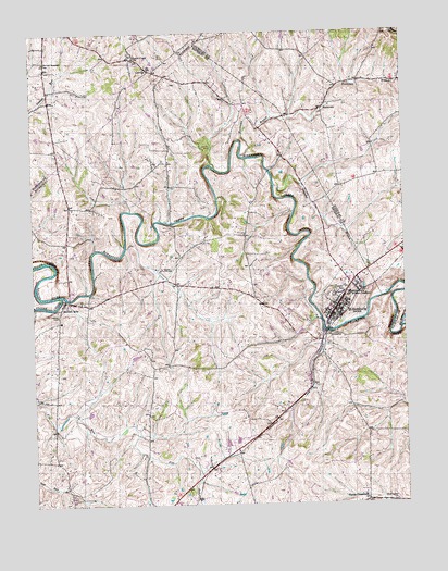
Millersburg, KY USGS Topographic Map
Click on map above to begin viewing in our Map Viewer.

This topographic map contains these locations and features:
Feature Name Type Latitude Longitude GNIS ID View Map
Big Brushy CreekStreamN38.2965°W84.1260°487147View Map
Blacks CrossroadsPopulated PlaceN38.2509°W84.1383°507520View Map
City of MillersburgCivilN38.3041°W84.1450°2404264View Map
ColvillePopulated PlaceN38.3654°W84.2102°507735View Map
Colville Post Office (historical)Post OfficeN38.3658°W84.2106°2564172View Map
Herrington ChurchChurchN38.2506°W84.1288°494089View Map
Hinkston CreekStreamN38.3054°W84.2405°494298View Map
HooktownPopulated PlaceN38.3545°W84.1516°508274View Map
Hooktown BranchStreamN38.3423°W84.1791°494504View Map
Hooktown Post Office (historical)Post OfficeN38.3543°W84.1521°2555863View Map
Indian Creek ChurchChurchN38.3684°W84.2147°494941View Map
Irish Railroad Station (historical)LocaleN38.3123°W84.1287°2555562View Map
Laysons BranchStreamN38.3342°W84.1680°496103View Map
MillersburgPopulated PlaceN38.3020°W84.1474°498363View Map
Millersburg DivisionCivilN38.2887°W84.1896°1937146View Map
Millersburg Fire and RescueBuildingN38.3014°W84.1516°2636393View Map
Millersburg Military Academy (historical)SchoolN38.3054°W84.1435°498365View Map
Millersburg Police DepartmentBuildingN38.3058°W84.1454°2767678View Map
Old East Broadwell CemeteryCemeteryN38.3670°W84.2452°499821View Map
Pleasant Hill (historical)LocaleN38.3652°W84.2084°2564113View Map
Pleasant Hill Farm (historical)LocaleN38.3537°W84.1637°2555862View Map
Ruddels Mill CemeteryCemeteryN38.3003°W84.2416°499832View Map
Ruddels MillsPopulated PlaceN38.3042°W84.2380°502455View Map
Stoner CreekStreamN38.3054°W84.2405°504482View Map
Walnut GroveLocaleN38.3410°W84.1509°2555571View Map

Note: Coordinates in the location and feature list above are referenced to NAD83 datum.


Copyright (C) 2008-2024 Ryan Niemi / Sunset Dynamics ... All Rights Reserved