TopoQuest Logo
Do you find TopoQuest useful?
Help keep TopoQuest running and adding new maps/features by donating!
Bitcoin:  19c7KJd3qBynnjoSw5npx9KScwjBe4ifkT
Litecoin:  LXs6TkuXGGXo1vDsWCkWVdjQX94eUKd6ui
Home View Maps Find Maps Find Places Resources & Links


Milan West, Missouri Topographic Map

USGS Map Title: Milan West, MO
USGS Map MRC: 40093B2
DRG (GeoTIFF) Download: o40093b2.tif


Neighboring USGS Topographic Map Quads:


  Harris, MO  
40093C3
 

  Pollock SW, MO  
40093C2
 

  Pollock, MO  
40093C1
 

  Osgood, MO  
40093B3
 

  Milan West, MO  
40093B2
 

  Milan East, MO  
40093B1
 

  Lindley, MO  
40093A3
 

  Browning, MO  
40093A2
 

  Milan SE, MO  
40093A1


Map MRC Location:

N41°
W94°
N41°
W93°
H8 H7 H6 H5 H4 H3 H2 H1
G8 G7 G6 G5 G4 G3 G2 G1
F8 F7 F6 F5 F4 F3 F2 F1
E8 E7 E6 E5 E4 E3 E2 E1
D8 D7 D6 D5 D4 D3 D2 D1
C8 C7 C6 C5 C4 C3 C2 C1
B8 B7 B6 B5 B4 B3 B2 B1
A8 A7 A6 A5 A4 A3 A2 A1
N40°
W94°
N40°
W93°

Milan West, MO USGS 1:24K Topographic Map Preview:
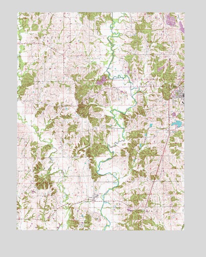
Milan West, MO USGS Topographic Map
Click on map above to begin viewing in our Map Viewer.

This topographic map contains these locations and features:
Feature Name Type Latitude Longitude GNIS ID View Map
Booth LakeReservoirN40.1800°W93.1535°760829View Map
Booth Lake DamDamN40.1800°W93.1535°760828View Map
Cowgill-Roemer AirportAirportN40.1783°W93.1301°758811View Map
Detwilder Lake DamDamN40.2167°W93.1685°760844View Map
Detwiller LakeReservoirN40.2164°W93.1669°760845View Map
Dickson Lake DamDamN40.1850°W93.1502°760846View Map
Eddys Lake DamDamN40.1934°W93.1335°761759View Map
Eggleston School (historical)SchoolN40.1659°W93.2438°733931View Map
Forest Grove ParkParkN40.2072°W93.1258°718084View Map
Glaze CemeteryCemeteryN40.1520°W93.2263°718492View Map
Gose School (historical)SchoolN40.2331°W93.1608°733932View Map
Henry CemeteryCemeteryN40.1286°W93.1991°719379View Map
Ischan Lake DamDamN40.1384°W93.1685°761754View Map
Lovell CemeteryCemeteryN40.2392°W93.1588°721621View Map
McClaskey School (historical)SchoolN40.2042°W93.1752°733933View Map
MilanPopulated PlaceN40.2022°W93.1252°722309View Map
Moggart School (historical)SchoolN40.1486°W93.1510°733935View Map
Mount Vernon School (historical)SchoolN40.1775°W93.1605°733934View Map
Pickering Lake DamDamN40.2050°W93.1719°762342View Map
RegerPopulated PlaceN40.1439°W93.1927°725204View Map
Shatto CemeteryCemeteryN40.1914°W93.2041°726282View Map
Shatto DamDamN40.1867°W93.1269°760297View Map
Shatto LakeReservoirN40.1861°W93.1302°760298View Map
Sterling School (historical)SchoolN40.2300°W93.2255°733929View Map
Sullivan ChurchChurchN40.1953°W93.2041°727270View Map
Sullivan County Memorial HospitalHospitalN40.2015°W93.1337°2655033View Map
Wilhite CemeteryCemeteryN40.1961°W93.2185°728857View Map
Wilhite School (historical)SchoolN40.1892°W93.2180°733930View Map

Note: Coordinates in the location and feature list above are referenced to NAD83 datum.


Copyright (C) 2008-2024 Ryan Niemi / Sunset Dynamics ... All Rights Reserved