TopoQuest Logo
Do you find TopoQuest useful?
Help keep TopoQuest running and adding new maps/features by donating!
Bitcoin:  19c7KJd3qBynnjoSw5npx9KScwjBe4ifkT
Litecoin:  LXs6TkuXGGXo1vDsWCkWVdjQX94eUKd6ui
Home View Maps Find Maps Find Places Resources & Links


Milan East, Missouri Topographic Map

USGS Map Title: Milan East, MO
USGS Map MRC: 40093B1
DRG (GeoTIFF) Download: o40093b1.tif


Neighboring USGS Topographic Map Quads:


  Pollock SW, MO  
40093C2
 

  Pollock, MO  
40093C1
 

  Green City, MO  
40092C8
 

  Milan West, MO  
40093B2
 

  Milan East, MO  
40093B1
 

  Mystic, MO  
40092B8
 

  Browning, MO  
40093A2
 

  Milan SE, MO  
40093A1
 

  Winigan, MO  
40092A8


Map MRC Location:

N41°
W94°
N41°
W93°
H8 H7 H6 H5 H4 H3 H2 H1
G8 G7 G6 G5 G4 G3 G2 G1
F8 F7 F6 F5 F4 F3 F2 F1
E8 E7 E6 E5 E4 E3 E2 E1
D8 D7 D6 D5 D4 D3 D2 D1
C8 C7 C6 C5 C4 C3 C2 C1
B8 B7 B6 B5 B4 B3 B2 B1
A8 A7 A6 A5 A4 A3 A2 A1
N40°
W94°
N40°
W93°

Milan East, MO USGS 1:24K Topographic Map Preview:
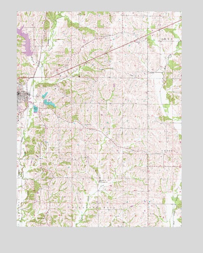
Milan East, MO USGS Topographic Map
Click on map above to begin viewing in our Map Viewer.

This topographic map contains these locations and features:
Feature Name Type Latitude Longitude GNIS ID View Map
City of MilanCivilN40.2031°W93.1241°2395320View Map
City of Milan LakeReservoirN40.2013°W93.1039°760833View Map
Deep Spring CemeteryCemeteryN40.1300°W93.1041°716786View Map
Elmwood BranchStreamN40.2172°W93.1066°717550View Map
Elmwood City Lake DamDamN40.2250°W93.1152°760589View Map
Frazier School (historical)SchoolN40.2303°W93.1127°733936View Map
Hickory Grove CemeteryCemeteryN40.1508°W93.0630°719459View Map
Hickory Grove School (historical)SchoolN40.1528°W93.0627°733939View Map
Holly Hill School (historical)SchoolN40.2153°W93.0349°733943View Map
Ivy Hill School (historical)SchoolN40.2395°W93.0177°733941View Map
Lee School (historical)SchoolN40.1253°W93.0694°733940View Map
Marlay CemeteryCemeteryN40.1675°W93.1227°721885View Map
Milan Fire DepartmentBuildingN40.2013°W93.1241°2620251View Map
Milan Lake Dam - South DamDamN40.1984°W93.1035°760830View Map
Milan Lake Dam-North DamDamN40.2000°W93.1052°760832View Map
Milan Police DepartmentBuildingN40.2027°W93.1238°2752378View Map
Milan Post OfficePost OfficeN40.2010°W93.1249°2782714View Map
Mount Moriah ChurchChurchN40.1522°W93.0633°722790View Map
Mount Olive CemeteryCemeteryN40.1675°W93.0158°722803View Map
New Milan ReservoirReservoirN40.2308°W93.1169°760590View Map
Number 41 LakeReservoirN40.1984°W93.1035°760831View Map
Oak Grove CemeteryCemeteryN40.1845°W93.0749°723569View Map
Oak Grove School (historical)SchoolN40.1828°W93.0733°733937View Map
Payne CemeteryCemeteryN40.2358°W93.0583°724119View Map
Payne School (historical)SchoolN40.2353°W93.0597°733942View Map
Pleasant Grove School (historical)SchoolN40.1486°W93.1010°733938View Map
Prairie Flower School (historical)SchoolN40.1522°W93.0255°733945View Map
SorrellPopulated PlaceN40.2150°W93.0205°741272View Map
Sorrell Post OfficePost OfficeN40.2150°W93.0205°760185View Map
Sullivan CountyCivilN40.2106°W93.1115°758558View Map
Sullivan County Sheriff's OfficeBuildingN40.2025°W93.1249°2752316View Map
Sunny Ridge School (historical)SchoolN40.1820°W93.0272°733944View Map
Township of PolkCivilN40.2040°W93.1115°767450View Map

Note: Coordinates in the location and feature list above are referenced to NAD83 datum.


Copyright (C) 2008-2024 Ryan Niemi / Sunset Dynamics ... All Rights Reserved