TopoQuest Logo
Do you find TopoQuest useful?
Help keep TopoQuest running and adding new maps/features by donating!
Bitcoin:  19c7KJd3qBynnjoSw5npx9KScwjBe4ifkT
Litecoin:  LXs6TkuXGGXo1vDsWCkWVdjQX94eUKd6ui
Home View Maps Find Maps Find Places Resources & Links


Bearhead Mountain, Washington Topographic Map

USGS Map Title: Bearhead Mountain, WA
USGS Map MRC: 47121A7
DRG (GeoTIFF) Download: o47121a7.tif


Neighboring USGS Topographic Map Quads:


  Enumclaw, WA  
47121B8
 

  Cyclone Creek, WA  
47121B7
 

  Greenwater, WA  
47121B6
 

  Old Baldy Mountain, WA  
47121A8
 

  Bearhead Mountain, WA  
47121A7
 

  Clear West Peak, WA  
47121A6
 

  Golden Lakes, WA  
46121H8
 

  Mowich Lake, WA  
46121H7
 

  Sunrise, WA  
46121H6


Map MRC Location:

N48°
W122°
N48°
W121°
H8 H7 H6 H5 H4 H3 H2 H1
G8 G7 G6 G5 G4 G3 G2 G1
F8 F7 F6 F5 F4 F3 F2 F1
E8 E7 E6 E5 E4 E3 E2 E1
D8 D7 D6 D5 D4 D3 D2 D1
C8 C7 C6 C5 C4 C3 C2 C1
B8 B7 B6 B5 B4 B3 B2 B1
A8 A7 A6 A5 A4 A3 A2 A1
N47°
W122°
N47°
W121°

Bearhead Mountain, WA USGS 1:24K Topographic Map Preview:
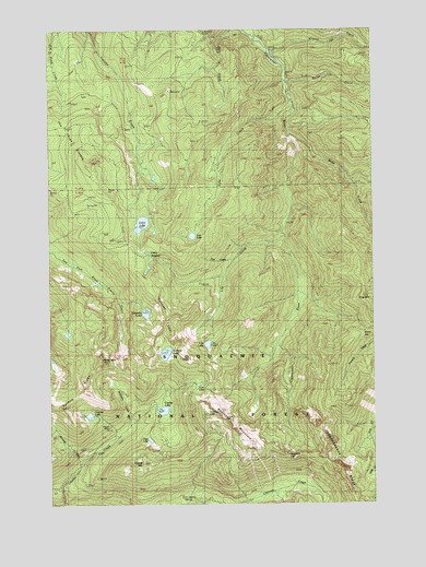
Bearhead Mountain, WA USGS Topographic Map
Click on map above to begin viewing in our Map Viewer.

This topographic map contains these locations and features:
Feature Name Type Latitude Longitude GNIS ID View Map
Bearhead MountainSummitN47.0232°W121.8151°1516300View Map
Byron CreekStreamN47.1098°W121.7843°1517179View Map
Carbon TrailTrailN47.0340°W121.7837°1517389View Map
Cayada MountainSummitN47.0107°W121.8401°1517517View Map
Cedar LakeLakeN47.0738°W121.8403°1517569View Map
Celery MeadowFlatN47.0665°W121.8390°1517584View Map
Clearwater TrailTrailN47.0612°W121.7807°1517848View Map
Clearwater WildernessReserveN47.0405°W121.8108°1530043View Map
Clipper MineMineN47.0204°W121.8532°1517867View Map
Coplay LakeLakeN47.0247°W121.8326°1518064View Map
Copper King MineMineN47.0323°W121.8315°1518084View Map
Coundly LakeLakeN47.0503°W121.8389°1518201View Map
Double Camp ShelterLocaleN47.0423°W121.7682°1518886View Map
Dry CampLocaleN47.0529°W121.7632°1518935View Map
East LakeLakeN47.0169°W121.8379°1519134View Map
Falls CreekStreamN47.1248°W121.8004°1519462View Map
Frog MountainSummitN47.0540°W121.7520°1519827View Map
Hurricane GapGapN47.0121°W121.7848°1521091View Map
Kennedy CreekStreamN47.0109°W121.8634°1521612View Map
Lily CreekStreamN47.0707°W121.7848°1522096View Map
Lily LakeLakeN47.0420°W121.8153°1522099View Map
Lyle CreekStreamN47.1045°W121.7820°1522590View Map
Lyle LakeLakeN47.0705°W121.8208°1522591View Map
Martin GapGapN47.0457°W121.7545°1522768View Map
McGilvery CreekStreamN47.0218°W121.8443°1522898View Map
Milky CreekStreamN47.0968°W121.7832°1523143View Map
Mineral CreekStreamN47.1176°W121.7895°1523211View Map
Pitcher MountainSummitN47.0379°W121.8559°1524490View Map
Queen Bee MineMineN47.0287°W121.8470°1524755View Map
Rooster CombRidgeN47.0504°W121.8293°1525204View Map
Summit LakeLakeN47.0397°W121.8315°1526715View Map
Summit Lake TrailTrailN47.0601°W121.8404°1526721View Map
Surprise LakeLakeN47.0233°W121.8609°1526791View Map
Test CreekStreamN47.0643°W121.8043°1527018View Map
Twin LakeLakeN47.0313°W121.8191°1527533View Map
W-E Camp ShelterLocaleN47.0157°W121.7843°1527739View Map

Note: Coordinates in the location and feature list above are referenced to NAD83 datum.


Copyright (C) 2008-2024 Ryan Niemi / Sunset Dynamics ... All Rights Reserved