TopoQuest Logo
Do you find TopoQuest useful?
Help keep TopoQuest running and adding new maps/features by donating!
Bitcoin:  19c7KJd3qBynnjoSw5npx9KScwjBe4ifkT
Litecoin:  LXs6TkuXGGXo1vDsWCkWVdjQX94eUKd6ui
Home View Maps Find Maps Find Places Resources & Links


Bear Valley, California Topographic Map

USGS Map Title: Bear Valley, CA
USGS Map MRC: 37120E1
DRG (GeoTIFF) Download: o37120e1.tif


Neighboring USGS Topographic Map Quads:


  Coulterville, CA  
37120F2
 

  Buckhorn Peak, CA  
37120F1
 

  Kinsley, CA  
37119F8
 

  Hornitos, CA  
37120E2
 

  Bear Valley, CA  
37120E1
 

  Feliciana Mountain, CA  
37119E8
 

  Indian Gulch, CA  
37120D2
 

  Catheys Valley, CA  
37120D1
 

  Mariposa, CA  
37119D8


Map MRC Location:

N38°
W121°
N38°
W120°
H8 H7 H6 H5 H4 H3 H2 H1
G8 G7 G6 G5 G4 G3 G2 G1
F8 F7 F6 F5 F4 F3 F2 F1
E8 E7 E6 E5 E4 E3 E2 E1
D8 D7 D6 D5 D4 D3 D2 D1
C8 C7 C6 C5 C4 C3 C2 C1
B8 B7 B6 B5 B4 B3 B2 B1
A8 A7 A6 A5 A4 A3 A2 A1
N37°
W121°
N37°
W120°

Bear Valley, CA USGS 1:24K Topographic Map Preview:
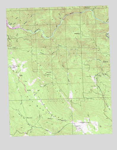
Bear Valley, CA USGS Topographic Map
Click on map above to begin viewing in our Map Viewer.

This topographic map contains these locations and features:
Feature Name Type Latitude Longitude GNIS ID View Map
Bear ValleyPopulated PlaceN37.5688°W120.1193°1659693View Map
Bear Valley Census Designated PlaceCensusN37.5671°W120.1230°2582941View Map
Bear Valley SchoolSchoolN37.5688°W120.1171°233472View Map
Bear Valley Sub-StationLocaleN37.5863°W120.1249°1654441View Map
Bonds Store (historical)LocaleN37.6049°W120.1146°1958577View Map
Bullion KnobSummitN37.5344°W120.0305°1958578View Map
Bullion MountainSummitN37.5591°W120.0763°233574View Map
Cow and Calf GulchValleyN37.5074°W120.0988°233730View Map
David GulchValleyN37.6060°W120.1185°266622View Map
Department of Forestry and Fire Protection Mount Bullion Conservation CampBuildingN37.5361°W120.0496°2623959View Map
Diltz MineMineN37.5585°W120.0068°233787View Map
Drunken GulchValleyN37.5872°W120.0638°233797View Map
Fremont PeakSummitN37.5594°W120.0763°233903View Map
Fremont SpringSpringN37.5619°W120.0735°233906View Map
French MineMineN37.5944°W120.1007°233908View Map
Golden Key MineMineN37.5572°W120.0157°233937View Map
Good GulchValleyN37.6083°W120.0035°233348View Map
Green GulchValleyN37.5085°W120.0949°233954View Map
Half Way GulchValleyN37.5377°W120.0991°233975View Map
Hall GulchValleyN37.6202°W120.0218°1662275View Map
Halls GulchValleyN37.6202°W120.0216°252560View Map
Josephine MineMineN37.5874°W120.1202°234097View Map
KCIV-FM (Mount Bullion)TowerN37.5333°W120.0257°1662979View Map
KEFR-FM (Le Grand)TowerN37.5335°W120.0316°1662918View Map
KHRA-FM (Mariposa)TowerN37.5333°W120.0257°1662961View Map
KMPO-FM (Modesto)TowerN37.5333°W120.0257°1662972View Map
KUBB-FM (Mariposa)TowerN37.5333°W120.0257°1662962View Map
Las MariposasCivilN37.5266°W120.0971°266897View Map
Lyons GulchValleyN37.5827°W120.0530°234218View Map
Mariposa County Fire Department Company 25 Mount Bullion / AirportBuildingN37.5090°W120.0383°2624309View Map
Mariposa County LandfillLocaleN37.5031°W120.0075°2726525View Map
Mariposa-Yosemite AirportAirportN37.5098°W120.0393°1653726View Map
May RockPillarN37.5446°W120.0988°234254View Map
McCabe FlatFlatN37.5969°W120.0030°234259View Map
Mount BullionPopulated PlaceN37.5072°W120.0449°233575View Map
Mount Bullion Census Designated PlaceCensusN37.5069°W120.0478°2628762View Map
Mount Bullion Youth Conservation CampLocaleN37.5360°W120.0502°1809328View Map
Mount OphirLocaleN37.5147°W120.0646°234336View Map
Mountain King MineMineN37.6238°W120.0313°234338View Map
North Fork Merced RiverStreamN37.6127°W120.0588°267075View Map
Norwegian GulchValleyN37.5177°W120.0896°234388View Map
Nutmeg MineMineN37.5560°W120.0252°234392View Map
Pendola GardensLocaleN37.5180°W120.1052°234447View Map
Permit MineMineN37.5469°W120.0207°234450View Map
Pine Tree MineMineN37.5949°W120.1230°234480View Map
Rocky GulchValleyN37.6052°W120.1096°234584View Map
Sherlock CreekStreamN37.5977°W120.0710°267238View Map
Solomon GulchValleyN37.6052°W120.1077°267387View Map
Telegraph HillSummitN37.5983°W120.0371°236083View Map
Trabucco GardensLocaleN37.5599°W120.1130°236496View Map
Washington FlatFlatN37.6083°W120.1227°237275View Map
Whiskey FlatFlatN37.5699°W120.0110°237614View Map
Whitlock CreekStreamN37.5594°W120.0132°237703View Map

Note: Coordinates in the location and feature list above are referenced to NAD83 datum.


Copyright (C) 2008-2024 Ryan Niemi / Sunset Dynamics ... All Rights Reserved