TopoQuest Logo
Do you find TopoQuest useful?
Help keep TopoQuest running and adding new maps/features by donating!
Bitcoin:  19c7KJd3qBynnjoSw5npx9KScwjBe4ifkT
Litecoin:  LXs6TkuXGGXo1vDsWCkWVdjQX94eUKd6ui
Home View Maps Find Maps Find Places Resources & Links


McCargoe Cove, Michigan Topographic Map

USGS Map Title: McCargoe Cove, MI
USGS Map MRC: 48088A6
DRG (GeoTIFF) Download: o48088a6.tif


Neighboring USGS Topographic Map Quads:


  McCargoe Cove, MI  
48088A6


Map MRC Location:

N49°
W89°
N49°
W88°
H8 H7 H6 H5 H4 H3 H2 H1
G8 G7 G6 G5 G4 G3 G2 G1
F8 F7 F6 F5 F4 F3 F2 F1
E8 E7 E6 E5 E4 E3 E2 E1
D8 D7 D6 D5 D4 D3 D2 D1
C8 C7 C6 C5 C4 C3 C2 C1
B8 B7 B6 B5 B4 B3 B2 B1
A8 A7 A6 A5 A4 A3 A2 A1
N48°
W89°
N48°
W88°

McCargoe Cove, MI USGS 1:24K Topographic Map Preview:
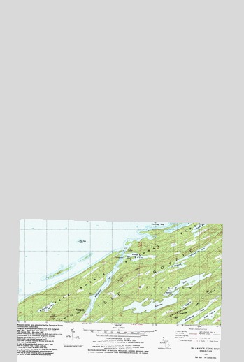
McCargoe Cove, MI USGS Topographic Map
Click on map above to begin viewing in our Map Viewer.

This topographic map contains these locations and features:
Feature Name Type Latitude Longitude GNIS ID View Map
Amygdaloid ArchArchN48.1481°W88.6281°2701939View Map
Amygdaloid LakeLakeN48.1461°W88.6354°1618260View Map
Angleworm LakeLakeN48.0839°W88.6492°1618261View Map
Birch IslandIslandN48.1108°W88.6847°2097222View Map
Birch Island CampgroundLocaleN48.1096°W88.6867°1618263View Map
Brady CoveBayN48.1104°W88.6787°1618266View Map
Hawk IslandIslandN48.1032°W88.7256°1618278View Map
Herring BayBayN48.1260°W88.6631°1618279View Map
Indian PointCapeN48.1121°W88.6848°1618280View Map
Kjaringa KjeftBayN48.1332°W88.6670°1618283View Map
Lake BensonLakeN48.0874°W88.6316°1618262View Map
Lake EvaLakeN48.1236°W88.6393°1618272View Map
Lake ShesheebLakeN48.1072°W88.6519°1618309View Map
Lake WagejoLakeN48.0914°W88.6460°1618314View Map
Linklater LakeLakeN48.1127°W88.6415°1618286View Map
McCargoe CoveBayN48.0988°W88.6973°1618290View Map
McCargoe Cove CampgroundLocaleN48.0868°W88.7092°1618291View Map
McDonald LakeLakeN48.0888°W88.7320°1618292View Map
Minong MineMineN48.0838°W88.7259°1618293View Map
Minong Post Office (historical)Post OfficeN48.1117°W88.6906°2112156View Map
Ollies Dogs RocksIslandN48.1160°W88.7156°1618298View Map
Pickerel CoveBayN48.1288°W88.6378°1618300View Map
Pine MountainSummitN48.0844°W88.7283°1618301View Map
Round IslandIslandN48.1274°W88.6734°1618305View Map
Sargent LakeLakeN48.0924°W88.6583°1618307View Map
Stanley RidgeRidgeN48.1027°W88.6841°1618311View Map
The NarrowsChannelN48.0961°W88.6553°2097221View Map

Note: Coordinates in the location and feature list above are referenced to NAD83 datum.


Copyright (C) 2008-2024 Ryan Niemi / Sunset Dynamics ... All Rights Reserved