TopoQuest Logo
Do you find TopoQuest useful?
Help keep TopoQuest running and adding new maps/features by donating!
Bitcoin:  19c7KJd3qBynnjoSw5npx9KScwjBe4ifkT
Litecoin:  LXs6TkuXGGXo1vDsWCkWVdjQX94eUKd6ui
Home View Maps Find Maps Find Places Resources & Links


Marial, Oregon Topographic Map

USGS Map Title: Marial, OR
USGS Map MRC: 42123F8
DRG (GeoTIFF) Download: o42123f8.tif


Neighboring USGS Topographic Map Quads:


  China Flat, OR  
42124G1
 

  Eden Valley, OR  
42123G8
 

  Mount Bolivar, OR  
42123G7
 

  Illahe, OR  
42124F1
 

  Marial, OR  
42123F8
 

  Kelsey Peak, OR  
42123F7
 

  Agness, OR  
42124E1
 

  Brandy Peak, OR  
42123E8
 

  Hobson Horn, OR  
42123E7


Map MRC Location:

N43°
W124°
N43°
W123°
H8 H7 H6 H5 H4 H3 H2 H1
G8 G7 G6 G5 G4 G3 G2 G1
F8 F7 F6 F5 F4 F3 F2 F1
E8 E7 E6 E5 E4 E3 E2 E1
D8 D7 D6 D5 D4 D3 D2 D1
C8 C7 C6 C5 C4 C3 C2 C1
B8 B7 B6 B5 B4 B3 B2 B1
A8 A7 A6 A5 A4 A3 A2 A1
N42°
W124°
N42°
W123°

Marial, OR USGS 1:24K Topographic Map Preview:
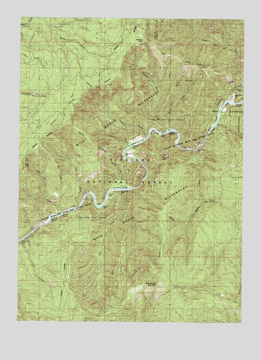
Marial, OR USGS Topographic Map
Click on map above to begin viewing in our Map Viewer.

This topographic map contains these locations and features:
Feature Name Type Latitude Longitude GNIS ID View Map
Blossom BarBarN42.7023°W123.9215°1138274View Map
Blossom Bar CreekStreamN42.7034°W123.9168°1161278View Map
Blossom Bar RapidsRapidsN42.7026°W123.9187°1154270View Map
Blossom Bar Recreation SiteLocaleN42.7037°W123.9179°1167131View Map
Bobs Garden MountainSummitN42.6400°W123.9237°1138373View Map
Bobs Garden TrailTrailN42.6329°W123.9401°1138374View Map
Brushy BarBarN42.6793°W123.9470°1138705View Map
Brushy Bar CreekStreamN42.6798°W123.9445°1138726View Map
Brushy Bar Recreation SiteLocaleN42.6823°W123.9448°1155702View Map
Brushy Bar RiffleRapidsN42.6796°W123.9443°1159146View Map
Burns CreekStreamN42.7046°W123.9159°1138978View Map
Camp TacomaLocaleN42.6723°W123.9693°1116489View Map
China Bar RapidsRapidsN42.7151°W123.8804°1154286View Map
Clay HillRidgeN42.6893°W123.9798°1139769View Map
Clay Hill CemeteryCemeteryN42.6696°W123.9815°1156910View Map
Clay Hill CreekStreamN42.6707°W123.9787°1139770View Map
Clay Hill RapidsRapidsN42.6665°W123.9834°1154275View Map
Clay Hill StillwaterAreaN42.6590°W123.9981°1159363View Map
CoffeepotRapidsN42.6987°W123.8987°1116485View Map
Devils BackboneRidgeN42.6937°W123.9481°1140937View Map
Devils StairsRapidsN42.7012°W123.9295°1154291View Map
Dostler CreekStreamN42.7054°W123.8915°1154370View Map
East CreekStreamN42.6790°W123.9390°1141518View Map
East Creek Recreation SiteLocaleN42.6790°W123.9445°1167132View Map
East Mule Recreation SiteLocaleN42.7154°W123.8820°1167128View Map
Fall CreekStreamN42.6573°W123.9998°1141963View Map
Gleason BarBarN42.7034°W123.9237°1116487View Map
Gleason Bar Recreation SiteLocaleN42.7023°W123.9220°1167130View Map
Half Moon BarBarN42.6934°W123.9420°1143205View Map
Half Moon RiffleRapidsN42.6934°W123.9423°1116482View Map
Hanging RockSummitN42.7399°W123.9322°1161385View Map
Huggins CanyonValleyN42.6804°W123.9359°1161646View Map
Inspiration PointCliffN42.6965°W123.9040°1144101View Map
Jackson CreekStreamN42.6971°W123.9373°1161400View Map
MarialPopulated PlaceN42.7123°W123.8890°1145806View Map
Marial LodgeLocaleN42.7121°W123.8906°1167134View Map
Marial Post Office (historical)Post OfficeN42.7123°W123.8890°1165586View Map
Marks CreekStreamN42.7123°W123.8901°1154367View Map
Mule Creek CanyonValleyN42.7165°W123.8845°1154298View Map
Mule Creek CemeteryCemeteryN42.7080°W123.8932°1116490View Map
Mule MountainSummitN42.7305°W123.9098°1146639View Map
NarrowsRapidsN42.7065°W123.8915°1116484View Map
Panther CreekStreamN42.7498°W123.9937°1147390View Map
Panther RidgeRidgeN42.6968°W123.9898°1147402View Map
Paradise BarBarN42.6979°W123.9345°1147412View Map
Paradise CreekStreamN42.7012°W123.9284°1147414View Map
Paradise RiffleRapidsN42.6976°W123.9381°1116486View Map
Pinnacle PointSummitN42.6926°W123.9218°1147746View Map
Price CreekStreamN42.7207°W123.8818°1154369View Map
Rocky Bar CreekStreamN42.7137°W123.8873°1154368View Map
Rogue River RanchLocaleN42.7184°W123.8815°1116481View Map
Shasta Costa OverlookLocaleN42.6334°W123.9234°1926256View Map
Slide CreekStreamN42.7082°W123.8901°1154366View Map
Solitude BarBarN42.6712°W123.9556°1149870View Map
Solitude RiffleRapidsN42.6729°W123.9545°1158933View Map
Stair CreekStreamN42.6957°W123.9015°1150321View Map
Stair Creek FallsFallsN42.6968°W123.8995°1150322View Map
Sulphur SpringSpringN42.6734°W123.9609°1154365View Map
Tacoma RapidsRapidsN42.6690°W123.9759°1161650View Map
Tale Creek Recreation SiteLocaleN42.6729°W123.9670°1167135View Map
Tate CreekStreamN42.6729°W123.9668°1150902View Map
Tichenor RiffleRapidsN42.6771°W123.9515°1116488View Map
Tucker FlatFlatN42.7215°W123.8790°1116483View Map
Tucker Flat CampLocaleN42.7212°W123.8781°1161560View Map
West Fork Clay Hill CreekStreamN42.6748°W123.9859°1154376View Map
West Mule Recreation SiteLocaleN42.7168°W123.8856°1167129View Map
Wild Rogue WildernessReserveN42.6954°W123.9412°1639417View Map

Note: Coordinates in the location and feature list above are referenced to NAD83 datum.


Copyright (C) 2008-2024 Ryan Niemi / Sunset Dynamics ... All Rights Reserved