TopoQuest Logo
Do you find TopoQuest useful?
Help keep TopoQuest running and adding new maps/features by donating!
Bitcoin:  19c7KJd3qBynnjoSw5npx9KScwjBe4ifkT
Litecoin:  LXs6TkuXGGXo1vDsWCkWVdjQX94eUKd6ui
Home View Maps Find Maps Find Places Resources & Links


Luis Lopez, New Mexico Topographic Map

USGS Map Title: Luis Lopez, NM
USGS Map MRC: 33106H8
DRG (GeoTIFF) Download: o33106h8.tif


Neighboring USGS Topographic Map Quads:


  Water Canyon, NM  
34107A1
 

  Socorro, NM  
34106A8
 

  Loma De Las Canas, NM  
34106A7
 

  Molino Peak, NM  
33107H1
 

  Luis Lopez, NM  
33106H8
 

  San Antonio, NM  
33106H7
 

  Cienega Ranch, NM  
33107G1
 

  Indian Well Wilderness, NM  
33106G8
 

  San Antonio SE, NM  
33106G7


Map MRC Location:

N34°
W107°
N34°
W106°
H8 H7 H6 H5 H4 H3 H2 H1
G8 G7 G6 G5 G4 G3 G2 G1
F8 F7 F6 F5 F4 F3 F2 F1
E8 E7 E6 E5 E4 E3 E2 E1
D8 D7 D6 D5 D4 D3 D2 D1
C8 C7 C6 C5 C4 C3 C2 C1
B8 B7 B6 B5 B4 B3 B2 B1
A8 A7 A6 A5 A4 A3 A2 A1
N33°
W107°
N33°
W106°

Luis Lopez, NM USGS 1:24K Topographic Map Preview:
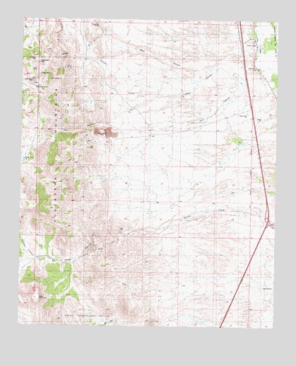
Luis Lopez, NM USGS Topographic Map
Click on map above to begin viewing in our Map Viewer.

This topographic map contains these locations and features:
Feature Name Type Latitude Longitude GNIS ID View Map
10044 Water WellWellN33.8917°W106.9203°925731View Map
179 United States 380 San Antonio InterchangeCrossingN33.9178°W106.8814°929568View Map
Big BasinMineN33.9615°W106.9734°915739View Map
Big Basin Group-Luis Lopez D MineMineN33.9648°W106.9725°916445View Map
Black Cat Claims-Luis LopezMineN33.9537°W106.9895°916447View Map
Black Crow and San Juan ClaimsMineN33.9484°W106.9734°939884View Map
Blue Gold-Luis Lopez DistrictMineN33.9978°W106.9939°916550View Map
Chupadera MountainsRangeN33.9398°W106.9853°905137View Map
Chupadera SpringSpringN33.9987°W106.9670°887579View Map
Esperanza Group-Luis LopezMineN33.9556°W106.9767°916449View Map
Frank Number 2-Luis Lopez DistrictMineN33.9487°W106.9570°916546View Map
Gloryyana Deposit-Luis Lopez DistrictMineN33.9878°W106.9925°937207View Map
Grand Canyon - Luis Lopez Distict MineMineN33.9878°W106.9925°939861View Map
Griffith Claims-Luis LopezMineN33.9845°W106.9773°916450View Map
Gussie MineMineN33.9878°W106.9925°939867View Map
Iron HorseMineN33.9890°W106.9478°915751View Map
Jacobo Sedillo RanchLocaleN33.9959°W106.9614°890398View Map
Lucky Strike and Grand Canyon MineMineN33.9801°W106.9936°940003View Map
Lucky Strike Number 1-Luis Lopez DistrictMineN33.9915°W106.9925°916549View Map
Luis LopezPopulated PlaceN33.9890°W106.8853°899699View Map
Luis Lopez Census Designated PlaceCensusN33.9905°W106.8878°2584147View Map
M and MMineN33.9698°W106.9911°916547View Map
M and M GroupMineN33.9665°W106.9950°917176View Map
Madera CanyonValleyN33.9015°W106.9895°936873View Map
Miera TankReservoirN33.9430°W106.9990°892029View Map
Montoya TankReservoirN33.9722°W106.9937°892190View Map
Nogal RanchLocaleN33.9012°W106.9817°892550View Map
Pretty Girl Group-Luis LopezMineN33.9637°W106.9856°916448View Map
Red CanyonValleyN33.9778°W106.8811°1744572View Map
Red Hill Claims-Luis Lopez DistrictMineN33.9531°W106.9614°916457View Map
Red Hill Ext.Claim-Luis LopezMineN33.9587°W106.9636°916444View Map
Rincon MaderaValleyN33.9445°W106.9992°910201View Map
San Antonio Fire and Rescue Sandhill RoadBuildingN33.9687°W106.8756°2657945View Map
San Antonito Census Designated PlaceCensusN33.8918°W106.8799°2584201View Map
SocorroLocaleN33.9320°W106.9495°929662View Map

Note: Coordinates in the location and feature list above are referenced to NAD83 datum.


Copyright (C) 2008-2024 Ryan Niemi / Sunset Dynamics ... All Rights Reserved