TopoQuest Logo
Do you find TopoQuest useful?
Help keep TopoQuest running and adding new maps/features by donating!
Bitcoin:  19c7KJd3qBynnjoSw5npx9KScwjBe4ifkT
Litecoin:  LXs6TkuXGGXo1vDsWCkWVdjQX94eUKd6ui
Home View Maps Find Maps Find Places Resources & Links


Louisville, Montana Topographic Map

USGS Map Title: Louisville, MT
USGS Map MRC: 46111E7
DRG (GeoTIFF) Download: o46111e7.tif


Neighboring USGS Topographic Map Quads:


  Lake Helena, MT  
46111F8
 

  Hauser Lake, MT  
46111F7
 

  Canyon Ferry, MT  
46111F6
 

  East Helena, MT  
46111E8
 

  Louisville, MT  
46111E7
 

  Canyon Ferry SW, MT  
46111E6
 

  Clancy, MT  
46111D8
 

  Casey Peak, MT  
46111D7
 

  Winston, MT  
46111D6


Map MRC Location:

N47°
W112°
N47°
W111°
H8 H7 H6 H5 H4 H3 H2 H1
G8 G7 G6 G5 G4 G3 G2 G1
F8 F7 F6 F5 F4 F3 F2 F1
E8 E7 E6 E5 E4 E3 E2 E1
D8 D7 D6 D5 D4 D3 D2 D1
C8 C7 C6 C5 C4 C3 C2 C1
B8 B7 B6 B5 B4 B3 B2 B1
A8 A7 A6 A5 A4 A3 A2 A1
N46°
W112°
N46°
W111°

Louisville, MT USGS 1:24K Topographic Map Preview:
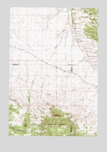
Louisville, MT USGS Topographic Map
Click on map above to begin viewing in our Map Viewer.

This topographic map contains these locations and features:
Feature Name Type Latitude Longitude GNIS ID View Map
09N02E26AD__01 WellWellN46.5097°W111.8119°816579View Map
10N02W32AADA01 WellWellN46.5855°W111.8733°816936View Map
10N09W20BACD01 SpringSpringN46.6133°W111.7600°817118View Map
Chicago MineMineN46.5122°W111.8197°800585View Map
ClasoilPopulated PlaceN46.5630°W111.7936°781334View Map
Clasoil Post Office (historical)Post OfficeN46.5630°W111.7936°1762486View Map
Corral CreekStreamN46.5702°W111.8247°800627View Map
Economy MineMineN46.5252°W111.8478°800743View Map
Little ButteSummitN46.5105°W111.8528°786261View Map
LouisvillePopulated PlaceN46.5627°W111.7958°786649View Map
Mitchell (historical)LocaleN46.5672°W111.8300°1762661View Map
Mitchell GulchValleyN46.5985°W111.8028°801179View Map
Penwell (historical)LocaleN46.5672°W111.8133°1762658View Map
Spokane Creek School (historical)SchoolN46.6097°W111.7889°801509View Map
Spokane HillsRangeN46.6172°W111.7705°801510View Map
Tri - Lakes Volunteer Fire Department Station 3BuildingN46.6221°W111.7906°2546670View Map
Turner CemeteryCemeteryN46.5305°W111.8494°792470View Map

Note: Coordinates in the location and feature list above are referenced to NAD83 datum.


Copyright (C) 2008-2024 Ryan Niemi / Sunset Dynamics ... All Rights Reserved