TopoQuest Logo
Do you find TopoQuest useful?
Help keep TopoQuest running and adding new maps/features by donating!
Bitcoin:  19c7KJd3qBynnjoSw5npx9KScwjBe4ifkT
Litecoin:  LXs6TkuXGGXo1vDsWCkWVdjQX94eUKd6ui
Home View Maps Find Maps Find Places Resources & Links


Lee Vining, California Topographic Map

USGS Map Title: Lee Vining, CA
USGS Map MRC: 37119H1
DRG (GeoTIFF) Download: o37119h1.tif


Neighboring USGS Topographic Map Quads:


  Lundy, CA  
38119A2
 

  Negit Island, CA  
38119A1
 

  Sulphur Pond, CA  
38118A8
 

  Mount Dana, CA  
37119H2
 

  Lee Vining, CA  
37119H1
 

  Mono Mills, CA  
37118H8
 

  Koip Peak, CA  
37119G2
 

  June Lake, CA  
37119G1
 

  Crestview, CA  
37118G8


Map MRC Location:

N38°
W120°
N38°
W119°
H8 H7 H6 H5 H4 H3 H2 H1
G8 G7 G6 G5 G4 G3 G2 G1
F8 F7 F6 F5 F4 F3 F2 F1
E8 E7 E6 E5 E4 E3 E2 E1
D8 D7 D6 D5 D4 D3 D2 D1
C8 C7 C6 C5 C4 C3 C2 C1
B8 B7 B6 B5 B4 B3 B2 B1
A8 A7 A6 A5 A4 A3 A2 A1
N37°
W120°
N37°
W119°

Lee Vining, CA USGS 1:24K Topographic Map Preview:
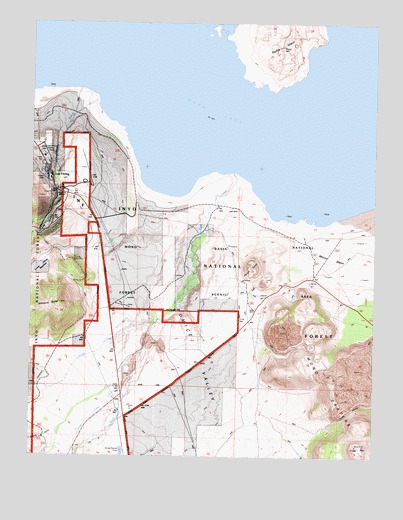
Lee Vining, CA USGS Topographic Map
Click on map above to begin viewing in our Map Viewer.

This topographic map contains these locations and features:
Feature Name Type Latitude Longitude GNIS ID View Map
Beartrack CreekStreamN37.9427°W119.1196°1652963View Map
Crater MountainSummitN37.8780°W119.0071°258892View Map
Farrington SiphonCanalN37.9033°W119.1188°260056View Map
Gibbs SiphonCanalN37.9344°W119.1188°260545View Map
Lee ViningPopulated PlaceN37.9574°W119.1218°262401View Map
Lee Vining AirportAirportN37.9528°W119.1046°1653599View Map
Lee Vining CanyonValleyN37.9591°W119.1163°252251View Map
Lee Vining Census Designated PlaceCensusN37.9546°W119.1221°2583054View Map
Lee Vining CreekStreamN37.9777°W119.1018°262402View Map
Lee Vining Elementary SchoolSchoolN37.9556°W119.1205°1812833View Map
Lee Vining High SchoolSchoolN37.9612°W119.1214°1812834View Map
Lee Vining Post OfficePost OfficeN37.9555°W119.1200°2781017View Map
Lee Vining Volunteer Fire DepartmentBuildingN37.9580°W119.1198°2624286View Map
Mono Basin National Forest Scenic AreaParkN37.9502°W119.0593°1652944View Map
Morzano PitMineN37.9075°W119.0786°2680981View Map
Navy BeachBeachN37.9416°W119.0196°1812843View Map
Navy Beach Observation SiteLocaleN37.9407°W119.0200°2547668View Map
North Crater Panum CraterCraterN37.9313°W119.0457°275748View Map
Panum CraterSummitN37.9296°W119.0446°264493View Map
Panum Crater Interpretive SiteLocaleN37.9256°W119.0488°2547679View Map
Parker CreekStreamN37.8824°W119.0988°264525View Map
Pumice ValleyBasinN37.9060°W119.0768°265062View Map
Rush CreekStreamN37.9546°W119.0524°267199View Map
Sawmill CanyonValleyN37.8818°W119.1175°265862View Map
South Tufa AreaAreaN37.9455°W119.0199°1812850View Map
South Tufa Interpretive SiteLocaleN37.9388°W119.0270°2547709View Map
Walker CreekStreamN37.9128°W119.0800°268749View Map
Williams ButteSummitN37.9188°W119.1168°269112View Map

Note: Coordinates in the location and feature list above are referenced to NAD83 datum.


Copyright (C) 2008-2024 Ryan Niemi / Sunset Dynamics ... All Rights Reserved