TopoQuest Logo
Do you find TopoQuest useful?
Help keep TopoQuest running and adding new maps/features by donating!
Bitcoin:  19c7KJd3qBynnjoSw5npx9KScwjBe4ifkT
Litecoin:  LXs6TkuXGGXo1vDsWCkWVdjQX94eUKd6ui
Home View Maps Find Maps Find Places Resources & Links


Larkspur, Colorado Topographic Map

USGS Map Title: Larkspur, CO
USGS Map MRC: 39104B8
DRG (GeoTIFF) Download: o39104b8.tif


Neighboring USGS Topographic Map Quads:


  Devils Head, CO  
39105C1
 

  Dawson Butte, CO  
39104C8
 

  Castle Rock South, CO  
39104C7
 

  Dakan Mountain, CO  
39105B1
 

  Larkspur, CO  
39104B8
 

  Greenland, CO  
39104B7
 

  Mount Deception, CO  
39105A1
 

  Palmer Lake, CO  
39104A8
 

  Monument, CO  
39104A7


Map MRC Location:

N40°
W105°
N40°
W104°
H8 H7 H6 H5 H4 H3 H2 H1
G8 G7 G6 G5 G4 G3 G2 G1
F8 F7 F6 F5 F4 F3 F2 F1
E8 E7 E6 E5 E4 E3 E2 E1
D8 D7 D6 D5 D4 D3 D2 D1
C8 C7 C6 C5 C4 C3 C2 C1
B8 B7 B6 B5 B4 B3 B2 B1
A8 A7 A6 A5 A4 A3 A2 A1
N39°
W105°
N39°
W104°

Larkspur, CO USGS 1:24K Topographic Map Preview:
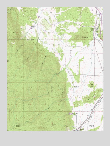
Larkspur, CO USGS Topographic Map
Click on map above to begin viewing in our Map Viewer.

This topographic map contains these locations and features:
Feature Name Type Latitude Longitude GNIS ID View Map
Ahlmaaz Gove DitchCanalN39.2193°W104.9548°2710915View Map
Butler CanyonValleyN39.1571°W104.9206°193169View Map
Cantrill DamDamN39.2483°W104.9472°198664View Map
Cantrill ReservoirReservoirN39.2482°W104.9488°198665View Map
Carpenter CreekStreamN39.2242°W104.8847°196378View Map
Churchill MineMineN39.2083°W104.9005°1703891View Map
Cook CreekStreamN39.2117°W104.8903°193182View Map
Crystal Springs RanchLocaleN39.1422°W104.9122°196377View Map
Eagle MountainSummitN39.1708°W104.8900°193178View Map
East Plum Creek DitchCanalN39.1887°W104.9279°2712013View Map
Fazzio DitchCanalN39.2284°W104.9592°2712080View Map
Gove CreekStreamN39.2355°W104.9617°183749View Map
Green Valley RanchLocaleN39.1689°W104.9108°193179View Map
Higginson PitMineN39.1375°W104.9019°1703892View Map
Kountz DitchCanalN39.2234°W104.9728°2723093View Map
LarkspurPopulated PlaceN39.2286°W104.8872°193176View Map
Larkspur Elementary SchoolSchoolN39.2322°W104.9045°1990184View Map
Larkspur Fire Protection District Station 161BuildingN39.2247°W104.8852°2368592View Map
Larkspur Post OfficePost OfficeN39.2288°W104.8850°2736052View Map
Metz CanyonValleyN39.2054°W104.9477°193171View Map
Monkey FaceSummitN39.2197°W104.9011°193175View Map
Perry Park South RanchLocaleN39.2314°W104.9650°193172View Map
Raspberry ButteSummitN39.2200°W104.9089°193174View Map
SprucePopulated PlaceN39.1567°W104.8783°193180View Map
Spruce MountainSummitN39.1553°W104.8989°193177View Map
Stark CreekStreamN39.2189°W104.9783°183743View Map
Starr CanyonValleyN39.2187°W104.9784°193173View Map
Stone CanyonValleyN39.1888°W104.9238°193170View Map
Swank CabinLocaleN39.1314°W104.9414°193181View Map
Town of LarkspurCivilN39.2237°W104.8935°2412878View Map

Note: Coordinates in the location and feature list above are referenced to NAD83 datum.


Copyright (C) 2008-2024 Ryan Niemi / Sunset Dynamics ... All Rights Reserved