TopoQuest Logo
Do you find TopoQuest useful?
Help keep TopoQuest running and adding new maps/features by donating!
Bitcoin:  19c7KJd3qBynnjoSw5npx9KScwjBe4ifkT
Litecoin:  LXs6TkuXGGXo1vDsWCkWVdjQX94eUKd6ui
Home View Maps Find Maps Find Places Resources & Links


Lambert Rocks, Oregon Topographic Map

USGS Map Title: Lambert Rocks, OR
USGS Map MRC: 43117A6
DRG (GeoTIFF) Download: o43117a6.tif


Neighboring USGS Topographic Map Quads:


  Sacramento Butte, OR  
43117B7
 

  Rinehart Canyon, OR  
43117B6
 

  The Hole in the Ground, OR  
43117B5
 

  Wrangle Butte, OR  
43117A7
 

  Lambert Rocks, OR  
43117A6
 

  Bogus Bench, OR  
43117A5
 

  Iron Mountain, OR  
42117H7
 

  Owyhee Butte, OR  
42117H6
 

  Arock, OR  
42117H5


Map MRC Location:

N44°
W118°
N44°
W117°
H8 H7 H6 H5 H4 H3 H2 H1
G8 G7 G6 G5 G4 G3 G2 G1
F8 F7 F6 F5 F4 F3 F2 F1
E8 E7 E6 E5 E4 E3 E2 E1
D8 D7 D6 D5 D4 D3 D2 D1
C8 C7 C6 C5 C4 C3 C2 C1
B8 B7 B6 B5 B4 B3 B2 B1
A8 A7 A6 A5 A4 A3 A2 A1
N43°
W118°
N43°
W117°

Lambert Rocks, OR USGS 1:24K Topographic Map Preview:
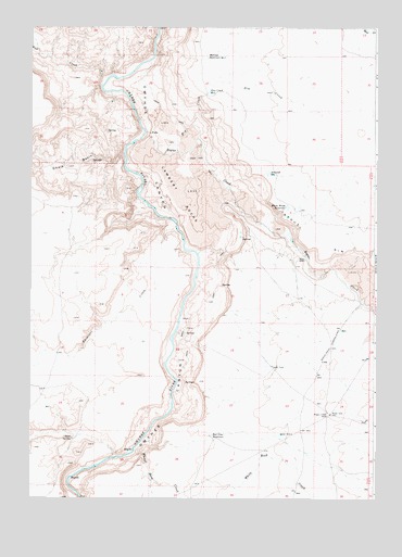
Lambert Rocks, OR USGS Topographic Map
Click on map above to begin viewing in our Map Viewer.

This topographic map contains these locations and features:
Feature Name Type Latitude Longitude GNIS ID View Map
Anawalt ReservoirReservoirN43.0866°W117.6646°1116924View Map
Bogus CreekStreamN43.0971°W117.7093°1117904View Map
Bogus Creek WellWellN43.0224°W117.6421°1117906View Map
Bogus RanchLocaleN43.0635°W117.6510°1117908View Map
Bogus RimCliffN43.0632°W117.6454°1117909View Map
Bull CreekStreamN43.1115°W117.7229°1118279View Map
Chalk BasinBasinN43.0888°W117.7343°1118798View Map
Dry CreekStreamN43.0921°W117.6977°1120116View Map
Dry Creek ReservoirReservoirN43.1076°W117.6861°1120150View Map
Lambert RocksLavaN43.0804°W117.6971°1122925View Map
Morcom Reservoir Number TwoReservoirN43.1170°W117.6866°1124345View Map
Red Line ReservoirReservoirN43.0166°W117.6845°1125886View Map
Ryegrass CreekStreamN43.0721°W117.6979°1126390View Map
Sand SpringSpringN43.0158°W117.7351°1126580View Map
White Rock CreekStreamN43.0132°W117.7124°1128991View Map
White Wash ReservoirReservoirN43.0772°W117.6575°1129004View Map

Note: Coordinates in the location and feature list above are referenced to NAD83 datum.


Copyright (C) 2008-2024 Ryan Niemi / Sunset Dynamics ... All Rights Reserved