TopoQuest Logo
Do you find TopoQuest useful?
Help keep TopoQuest running and adding new maps/features by donating!
Bitcoin:  19c7KJd3qBynnjoSw5npx9KScwjBe4ifkT
Litecoin:  LXs6TkuXGGXo1vDsWCkWVdjQX94eUKd6ui
Home View Maps Find Maps Find Places Resources & Links


Lake of the Woods North, Oregon Topographic Map

USGS Map Title: Lake of the Woods North, OR
USGS Map MRC: 42122D2
DRG (GeoTIFF) Download: o42122d2.tif


Neighboring USGS Topographic Map Quads:


  Rustler Peak, OR  
42122E3
 

  Pelican Butte, OR  
42122E2
 

  Crystal Spring, OR  
42122E1
 

  Mount McLoughlin, OR  
42122D3
 

  Lake of the Woods North, OR  
42122D2
 

  Pelican Bay, OR  
42122D1
 

  Brown Mountain, OR  
42122C3
 

  Lake of the Woods South, OR  
42122C2
 

  Aspen Lake, OR  
42122C1


Map MRC Location:

N43°
W123°
N43°
W122°
H8 H7 H6 H5 H4 H3 H2 H1
G8 G7 G6 G5 G4 G3 G2 G1
F8 F7 F6 F5 F4 F3 F2 F1
E8 E7 E6 E5 E4 E3 E2 E1
D8 D7 D6 D5 D4 D3 D2 D1
C8 C7 C6 C5 C4 C3 C2 C1
B8 B7 B6 B5 B4 B3 B2 B1
A8 A7 A6 A5 A4 A3 A2 A1
N42°
W123°
N42°
W122°

Lake of the Woods North, OR USGS 1:24K Topographic Map Preview:
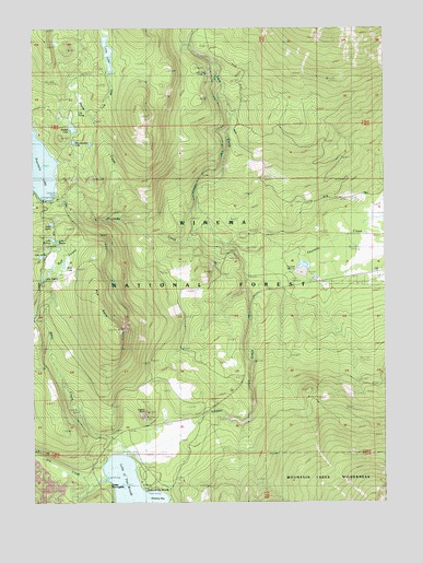
Lake of the Woods North, OR USGS Topographic Map
Click on map above to begin viewing in our Map Viewer.

This topographic map contains these locations and features:
Feature Name Type Latitude Longitude GNIS ID View Map
Aspen Point Campground Boat RampLocaleN42.3851°W122.2151°2700024View Map
Aspen Point Recreation SiteLocaleN42.3846°W122.2136°1161664View Map
Billie CreekStreamN42.3879°W122.2211°1117702View Map
Budger LakeLakeN42.4737°W122.2369°1138878View Map
Bull SwampSwampN42.4390°W122.2449°1138928View Map
Camp McLoughlinLocaleN42.3801°W122.2239°1139254View Map
Cascade CanalCanalN42.4179°W122.2353°1139413View Map
Cottonwood CampLocaleN42.4471°W122.1870°1158180View Map
Dry CreekStreamN42.3812°W122.2245°1141294View Map
Four Mile Lake TrailTrailN42.4774°W122.2378°1156150View Map
Fourmile Flat QuarryBasinN42.4354°W122.1556°1156148View Map
Fourmile Lake Boat RampLocaleN42.4548°W122.2444°2700258View Map
Fourmile Lake DamDamN42.4553°W122.2438°1153918View Map
Fourmile Lake Recreation SiteLocaleN42.4554°W122.2484°1161667View Map
Fourmile Rock PitMineN42.4354°W122.1561°1161703View Map
Great Meadows Recreation SiteLocaleN42.4010°W122.1820°1156149View Map
Greylock Mountain TrailTrailN42.3971°W122.1484°1143078View Map
Horse CreekStreamN42.4487°W122.2170°1143745View Map
Lake AphisLakeN42.4484°W122.2446°1137270View Map
Lake BerniceLakeN42.4443°W122.2441°1137945View Map
Lake ClovisLakeN42.4438°W122.2423°1139861View Map
Lake JaniceLakeN42.4397°W122.2482°1159238View Map
Lake MaliceLakeN42.4343°W122.2475°1145771View Map
Lake of the WoodsPopulated PlaceN42.3787°W122.2122°1161411View Map
Lake of the Woods Post Office (historical)Post OfficeN42.3787°W122.2122°1165506View Map
Lake of the Woods ResortLocaleN42.3785°W122.2117°1156152View Map
Lake of the Woods Resort MarinaHarborN42.3773°W122.2109°2699003View Map
Lilly PondLakeN42.4775°W122.2354°1145008View Map
Long CreekStreamN42.4760°W122.2281°1145392View Map
Long LakeLakeN42.4935°W122.2241°1145418View Map
Long Lake CampLocaleN42.4982°W122.2245°1145423View Map
Lost CreekStreamN42.4465°W122.1878°1145520View Map
Lost Creek Cinder PitMineN42.4882°W122.1886°1156880View Map
Lost Peak TrailTrailN42.4804°W122.2122°1145554View Map
Pearce PointSummitN42.3987°W122.2106°1147525View Map
Rainbow Bay Boat LaunchLocaleN42.3777°W122.2106°2700023View Map
Rainbow Bay Recreation SiteLocaleN42.3776°W122.2081°1161666View Map
Rye SpurRidgeN42.4274°W122.2281°1148881View Map
Rye Spur TrailTrailN42.4199°W122.2189°1156151View Map
Seldom CreekStreamN42.4390°W122.1614°1149224View Map
White Pine Campground (historical)LocaleN42.3776°W122.2122°1161665View Map
Wolf LakeSwampN42.4373°W122.2401°1152590View Map
Woodpecker LakeLakeN42.4699°W122.2365°1152632View Map

Note: Coordinates in the location and feature list above are referenced to NAD83 datum.


Copyright (C) 2008-2024 Ryan Niemi / Sunset Dynamics ... All Rights Reserved