TopoQuest Logo
Do you find TopoQuest useful?
Help keep TopoQuest running and adding new maps/features by donating!
Bitcoin:  19c7KJd3qBynnjoSw5npx9KScwjBe4ifkT
Litecoin:  LXs6TkuXGGXo1vDsWCkWVdjQX94eUKd6ui
Home View Maps Find Maps Find Places Resources & Links


Kino Springs, Arizona Topographic Map

USGS Map Title: Kino Springs, AZ
USGS Map MRC: 31110C7
DRG (GeoTIFF) Download: o31110c7.tif


Neighboring USGS Topographic Map Quads:


  Rio Rico, AZ  
31110D8
 

  Cumero Canyon, AZ  
31110D7
 

  Harshaw, AZ  
31110D6
 

  Nogales, AZ  
31110C8
 

  Kino Springs, AZ  
31110C7
 

  Duquesne, AZ  
31110C6


Map MRC Location:

N32°
W111°
N32°
W110°
H8 H7 H6 H5 H4 H3 H2 H1
G8 G7 G6 G5 G4 G3 G2 G1
F8 F7 F6 F5 F4 F3 F2 F1
E8 E7 E6 E5 E4 E3 E2 E1
D8 D7 D6 D5 D4 D3 D2 D1
C8 C7 C6 C5 C4 C3 C2 C1
B8 B7 B6 B5 B4 B3 B2 B1
A8 A7 A6 A5 A4 A3 A2 A1
N31°
W111°
N31°
W110°

Kino Springs, AZ USGS 1:24K Topographic Map Preview:
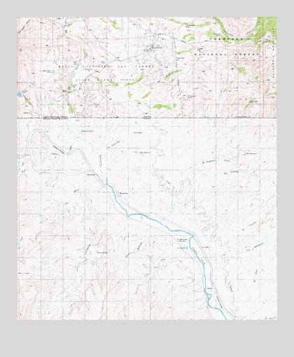
Kino Springs, AZ USGS Topographic Map
Click on map above to begin viewing in our Map Viewer.

This topographic map contains these locations and features:
Feature Name Type Latitude Longitude GNIS ID View Map
Anguis House (historical)LocaleN31.3584°W110.8451°36523View Map
Benedicts (historical)LocaleN31.3526°W110.8454°36547View Map
Brickwood CanyonValleyN31.3368°W110.8534°26737View Map
Brickwoods Ranch (historical)LocaleN31.3368°W110.8509°36560View Map
Buena Vista RanchLocaleN31.3454°W110.8479°36564View Map
Cautiva TankReservoirN31.3433°W110.8743°36580View Map
Chamberlain TankReservoirN31.3713°W110.7948°27494View Map
Correllos House (historical)LocaleN31.3568°W110.8462°36592View Map
Granger CorralLocaleN31.3606°W110.7986°2680478View Map
Granger TankReservoirN31.3616°W110.7892°36642View Map
Granger WellWellN31.3578°W110.7994°36643View Map
Guadalupe Cruz (historical)LocaleN31.3537°W110.8423°36649View Map
Italian CanyonValleyN31.3645°W110.7615°30438View Map
Kino SpringsPopulated PlaceN31.3632°W110.8101°36683View Map
Kino Springs Census Designated PlaceCensusN31.3641°W110.8097°2582806View Map
Kino Springs Country ClubLocaleN31.3696°W110.8542°2622998View Map
Lows RanchLocaleN31.3437°W110.8465°36711View Map
Maria Santisima del CarmenCivilN31.3487°W110.8326°31511View Map
Morales House (historical)LocaleN31.3487°W110.8451°36738View Map
Pecks (historical)LocaleN31.3623°W110.8451°36776View Map
Piedra Gosa Tank Number TwoReservoirN31.3421°W110.7942°2680479View Map
Piedragosa TanksReservoirN31.3420°W110.7934°36787View Map
Quien Sabe TankReservoirN31.3523°W110.8609°36794View Map
Sierra Tordilla CorralLocaleN31.3403°W110.7644°2680475View Map
Sierra Tordilla WellWellN31.3401°W110.7637°36844View Map
Stanley CorralLocaleN31.3617°W110.7722°2680474View Map
Sycamore CanyonValleyN31.3654°W110.7740°35019View Map
Sycamore TankReservoirN31.3678°W110.7774°36859View Map
Verba Buena RanchLocaleN31.3732°W110.8520°36896View Map

Note: Coordinates in the location and feature list above are referenced to NAD83 datum.


Copyright (C) 2008-2024 Ryan Niemi / Sunset Dynamics ... All Rights Reserved