TopoQuest Logo
Do you find TopoQuest useful?
Help keep TopoQuest running and adding new maps/features by donating!
Bitcoin:  19c7KJd3qBynnjoSw5npx9KScwjBe4ifkT
Litecoin:  LXs6TkuXGGXo1vDsWCkWVdjQX94eUKd6ui
Home View Maps Find Maps Find Places Resources & Links


Kettleman City, California Topographic Map

USGS Map Title: Kettleman City, CA
USGS Map MRC: 36119A8
DRG (GeoTIFF) Download: o36119a8.tif


Neighboring USGS Topographic Map Quads:


  Huron, CA  
36120B1
 

  Westhaven, CA  
36119B8
 

  Stratford, CA  
36119B7
 

  La Cima, CA  
36120A1
 

  Kettleman City, CA  
36119A8
 

  Stratford SE, CA  
36119A7
 

  Kettleman Plain, CA  
35120H1
 

  Los Viejos, CA  
35119H8
 

  Dudley Ridge, CA  
35119H7


Map MRC Location:

N37°
W120°
N37°
W119°
H8 H7 H6 H5 H4 H3 H2 H1
G8 G7 G6 G5 G4 G3 G2 G1
F8 F7 F6 F5 F4 F3 F2 F1
E8 E7 E6 E5 E4 E3 E2 E1
D8 D7 D6 D5 D4 D3 D2 D1
C8 C7 C6 C5 C4 C3 C2 C1
B8 B7 B6 B5 B4 B3 B2 B1
A8 A7 A6 A5 A4 A3 A2 A1
N36°
W120°
N36°
W119°

Kettleman City, CA USGS 1:24K Topographic Map Preview:
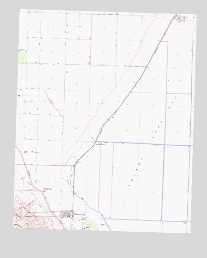
Kettleman City, CA USGS Topographic Map
Click on map above to begin viewing in our Map Viewer.

This topographic map contains these locations and features:
Feature Name Type Latitude Longitude GNIS ID View Map
Arroyo DegolladoStreamN36.0191°W119.9825°238747View Map
Arroyo RobadorStreamN36.0016°W119.9465°255302View Map
Blakeley CanalCanalN36.0625°W119.9362°239468View Map
Goodfellow Ranch (historical)LocaleN36.0222°W119.9582°1665703View Map
Kettleman CityPopulated PlaceN36.0083°W119.9618°1652733View Map
Kettleman City Branch Kings County LibraryBuildingN36.0080°W119.9599°1809252View Map
Kettleman City Census Designated PlaceCensusN36.0090°W119.9629°2408476View Map
Kettleman City Elementary SchoolSchoolN36.0077°W119.9615°1809253View Map
Kettleman City Post OfficePost OfficeN36.0099°W119.9600°1809254View Map
Kettleman Hills Compressor StationLocaleN36.0219°W119.9799°1654683View Map
Kings County Fire Department Station 9 Kettleman CityBuildingN36.0068°W119.9597°2624072View Map
Millham City (historical)Populated PlaceN36.0375°W119.9993°1665704View Map
Saint Cecilias Catholic ChurchChurchN36.0102°W119.9615°1809260View Map
West Lake FarmsLocaleN36.1222°W119.8899°251361View Map
West Tulare Lands RanchLocaleN36.0500°W119.9412°251383View Map
Westlake Farms AirportAirportN36.1213°W119.8921°1654034View Map

Note: Coordinates in the location and feature list above are referenced to NAD83 datum.


Copyright (C) 2008-2024 Ryan Niemi / Sunset Dynamics ... All Rights Reserved