TopoQuest Logo
Do you find TopoQuest useful?
Help keep TopoQuest running and adding new maps/features by donating!
Bitcoin:  19c7KJd3qBynnjoSw5npx9KScwjBe4ifkT
Litecoin:  LXs6TkuXGGXo1vDsWCkWVdjQX94eUKd6ui
Home View Maps Find Maps Find Places Resources & Links


Keswick, Virginia Topographic Map

USGS Map Title: Keswick, VA
USGS Map MRC: 38078A3
DRG (GeoTIFF) Download: o38078a3.tif


Neighboring USGS Topographic Map Quads:


  Earlysville, VA  
38078B4
 

  Barboursville, VA  
38078B3
 

  Gordonsville, VA  
38078B2
 

  Charlottesville East, VA  
38078A4
 

  Keswick, VA  
38078A3
 

  Boswells Tavern, VA  
38078A2
 

  Simeon, VA  
37078H4
 

  Boyd Tavern, VA  
37078H3
 

  Zion Crossroads, VA  
37078H2


Map MRC Location:

N39°
W79°
N39°
W78°
H8 H7 H6 H5 H4 H3 H2 H1
G8 G7 G6 G5 G4 G3 G2 G1
F8 F7 F6 F5 F4 F3 F2 F1
E8 E7 E6 E5 E4 E3 E2 E1
D8 D7 D6 D5 D4 D3 D2 D1
C8 C7 C6 C5 C4 C3 C2 C1
B8 B7 B6 B5 B4 B3 B2 B1
A8 A7 A6 A5 A4 A3 A2 A1
N38°
W79°
N38°
W78°

Keswick, VA USGS 1:24K Topographic Map Preview:
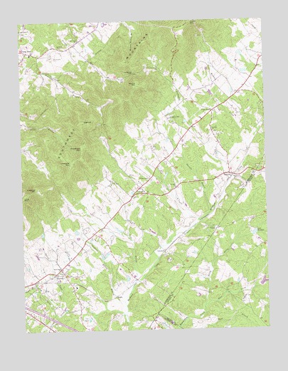
Keswick, VA USGS Topographic Map
Click on map above to begin viewing in our Map Viewer.

This topographic map contains these locations and features:
Feature Name Type Latitude Longitude GNIS ID View Map
All Saints Episcopal ChapelChurchN38.1118°W78.3672°1675173View Map
Babgy Memorial ChurchChurchN38.0957°W78.3350°1462640View Map
Beaver DamDamN38.0185°W78.2547°1490343View Map
Beaverdam PondReservoirN38.0192°W78.2514°1490344View Map
BelvoirLocaleN38.0604°W78.3150°1675187View Map
Ben CoolynLocaleN38.0335°W78.3578°1675188View Map
Bridle SpurLocaleN38.0321°W78.3525°1675201View Map
Broadhead MountainSummitN38.0737°W78.3439°1495302View Map
Bruce CemeteryCemeteryN38.0271°W78.2686°1463939View Map
CampbellPopulated PlaceN38.0318°W78.3022°1495347View Map
Cash CornerPopulated PlaceN38.0882°W78.2761°1477185View Map
CastiliaLocaleN38.0590°W78.3289°1675214View Map
Castle HillSummitN38.0849°W78.2975°1675215View Map
Castle HillLocaleN38.0860°W78.2978°1464522View Map
Chopping Bottom BranchStreamN38.0115°W78.3231°1464874View Map
CismontPopulated PlaceN38.0576°W78.3136°1495392View Map
Cismont ManorLocaleN38.0410°W78.3422°1675223View Map
Cismont School (historical)SchoolN38.0476°W78.2983°1675224View Map
Clover HillLocaleN38.0504°W78.3356°1675229View Map
CobhamPopulated PlaceN38.0629°W78.2681°1495406View Map
Cobham ParkPopulated PlaceN38.0585°W78.2617°1675230View Map
Cobham Post OfficePost OfficeN38.0629°W78.2683°1675231View Map
Daniels BranchStreamN38.0471°W78.2792°1465592View Map
East Prong Beaverdam CreekStreamN38.0099°W78.2820°1466114View Map
EdgeworthLocaleN38.1085°W78.2636°1675242View Map
Edgeworth Farms DamDamN38.1035°W78.2597°1489097View Map
Edgeworth Farms LakeReservoirN38.1044°W78.2600°1489098View Map
EverettsvillePopulated PlaceN38.0135°W78.3745°1675248View Map
Ferron DamDamN38.0135°W78.2847°1490327View Map
Ferron LakeReservoirN38.0135°W78.2852°1490328View Map
FindowrieBuildingN38.0274°W78.3000°1690313View Map
Free Union CemeteryCemeteryN38.1210°W78.3733°1690316View Map
Free Union ChurchChurchN38.1218°W78.3739°1466872View Map
Free Union Church (historical)ChurchN38.1046°W78.3606°1675257View Map
Grace CemeteryCemeteryN38.0604°W78.3081°1675267View Map
Hallock DamDamN38.0401°W78.3631°1489020View Map
Hallock PondReservoirN38.0392°W78.3646°1489021View Map
HightopSummitN38.0837°W78.3436°1468036View Map
Jacks BranchStreamN38.0168°W78.3195°1468578View Map
KeswickPopulated PlaceN38.0226°W78.3592°1495786View Map
Keswick Country ClubLocaleN38.0132°W78.3597°1675295View Map
Keswick Hunt ClubLocaleN38.0185°W78.3692°1675294View Map
Keswick Post OfficePost OfficeN38.0231°W78.3584°1675296View Map
Keswick School (historical)SchoolN38.0074°W78.3458°1675297View Map
Lake SenahamReservoirN38.0389°W78.2561°1474165View Map
Little Keswick SchoolSchoolN38.0227°W78.3584°2497759View Map
Lonesome MountainSummitN38.0679°W78.3489°1469750View Map
Long CemeteryCemeteryN38.1010°W78.3228°1469801View Map
Long MountainSummitN38.0537°W78.3747°1493557View Map
Merrie MillLocaleN38.0512°W78.2928°1675320View Map
North Prong Beaverdam CreekStreamN38.0099°W78.2822°1471635View Map
Oakland SchoolSchoolN38.0361°W78.3077°2497717View Map
Old KeswickLocaleN38.0929°W78.2847°1675342View Map
Piedmont ChurchChurchN38.1146°W78.3536°1472278View Map
Poorhouse FarmLocaleN38.0043°W78.3433°1675354View Map
Preddy Creek ChurchChurchN38.1174°W78.3445°1472766View Map
Rivanna DistrictCivilN38.0929°W78.3469°1927464View Map
RosenaPopulated PlaceN38.1154°W78.3470°1675370View Map
RugbyPopulated PlaceN38.0138°W78.3278°1496179View Map
Saint Andrews ChapelChurchN38.0404°W78.2764°1473695View Map
Saint Johns CemeteryCemeteryN38.0804°W78.2761°1675374View Map
Saint Johns ChurchChurchN38.0804°W78.2767°1473781View Map
Shackelford Family CemeteryCemeteryN38.1095°W78.3586°1474189View Map
South Plains CemeteryCemeteryN38.0239°W78.3550°1675390View Map
South Plains ChurchChurchN38.0243°W78.3553°1474878View Map
Southwest MountainsRidgeN38.0957°W78.3350°1462310View Map
Stony PointPopulated PlaceN38.1129°W78.3714°1496270View Map
Stony Point Elementary SchoolSchoolN38.1119°W78.3694°1675397View Map
Stony Point Volunteer Fire CompanyBuildingN38.1111°W78.3717°2075646View Map
Stony Point Volunteer Fire Company Station 6BuildingN38.1111°W78.3716°1675396View Map
Sugarloaf MountainSummitN38.0576°W78.3672°1475298View Map
Tall OaksLocaleN38.0357°W78.3497°1675399View Map
Turkeysag CreekStreamN38.0607°W78.2675°1475973View Map
Turkeysag GapGapN38.1037°W78.3164°1475974View Map
Virginia FarmsLocaleN38.0190°W78.3261°1675414View Map
Walkers Parish ChurchChurchN38.0610°W78.3083°1476248View Map
Walnut MountainSummitN38.0999°W78.3142°1476286View Map
Zion Hill CemeteryCemeteryN38.0574°W78.2967°1675438View Map
Zion Hill ChurchChurchN38.0576°W78.2956°1474419View Map

Note: Coordinates in the location and feature list above are referenced to NAD83 datum.


Copyright (C) 2008-2024 Ryan Niemi / Sunset Dynamics ... All Rights Reserved