TopoQuest Logo
Do you find TopoQuest useful?
Help keep TopoQuest running and adding new maps/features by donating!
Bitcoin:  19c7KJd3qBynnjoSw5npx9KScwjBe4ifkT
Litecoin:  LXs6TkuXGGXo1vDsWCkWVdjQX94eUKd6ui
Home View Maps Find Maps Find Places Resources & Links


Kerhonkson, New York Topographic Map

USGS Map Title: Kerhonkson, NY
USGS Map MRC: 41074G3
DRG (GeoTIFF) Download: o41074g3.tif


Neighboring USGS Topographic Map Quads:


  Peekamoose Mountain, NY  
41074H4
 

  West Shokan, NY  
41074H3
 

  Ashokan, NY  
41074H2
 

  Rondout Reservoir, NY  
41074G4
 

  Kerhonkson, NY  
41074G3
 

  Mohonk Lake, NY  
41074G2
 

  Ellenville, NY  
41074F4
 

  Napanoch, NY  
41074F3
 

  Gardiner, NY  
41074F2


Map MRC Location:

N42°
W75°
N42°
W74°
H8 H7 H6 H5 H4 H3 H2 H1
G8 G7 G6 G5 G4 G3 G2 G1
F8 F7 F6 F5 F4 F3 F2 F1
E8 E7 E6 E5 E4 E3 E2 E1
D8 D7 D6 D5 D4 D3 D2 D1
C8 C7 C6 C5 C4 C3 C2 C1
B8 B7 B6 B5 B4 B3 B2 B1
A8 A7 A6 A5 A4 A3 A2 A1
N41°
W75°
N41°
W74°

Kerhonkson, NY USGS 1:24K Topographic Map Preview:
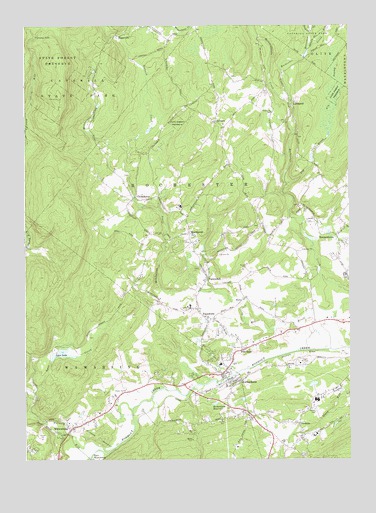
Kerhonkson, NY USGS Topographic Map
Click on map above to begin viewing in our Map Viewer.

This topographic map contains these locations and features:
Feature Name Type Latitude Longitude GNIS ID View Map
Accord Fire District Rochester Volunteer Fire Company 2BuildingN41.8607°W74.3017°2735441View Map
Arrowhead FarmsLocaleN41.7853°W74.2731°2559336View Map
Beaverdam CreekStreamN41.8662°W74.2665°943455View Map
Bell's Tree FarmLocaleN41.8269°W74.2703°2559305View Map
Burd FarmLocaleN41.7664°W74.3247°2559307View Map
Catskill Native NurseryLocaleN41.8319°W74.3014°2559340View Map
CherrytownPopulated PlaceN41.8251°W74.3293°972317View Map
Cherrytown School (historical)SchoolN41.8247°W74.3314°2370514View Map
Community Bible ChurchChurchN41.7570°W74.3574°2598111View Map
Escot Valley FarmLocaleN41.7614°W74.3297°2559341View Map
FantinekillPopulated PlaceN41.8020°W74.3046°949905View Map
Federated Church of KerhonksonChurchN41.7737°W74.2980°2598322View Map
Foords More Sanitarium (historical)HospitalN41.7539°W74.2914°2370512View Map
Frank Utter Colony FarmLocaleN41.7697°W74.3347°2370513View Map
GranitePopulated PlaceN41.7601°W74.2690°951500View Map
Granite Road Mobile Home ParkPopulated PlaceN41.7539°W74.2732°2599362View Map
Gray BrookStreamN41.8582°W74.2802°2771423View Map
Hidden Forest Mobile Home ParkPopulated PlaceN41.7970°W74.2541°2599364View Map
Hudson Valley ResortLocaleN41.7707°W74.2665°2599414View Map
Kelder's FarmLocaleN41.7889°W74.2589°2559315View Map
KerhonksonPopulated PlaceN41.7748°W74.2982°954549View Map
Kerhonkson Census Designated PlaceCensusN41.7797°W74.2955°2389999View Map
Kerhonkson Elementary SchoolSchoolN41.7774°W74.2998°2667405View Map
Kerhonkson Fire CompanyBuildingN41.7734°W74.2953°2718318View Map
Kerhonkson High SchoolSchoolN41.7772°W74.2981°2370515View Map
Kerhonkson Post OfficePost OfficeN41.7757°W74.2954°2599321View Map
Kerhonkson ReservoirReservoirN41.7659°W74.3017°954550View Map
Kingdom Hall of Jehovahs WitnessesChurchN41.7621°W74.3512°2598119View Map
LiebhardtPopulated PlaceN41.8518°W74.2721°972723View Map
Liebhardt SchoolSchoolN41.8501°W74.2793°955290View Map
Loosestrife FarmLocaleN41.8014°W74.2828°2559350View Map
Lyon CreekStreamN41.7701°W74.3718°956187View Map
Lyon LakeLakeN41.7805°W74.3606°956190View Map
MettacahontsPopulated PlaceN41.8129°W74.2543°957043View Map
Mettacahonts CreekStreamN41.8534°W74.2715°970351View Map
Mettacahonts School (historical)SchoolN41.8144°W74.2542°2370516View Map
Mine Hole BrookStreamN41.7681°W74.3257°1781937View Map
MombaccusPopulated PlaceN41.8151°W74.3115°957497View Map
Mombaccus CreekStreamN41.7893°W74.2899°957498View Map
Mombaccus School (historical)SchoolN41.8147°W74.3119°2370517View Map
Napanoch Census Designated PlaceCensusN41.7514°W74.3729°2389527View Map
Napanoch Volunteer Fire Department Station 2BuildingN41.7564°W74.3570°2735506View Map
Norwegian Wood FarmLocaleN41.7742°W74.3289°2559353View Map
One Earth FarmLocaleN41.7619°W74.3214°2559354View Map
PataukunkPopulated PlaceN41.7918°W74.3060°959972View Map
Pataukunk School (historical)SchoolN41.7914°W74.3058°2370518View Map
Pine BushPopulated PlaceN41.7820°W74.2899°960422View Map
Pine Bush CemeteryCemeteryN41.7834°W74.2830°2559443View Map
Pinebush School (historical)SchoolN41.7883°W74.2664°2370519View Map
Pinegrove Dude RanchLocaleN41.7942°W74.3111°2559332View Map
Piolis Brookside AirportAirportN41.8642°W74.3314°978100View Map
RiggsvillePopulated PlaceN41.8720°W74.3388°973005View Map
Rochester Center School (historical)SchoolN41.8150°W74.2822°2371309View Map
Rolling Meadow StablesLocaleN41.8053°W74.3303°2559355View Map
Rondout Valley Camping ResortLocaleN41.7965°W74.2543°2599410View Map
Sapbush CreekStreamN41.8390°W74.3352°964474View Map
Soccanissing School (historical)SchoolN41.7664°W74.3417°2371310View Map
Sugarbrook Maple FarmLocaleN41.8086°W74.3072°2559358View Map
TabascoPopulated PlaceN41.8476°W74.3007°973135View Map
Tabasco School (historical)SchoolN41.8544°W74.3003°2371311View Map
Town of RochesterCivilN41.8123°W74.2798°979427View Map
Ukrainian Catholic ChurchChurchN41.7615°W74.3136°2598137View Map
Vernooy FallsFallsN41.8718°W74.3705°968500View Map
Vernooy KillStreamN41.7529°W74.3452°968502View Map
Vly BrookStreamN41.8293°W74.2740°968582View Map
Vly SwampSwampN41.8558°W74.2564°968594View Map
WawarsingPopulated PlaceN41.7590°W74.3574°968946View Map
Wawarsing Christian AcademySchoolN41.7562°W74.3591°2597262View Map
Wawarsing School (historical)SchoolN41.7564°W74.3567°2371312View Map

Note: Coordinates in the location and feature list above are referenced to NAD83 datum.


Copyright (C) 2008-2024 Ryan Niemi / Sunset Dynamics ... All Rights Reserved