TopoQuest Logo
Do you find TopoQuest useful?
Help keep TopoQuest running and adding new maps/features by donating!
Bitcoin:  19c7KJd3qBynnjoSw5npx9KScwjBe4ifkT
Litecoin:  LXs6TkuXGGXo1vDsWCkWVdjQX94eUKd6ui
Home View Maps Find Maps Find Places Resources & Links


Kenton, Oklahoma Topographic Map

USGS Map Title: Kenton, OK
USGS Map MRC: 36102H8
DRG (GeoTIFF) Download: o36102h8.tif


Neighboring USGS Topographic Map Quads:


  Furnish Canyon East, CO  
37103A1
 

  Big Hole Canyon, CO  
37102A8
 

  Tubs Springs, CO  
37102A7
 

  Goodson School, NM  
36103H1
 

  Kenton, OK  
36102H8
 

  Kenton NE, OK  
36102H7
 

  Greendailey Canyon, NM  
36103G1
 

  Kenton SW, OK  
36102G8
 

  Kenton SE, OK  
36102G7


Map MRC Location:

N37°
W103°
N37°
W102°
H8 H7 H6 H5 H4 H3 H2 H1
G8 G7 G6 G5 G4 G3 G2 G1
F8 F7 F6 F5 F4 F3 F2 F1
E8 E7 E6 E5 E4 E3 E2 E1
D8 D7 D6 D5 D4 D3 D2 D1
C8 C7 C6 C5 C4 C3 C2 C1
B8 B7 B6 B5 B4 B3 B2 B1
A8 A7 A6 A5 A4 A3 A2 A1
N36°
W103°
N36°
W102°

Kenton, OK USGS 1:24K Topographic Map Preview:
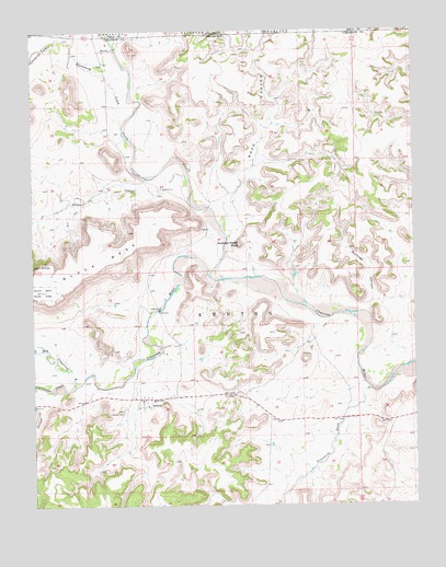
Kenton, OK USGS Topographic Map
Click on map above to begin viewing in our Map Viewer.

This topographic map contains these locations and features:
Feature Name Type Latitude Longitude GNIS ID View Map
Blacksmith CanyonValleyN36.9936°W102.9922°898250View Map
Blacksmith CanyonValleyN36.9930°W102.9904°1089486View Map
Blacksmith CreekStreamN36.9750°W102.9710°897544View Map
Burrows CanyonValleyN36.9270°W102.8916°1090736View Map
Carrizozo CreekStreamN36.9067°W102.9866°1090996View Map
Coopers ArroyoValleyN36.9612°W102.9492°1091674View Map
Dry Cimarron RiverStreamN36.9067°W102.9866°1092216View Map
Independence ArchArchN36.9522°W102.8761°2662661View Map
KentonPopulated PlaceN36.9031°W102.9633°1094330View Map
Kenton CemeteryCemeteryN36.8996°W102.9709°1094331View Map
Kenton Census Designated PlaceCensusN36.9064°W102.9652°2629924View Map
Kenton FirefightersBuildingN36.9027°W102.9619°2658536View Map
Kenton Post OfficePost OfficeN36.9029°W102.9619°1814648View Map
North Carrizo CreekStreamN36.9349°W102.9421°196326View Map
Road CanyonValleyN36.9571°W102.9358°196340View Map
Robbers Roost PeakSummitN36.9436°W102.9316°1097249View Map
Tesesquite CreekStreamN36.9050°W102.8891°898451View Map
Tharp CanyonValleyN36.9935°W102.9268°196341View Map
Tucker DamDamN36.9917°W102.9872°1758762View Map
Tucker ReservoirReservoirN36.9917°W102.9872°1758763View Map

Note: Coordinates in the location and feature list above are referenced to NAD83 datum.


Copyright (C) 2008-2024 Ryan Niemi / Sunset Dynamics ... All Rights Reserved