TopoQuest Logo
Do you find TopoQuest useful?
Help keep TopoQuest running and adding new maps/features by donating!
Bitcoin:  19c7KJd3qBynnjoSw5npx9KScwjBe4ifkT
Litecoin:  LXs6TkuXGGXo1vDsWCkWVdjQX94eUKd6ui
Home View Maps Find Maps Find Places Resources & Links


Keller, Texas Topographic Map

USGS Map Title: Keller, TX
USGS Map MRC: 32097H3
DRG (GeoTIFF) Download: o32097h3.tif


Neighboring USGS Topographic Map Quads:


  Rhome, TX  
33097A4
 

  Justin, TX  
33097A3
 

  Argyle, TX  
33097A2
 

  Avondale, TX  
32097H4
 

  Keller, TX  
32097H3
 

  Colleyville, TX  
32097H2
 

  Lake Worth, TX  
32097G4
 

  Haltom City, TX  
32097G3
 

  Hurst, TX  
32097G2


Map MRC Location:

N33°
W98°
N33°
W97°
H8 H7 H6 H5 H4 H3 H2 H1
G8 G7 G6 G5 G4 G3 G2 G1
F8 F7 F6 F5 F4 F3 F2 F1
E8 E7 E6 E5 E4 E3 E2 E1
D8 D7 D6 D5 D4 D3 D2 D1
C8 C7 C6 C5 C4 C3 C2 C1
B8 B7 B6 B5 B4 B3 B2 B1
A8 A7 A6 A5 A4 A3 A2 A1
N32°
W98°
N32°
W97°

Keller, TX USGS 1:24K Topographic Map Preview:
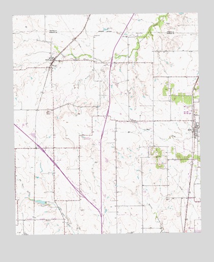
Keller, TX USGS Topographic Map
Click on map above to begin viewing in our Map Viewer.

This topographic map contains these locations and features:
Feature Name Type Latitude Longitude GNIS ID View Map
Alta Vista Mobile Home ParkPopulated PlaceN32.9340°W97.2824°2428249View Map
Amazing Grace Fellowship ChurchChurchN32.9332°W97.2536°2024781View Map
Blue MoundSummitN32.9446°W97.3520°1330912View Map
Buffalo CreekStreamN32.9762°W97.3020°1331561View Map
Callahan FieldParkN32.8779°W97.2603°2027961View Map
Calvary United Pentecostal ChurchChurchN32.9337°W97.2517°2023579View Map
Capp Smith Park TrailTrailN32.8751°W97.2572°2032925View Map
Chisholm Trail Intermediate SchoolSchoolN32.8848°W97.3014°2008673View Map
Circle C Ranch Airport (historical)AirportN32.8787°W97.3372°1387445View Map
City of HasletCivilN32.9612°W97.3379°2410713View Map
Fort Worth Alliance AirportAirportN32.9859°W97.3146°1386682View Map
Fort Worth Fire Department Station 35BuildingN32.9828°W97.3131°2551637View Map
Fort Worth Fire Department Station 37BuildingN32.9244°W97.2830°2551640View Map
Fort Worth Fire Department Station 38BuildingN32.9714°W97.2622°2551647View Map
Fossil Hill Middle SchoolSchoolN32.8771°W97.3020°2008572View Map
Fossil Hill Middle School Football FieldParkN32.8793°W97.3011°2027872View Map
Fossil Ridge High SchoolSchoolN32.8910°W97.2952°2428808View Map
HasletPopulated PlaceN32.9748°W97.3478°1337443View Map
Haslet Church of ChristChurchN32.9712°W97.3497°2024027View Map
Haslet City HallBuildingN32.9744°W97.3485°2753704View Map
Haslet Elementary SchoolSchoolN32.9693°W97.3492°2004018View Map
Haslet Fire DepartmentBuildingN32.9503°W97.3480°2551705View Map
Haslet Post OfficePost OfficeN32.9611°W97.3487°2731747View Map
Highland Middle SchoolSchoolN32.8837°W97.3486°2008603View Map
Hillcrest AirportAirportN32.9668°W97.2753°1386999View Map
Hillwood Middle SchoolSchoolN32.8886°W97.2635°2428813View Map
KellerPopulated PlaceN32.9346°W97.2517°1338994View Map
Keller Fire and RescueBuildingN32.9325°W97.2541°2551470View Map
Keller Pumping StationLocaleN32.9401°W97.2958°1384404View Map
Loughridge LakeReservoirN32.8938°W97.3583°1855788View Map
Loughridge Lake DamDamN32.8935°W97.3553°1855787View Map
Love and Healing Christian Fellowship ChurchChurchN32.8891°W97.2921°2428391View Map
Meadow Glen Mobile Home ParkPopulated PlaceN32.9452°W97.2944°2428250View Map
North Tarrant County Fire DepartmentBuildingN32.9385°W97.2693°2551830View Map
Northridge Baptist ChurchChurchN32.9504°W97.2978°2024169View Map
Park Glen Elementary SchoolSchoolN32.8843°W97.2756°2008506View Map
Pine Tree Estates Number 2Populated PlaceN32.9359°W97.2683°2428251View Map
Saginaw Fire Department Station 2BuildingN32.8757°W97.3520°2551631View Map
Sweets Chapel CemeteryCemeteryN32.9871°W97.2967°1348138View Map
Town Oaks Baptist ChurchChurchN32.9123°W97.2553°2024072View Map
Ultralight InternationalAirportN32.9487°W97.3292°1386794View Map
Watauga City HallBuildingN32.8751°W97.2555°2753458View Map
Whitley Road Elementary SchoolSchoolN32.8815°W97.2550°2008408View Map

Note: Coordinates in the location and feature list above are referenced to NAD83 datum.


Copyright (C) 2008-2024 Ryan Niemi / Sunset Dynamics ... All Rights Reserved