TopoQuest Logo
Do you find TopoQuest useful?
Help keep TopoQuest running and adding new maps/features by donating!
Bitcoin:  19c7KJd3qBynnjoSw5npx9KScwjBe4ifkT
Litecoin:  LXs6TkuXGGXo1vDsWCkWVdjQX94eUKd6ui
Home View Maps Find Maps Find Places Resources & Links


June Lake, California Topographic Map

USGS Map Title: June Lake, CA
USGS Map MRC: 37119G1
DRG (GeoTIFF) Download: o37119g1.tif


Neighboring USGS Topographic Map Quads:


  Mount Dana, CA  
37119H2
 

  Lee Vining, CA  
37119H1
 

  Mono Mills, CA  
37118H8
 

  Koip Peak, CA  
37119G2
 

  June Lake, CA  
37119G1
 

  Crestview, CA  
37118G8
 

  Mount Ritter, CA  
37119F2
 

  Mammoth Mountain, CA  
37119F1
 

  Old Mammoth, CA  
37118F8


Map MRC Location:

N38°
W120°
N38°
W119°
H8 H7 H6 H5 H4 H3 H2 H1
G8 G7 G6 G5 G4 G3 G2 G1
F8 F7 F6 F5 F4 F3 F2 F1
E8 E7 E6 E5 E4 E3 E2 E1
D8 D7 D6 D5 D4 D3 D2 D1
C8 C7 C6 C5 C4 C3 C2 C1
B8 B7 B6 B5 B4 B3 B2 B1
A8 A7 A6 A5 A4 A3 A2 A1
N37°
W120°
N37°
W119°

June Lake, CA USGS 1:24K Topographic Map Preview:
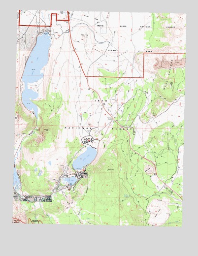
June Lake, CA USGS Topographic Map
Click on map above to begin viewing in our Map Viewer.

This topographic map contains these locations and features:
Feature Name Type Latitude Longitude GNIS ID View Map
Aeolian ButtesSummitN37.8533°W119.0607°1657891View Map
Aerie Crag CampgroundLocaleN37.8035°W119.1121°275770View Map
Fern CreekStreamN37.7627°W119.1132°260084View Map
Glass FlowLocaleN37.7577°W119.0276°275820View Map
Grant LakeReservoirN37.8400°W119.1115°260769View Map
Grant Lake 6-033 DamDamN37.8624°W119.1039°1663309View Map
Grant Lake Boating SiteLocaleN37.8330°W119.1195°2547620View Map
Grant Lake CamgroundLocaleN37.8312°W119.1206°2547621View Map
Grant Lake OverlookLocaleN37.8130°W119.1049°275769View Map
Gull LakeLakeN37.7756°W119.0833°260979View Map
Gull Lake CampgroundLocaleN37.7730°W119.0818°275781View Map
Gull Meadows Boating SiteLocaleN37.7750°W119.0862°2547622View Map
Hartley SpringsSpringN37.7674°W119.0408°261121View Map
Hartley Springs CampgroundLocaleN37.7716°W119.0376°275860View Map
June LakePopulated PlaceN37.7797°W119.0754°1658875View Map
June LakeLakeN37.7886°W119.0736°262048View Map
June Lake BeachLocaleN37.7961°W119.0696°2547634View Map
June Lake Beach CampgroundLocaleN37.7952°W119.0651°275778View Map
June Lake CampgroundLocaleN37.7819°W119.0749°275780View Map
June Lake Census Designated PlaceCensusN37.7677°W119.1022°2583044View Map
June Lake Fire Protection District Station 1 HeadquartersBuildingN37.7831°W119.0733°2624277View Map
June Lake Fire Protection District Station 2BuildingN37.7622°W119.1095°2623924View Map
June Lake JunctionPopulated PlaceN37.8124°W119.0543°262049View Map
June Lake Junction KioskBuildingN37.8116°W119.0549°2547635View Map
June Lake Post OfficePost OfficeN37.7779°W119.0758°2789137View Map
June Lake Post Office (historical)Post OfficeN37.7797°W119.0754°1940094View Map
June Loop AmphitheatreLocaleN37.7658°W119.0974°275784View Map
June Mountain Ski AreaLocaleN37.7513°W119.0726°275635View Map
June Mountain Ski LodgeLocaleN37.7658°W119.0890°275783View Map
Mono County Paramedics Station 2BuildingN37.7831°W119.0733°2662240View Map
Mono CratersCraterN37.8624°W119.0065°267024View Map
Mono Craters TunnelTunnelN37.8352°W119.0160°263744View Map
Obsidian DomeSummitN37.7591°W119.0204°275821View Map
Oh RidgeRidgeN37.7972°W119.0618°264310View Map
Oh! Ridge CampgroundLocaleN37.8005°W119.0713°275776View Map
Pine Cliff CampgroundLocaleN37.7968°W119.0764°2547683View Map
Pine Cliff Trailer ParkLocaleN37.7947°W119.0760°275777View Map
Punch BowlBasinN37.8149°W119.0265°265065View Map
Reversed CreekStreamN37.7666°W119.1218°265380View Map
Reversed Creek CampgroundLocaleN37.7705°W119.0849°275782View Map
Reversed PeakSummitN37.8044°W119.0996°265381View Map
Rush Creek Recreation SiteLocaleN37.7930°W119.1221°275774View Map
Silver Lake CampgroundLocaleN37.7841°W119.1243°275775View Map
Wilson ButteSummitN37.7824°W119.0260°269195View Map
Yost CreekStreamN37.7638°W119.1060°269367View Map
Yost Lake TrailheadLocaleN37.7829°W119.0725°2547589View Map

Note: Coordinates in the location and feature list above are referenced to NAD83 datum.


Copyright (C) 2008-2024 Ryan Niemi / Sunset Dynamics ... All Rights Reserved