TopoQuest Logo
Do you find TopoQuest useful?
Help keep TopoQuest running and adding new maps/features by donating!
Bitcoin:  19c7KJd3qBynnjoSw5npx9KScwjBe4ifkT
Litecoin:  LXs6TkuXGGXo1vDsWCkWVdjQX94eUKd6ui
Home View Maps Find Maps Find Places Resources & Links


Jumbo Peak, Nevada Topographic Map

USGS Map Title: Jumbo Peak, NV
USGS Map MRC: 36114B2
DRG (GeoTIFF) Download: o36114b2.tif


Neighboring USGS Topographic Map Quads:


  Lime Wash, NV  
36114C3
 

  Gold Butte, NV  
36114C2
 

  Azure Ridge, NV  
36114C1
 

  Garrett Butte, NV  
36114B3
 

  Jumbo Peak, NV  
36114B2
 

  Iceberg Canyon, NV  
36114B1
 

  The Temple, NV  
36114A3
 

  Hiller Mountains, NV  
36114A2
 

  Meadview North, AZ  
36114A1


Map MRC Location:

N37°
W115°
N37°
W114°
H8 H7 H6 H5 H4 H3 H2 H1
G8 G7 G6 G5 G4 G3 G2 G1
F8 F7 F6 F5 F4 F3 F2 F1
E8 E7 E6 E5 E4 E3 E2 E1
D8 D7 D6 D5 D4 D3 D2 D1
C8 C7 C6 C5 C4 C3 C2 C1
B8 B7 B6 B5 B4 B3 B2 B1
A8 A7 A6 A5 A4 A3 A2 A1
N36°
W115°
N36°
W114°

Jumbo Peak, NV USGS 1:24K Topographic Map Preview:
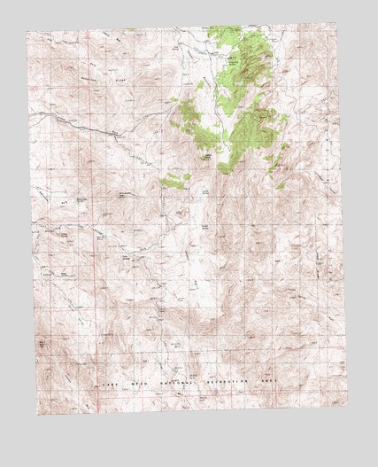
Jumbo Peak, NV USGS Topographic Map
Click on map above to begin viewing in our Map Viewer.

This topographic map contains these locations and features:
Feature Name Type Latitude Longitude GNIS ID View Map
Anderson MineMineN36.2258°W114.2119°855312View Map
Anderson RidgeRidgeN36.2317°W114.2177°838453View Map
Bonelli PeakSummitN36.1489°W114.2497°838967View Map
Cedar BasinBasinN36.2311°W114.1805°839381View Map
Cottonwood SpringSpringN36.1930°W114.1275°839776View Map
Eureka (historical)LocaleN36.2208°W114.1444°851450View Map
Falls SpringSpringN36.2429°W114.1886°840417View Map
Garnet ValleyValleyN36.1736°W114.2466°840618View Map
Gotchel SpringSpringN36.1840°W114.1829°840728View Map
Grapevine SpringSpringN36.2394°W114.1694°840770View Map
Greenhorn MineMineN36.1608°W114.1966°855313View Map
Hells KitchenBasinN36.1719°W114.1364°840947View Map
Jumbo BasinBasinN36.1733°W114.1855°841432View Map
Jumbo PeakSummitN36.2061°W114.1808°841436View Map
Jumbo SpringSpringN36.1960°W114.1825°845877View Map
Jumbo Springs WildernessReserveN36.1741°W114.1664°2542654View Map
Lakeshore MineMineN36.1378°W114.1952°854936View Map
Lookout MineMineN36.2341°W114.2119°855311View Map
Nevada Mica MineMineN36.1889°W114.2236°845921View Map
Pierson GapGapN36.2422°W114.1527°842805View Map
Radio Crystal MineMineN36.2480°W114.1722°854958View Map
Rattlesnake PeakSummitN36.1950°W114.2158°845614View Map
Rattlesnake SpringSpringN36.1938°W114.2333°843101View Map
Ruby SpringSpringN36.1696°W114.2396°847475View Map
Scanlon DugwayLocaleN36.1583°W114.2008°843527View Map
Turkey SpringSpringN36.1835°W114.2398°844460View Map
Twin SpringsSpringN36.1755°W114.2153°844501View Map
Windmill MineMineN36.1622°W114.1930°854990View Map

Note: Coordinates in the location and feature list above are referenced to NAD83 datum.


Copyright (C) 2008-2024 Ryan Niemi / Sunset Dynamics ... All Rights Reserved