TopoQuest Logo
Do you find TopoQuest useful?
Help keep TopoQuest running and adding new maps/features by donating!
Bitcoin:  19c7KJd3qBynnjoSw5npx9KScwjBe4ifkT
Litecoin:  LXs6TkuXGGXo1vDsWCkWVdjQX94eUKd6ui
Home View Maps Find Maps Find Places Resources & Links


Bald Peak, Wyoming Topographic Map

USGS Map Title: Bald Peak, WY
USGS Map MRC: 44109G3
DRG (GeoTIFF) Download: o44109g3.tif


Neighboring USGS Topographic Map Quads:


  Deep Lake, WY  
44109H4
 

  North Bennett Creek, WY  
44109H3
 

  Clark, WY  
44109H2
 

  Dillworth Bench, WY  
44109G4
 

  Bald Peak, WY  
44109G3
 

  Chapman Bench, WY  
44109G2
 

  Dead Indian Meadows, WY  
44109F4
 

  Pat O' Hara Mountain, WY  
44109F3
 

  Goff Lake, WY  
44109F2


Map MRC Location:

N45°
W110°
N45°
W109°
H8 H7 H6 H5 H4 H3 H2 H1
G8 G7 G6 G5 G4 G3 G2 G1
F8 F7 F6 F5 F4 F3 F2 F1
E8 E7 E6 E5 E4 E3 E2 E1
D8 D7 D6 D5 D4 D3 D2 D1
C8 C7 C6 C5 C4 C3 C2 C1
B8 B7 B6 B5 B4 B3 B2 B1
A8 A7 A6 A5 A4 A3 A2 A1
N44°
W110°
N44°
W109°

Bald Peak, WY USGS 1:24K Topographic Map Preview:
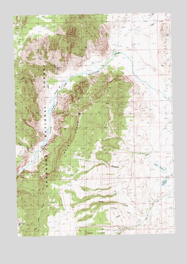
Bald Peak, WY USGS Topographic Map
Click on map above to begin viewing in our Map Viewer.

This topographic map contains these locations and features:
Feature Name Type Latitude Longitude GNIS ID View Map
Bakers RanchLocaleN44.7744°W109.2913°1597878View Map
Bald PeakSummitN44.8188°W109.3218°1597892View Map
Bald RidgeRidgeN44.7977°W109.3332°1597896View Map
Bridal Veil FallsFallsN44.8448°W109.3413°1598367View Map
Clarks Fork CanyonValleyN44.8474°W109.3029°1598775View Map
Cyclone BarBarN44.8344°W109.3413°1599097View Map
Cyclone Bar CreekStreamN44.8272°W109.3449°1599098View Map
Davidson RanchLocaleN44.7658°W109.2671°1599124View Map
Dead Indian GulchValleyN44.7858°W109.3719°1599147View Map
Dead Indian HillSummitN44.7572°W109.3743°1599148View Map
Dead Indian MineMineN44.7605°W109.3499°1725941View Map
Falls CreekStreamN44.8372°W109.3346°1599670View Map
Hogan ReservoirReservoirN44.7875°W109.2611°1600356View Map
Luce DamDamN44.7816°W109.2524°1607808View Map
Luce ReservoirReservoirN44.7797°W109.2573°1601192View Map
Martins RanchLocaleN44.8661°W109.2893°1601276View Map
Rapid CreekStreamN44.7963°W109.3599°1602396View Map
Sheep CreekStreamN44.7605°W109.2752°1602829View Map
Waggoner ClaimsMineN44.8472°W109.3517°1725971View Map
Willow CreekStreamN44.7619°W109.2702°1604201View Map

Note: Coordinates in the location and feature list above are referenced to NAD83 datum.


Copyright (C) 2008-2024 Ryan Niemi / Sunset Dynamics ... All Rights Reserved