TopoQuest Logo
Do you find TopoQuest useful?
Help keep TopoQuest running and adding new maps/features by donating!
Bitcoin:  19c7KJd3qBynnjoSw5npx9KScwjBe4ifkT
Litecoin:  LXs6TkuXGGXo1vDsWCkWVdjQX94eUKd6ui
Home View Maps Find Maps Find Places Resources & Links


Iron Springs, Pennsylvania Topographic Map

USGS Map Title: Iron Springs, PA
USGS Map MRC: 39077G4
DRG (GeoTIFF) Download: o39077g4.tif


Neighboring USGS Topographic Map Quads:


  Scotland, PA  
39077H5
 

  Caledonia Park, PA  
39077H4
 

  Arendtsville, PA  
39077H3
 

  Waynesboro, PA  
39077G5
 

  Iron Springs, PA  
39077G4
 

  Fairfield, PA  
39077G3
 

  Smithsburg, MD  
39077F5
 

  Blue Ridge Summit, PA  
39077F4
 

  Emmitsburg, MD  
39077F3


Map MRC Location:

N40°
W78°
N40°
W77°
H8 H7 H6 H5 H4 H3 H2 H1
G8 G7 G6 G5 G4 G3 G2 G1
F8 F7 F6 F5 F4 F3 F2 F1
E8 E7 E6 E5 E4 E3 E2 E1
D8 D7 D6 D5 D4 D3 D2 D1
C8 C7 C6 C5 C4 C3 C2 C1
B8 B7 B6 B5 B4 B3 B2 B1
A8 A7 A6 A5 A4 A3 A2 A1
N39°
W78°
N39°
W77°

Iron Springs, PA USGS 1:24K Topographic Map Preview:
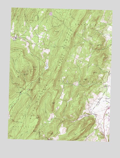
Iron Springs, PA USGS Topographic Map
Click on map above to begin viewing in our Map Viewer.

This topographic map contains these locations and features:
Feature Name Type Latitude Longitude GNIS ID View Map
Antietam DamDamN39.8184°W77.4530°1194366View Map
Bakers KnobSummitN39.8084°W77.4069°1168614View Map
Briar MountainSummitN39.8095°W77.4900°1170223View Map
Buzzard ParkSummitN39.8184°W77.4705°1170827View Map
Camp PennLocaleN39.7931°W77.4869°1206255View Map
Carbaugh ReservoirReservoirN39.8702°W77.4507°1201669View Map
Carbaugh Run DamDamN39.8718°W77.4514°1194397View Map
Carroll Valley Police DepartmentBuildingN39.7609°W77.3815°2754558View Map
Carroll Valley Resort Golf CourseLocaleN39.7590°W77.3780°1205848View Map
Chamberlains HillSummitN39.8412°W77.3919°1171537View Map
Charnita LakeLakeN39.7583°W77.3824°1212677View Map
Chimney RocksSummitN39.8162°W77.4700°1171786View Map
Cold SpringsSpringN39.8393°W77.4440°1172165View Map
Cold Springs SchoolSchoolN39.8409°W77.4603°1211036View Map
Copper RunStreamN39.7718°W77.4290°1172443View Map
Corls RidgeRidgeN39.8687°W77.4897°1172460View Map
Culp RidgeRidgeN39.7879°W77.4153°1172820View Map
Devils RacecourseAreaN39.7512°W77.4680°1211107View Map
Fairfield SchoolSchoolN39.7818°W77.3755°1174432View Map
Fairfield StationLocaleN39.7895°W77.3869°1174434View Map
Fairfield Union CemeteryCemeteryN39.7777°W77.3792°2774798View Map
GladhillPopulated PlaceN39.7518°W77.4497°1192519View Map
Green RidgeRidgeN39.8540°W77.4217°1176103View Map
Green Ridge TrailTrailN39.8601°W77.4242°1206251View Map
Green Ridge VistaLocaleN39.7929°W77.4625°1206254View Map
Green RunStreamN39.8454°W77.4069°1176110View Map
Greenstone Post OfficePost OfficeN39.7518°W77.4497°1214706View Map
Hayes RunStreamN39.8162°W77.4572°1176689View Map
Iron SpringSpringN39.7770°W77.3977°1177850View Map
Iron SpringsPopulated PlaceN39.7757°W77.3967°1177851View Map
Jacks MountainPopulated PlaceN39.7545°W77.4022°1203882View Map
Jacks MountainSummitN39.7576°W77.4180°1177905View Map
Jacks Mountain Covered BridgeBridgeN39.7672°W77.3864°2723088View Map
Kepner KnobSummitN39.7856°W77.4461°1178395View Map
Knob SpringsSpringN39.8581°W77.4425°1178613View Map
Maria FurnacePopulated PlaceN39.7751°W77.4050°1180406View Map
MarshallPopulated PlaceN39.8151°W77.3758°1212678View Map
Marys HillSummitN39.8293°W77.3836°1180518View Map
Marys RockPillarN39.8265°W77.3930°1211038View Map
McCarrys KnobSummitN39.7959°W77.4414°1201589View Map
Monument RockSummitN39.8118°W77.4822°1181489View Map
Mount Carmel ChurchChurchN39.8493°W77.3986°1181670View Map
Mount Carmel United Methodist Church CemeteryCemeteryN39.8492°W77.3993°2774908View Map
Mount HopePopulated PlaceN39.8034°W77.4275°1181704View Map
Mount Hope United Methodist Church CemeteryCemeteryN39.8042°W77.4300°2774909View Map
Mount Pleasant SchoolSchoolN39.8251°W77.4100°1211039View Map
New Baltimore SchoolSchoolN39.8437°W77.4797°1211035View Map
Old ForgePopulated PlaceN39.7945°W77.4842°1182913View Map
Old Forge Picnic AreaAreaN39.7951°W77.4830°1212849View Map
Pine MountainSummitN39.7565°W77.4469°1213643View Map
Poplar SpringSpringN39.8570°W77.4000°1202431View Map
RamPopulated PlaceN39.8515°W77.4605°1212679View Map
Rattlesnake RunStreamN39.7948°W77.4786°1184678View Map
Raven RockPillarN39.8326°W77.3803°1211037View Map
Roth Private Airstrip (historical)AirportN39.7993°W77.3805°1193743View Map
Rupp HillSummitN39.8154°W77.3961°1185625View Map
Saint Mary's CemeteryCemeteryN39.7769°W77.3797°1186359View Map
Saw Mill RunStreamN39.8701°W77.4533°1212680View Map
Snowy MountainSummitN39.8345°W77.4939°1187950View Map
Snowy Mountain Fire TowerTowerN39.8343°W77.4955°1206257View Map
Snowy Mountain Fire TowerBuildingN39.8342°W77.4950°2644771View Map
South MountainPopulated PlaceN39.8465°W77.4878°1188089View Map
South Mountain Post OfficePost OfficeN39.8484°W77.4897°2779963View Map
South Mountain Restoration CenterHospitalN39.8445°W77.4930°1212848View Map
South Mountain Restoration CenterHospitalN39.8461°W77.4928°1193411View Map
South Mountain Volunteer Fire Department - Company 16BuildingN39.8528°W77.4819°2645281View Map
Strang CemeteryCemeteryN39.8588°W77.4752°1188851View Map
Swamp CreekStreamN39.8034°W77.4119°1189138View Map
Tartown (historical)Populated PlaceN39.8196°W77.4527°1211041View Map
The KnobSummitN39.8534°W77.4442°1189413View Map
Township of HamiltonbanCivilN39.8031°W77.4143°1215784View Map
Trucker RunStreamN39.7926°W77.4855°1189883View Map
Tumbling RunStreamN39.8004°W77.4742°1189914View Map
Virginia MillsPopulated PlaceN39.8029°W77.3761°1190443View Map
Virginia RockSummitN39.7726°W77.4642°1190444View Map
Waynesboro DamDamN39.8179°W77.4544°1190721View Map
Waynesboro ReservoirReservoirN39.7978°W77.4760°1190722View Map
Wildcat RocksSummitN39.7598°W77.4686°1191417View Map

Note: Coordinates in the location and feature list above are referenced to NAD83 datum.


Copyright (C) 2008-2024 Ryan Niemi / Sunset Dynamics ... All Rights Reserved