TopoQuest Logo
Do you find TopoQuest useful?
Help keep TopoQuest running and adding new maps/features by donating!
Bitcoin:  19c7KJd3qBynnjoSw5npx9KScwjBe4ifkT
Litecoin:  LXs6TkuXGGXo1vDsWCkWVdjQX94eUKd6ui
Home View Maps Find Maps Find Places Resources & Links


Houston, Alabama Topographic Map

USGS Map Title: Houston, AL
USGS Map MRC: 34087B3
DRG (GeoTIFF) Download: o34087b3.tif


Neighboring USGS Topographic Map Quads:


  Bee Branch, AL  
34087C4
 

  Grayson, AL  
34087C3
 

  Upshaw, AL  
34087C2
 

  Double Springs, AL  
34087B4
 

  Houston, AL  
34087B3
 

  Addison, AL  
34087B2
 

  Poplar Springs, AL  
34087A4
 

  Black Pond, AL  
34087A3
 

  Arley, AL  
34087A2


Map MRC Location:

N35°
W88°
N35°
W87°
H8 H7 H6 H5 H4 H3 H2 H1
G8 G7 G6 G5 G4 G3 G2 G1
F8 F7 F6 F5 F4 F3 F2 F1
E8 E7 E6 E5 E4 E3 E2 E1
D8 D7 D6 D5 D4 D3 D2 D1
C8 C7 C6 C5 C4 C3 C2 C1
B8 B7 B6 B5 B4 B3 B2 B1
A8 A7 A6 A5 A4 A3 A2 A1
N34°
W88°
N34°
W87°

Houston, AL USGS 1:24K Topographic Map Preview:
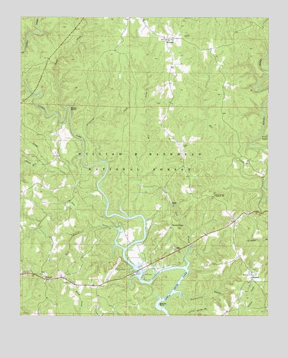
Houston, AL USGS Topographic Map
Click on map above to begin viewing in our Map Viewer.

This topographic map contains these locations and features:
Feature Name Type Latitude Longitude GNIS ID View Map
Adair ChapelChurchN34.1529°W87.2961°159048View Map
Bailey CemeteryCemeteryN34.1458°W87.2608°2681694View Map
Barnett CemeteryCemeteryN34.1803°W87.3119°2701978View Map
Barnett ChapelChurchN34.1720°W87.2983°159117View Map
Barnett ChapelPopulated PlaceN34.1620°W87.2995°159118View Map
Barnett Chapel Church CemeteryCemeteryN34.1717°W87.2986°2681696View Map
Barnett School (historical)SchoolN34.1729°W87.2986°162066View Map
Beasley BendBendN34.1304°W87.3047°159132View Map
Buck BranchStreamN34.1632°W87.3389°159261View Map
Bull BranchStreamN34.1459°W87.2906°159267View Map
Burdick CemeteryCemeteryN34.1355°W87.2600°2701706View Map
Cane CreekStreamN34.1534°W87.3222°159317View Map
Coles Mill (historical)LocaleN34.1895°W87.3739°1730475View Map
Curtis CemeteryCemeteryN34.1919°W87.3694°162948View Map
Curtis Mill CreekStreamN34.1904°W87.3642°159476View Map
Double Springs-Winston County AirportAirportN34.1430°W87.3295°161282View Map
Dragout CemeteryCemeteryN34.2189°W87.2739°2701728View Map
Enon CemeteryCemeteryN34.1378°W87.3344°2701732View Map
FairviewPopulated PlaceN34.1409°W87.3572°159586View Map
Fairview ChurchChurchN34.1415°W87.3631°162080View Map
Fairview Church CemeteryCemeteryN34.1425°W87.3628°2701734View Map
Fairview School (historical)SchoolN34.1422°W87.3614°2680045View Map
Fairview Work CenterBuildingN34.1404°W87.3667°162081View Map
Freeman-Williams CemeteryCemeteryN34.2136°W87.3078°2701737View Map
Grindstone CreekStreamN34.1898°W87.3331°159698View Map
Holly Grove School (historical)SchoolN34.1787°W87.3467°162087View Map
HoustonPopulated PlaceN34.1415°W87.2581°159817View Map
Houston Baptist Church CemeteryCemeteryN34.1444°W87.2578°2701774View Map
Houston ChurchChurchN34.1670°W87.2603°162088View Map
Houston Church of God CemeteryCemeteryN34.1686°W87.2614°2701773View Map
Houston JailBuildingN34.1411°W87.2575°2680861View Map
Houston Memorial United Methodist Church CemeteryCemeteryN34.1431°W87.2586°2701775View Map
Houston Post OfficePost OfficeN34.1415°W87.2578°167148View Map
Houston School (historical)SchoolN34.1456°W87.2583°2680092View Map
Houston Union ChurchChurchN34.1448°W87.2572°162950View Map
Houston Union Church CemeteryCemeteryN34.1442°W87.2567°2701776View Map
Houston Volunteer Fire DepartmentBuildingN34.1418°W87.2583°2683382View Map
Inman CreekStreamN34.2001°W87.2536°159846View Map
LakeshorePopulated PlaceN34.1447°W87.3139°2680869View Map
Littles CemeteryCemeteryN34.1391°W87.2588°2701823View Map
Lowrimore CemeteryCemeteryN34.2394°W87.3528°2701825View Map
Memorial ChurchChurchN34.1426°W87.2586°160084View Map
Mill CreekStreamN34.1665°W87.3206°160100View Map
Moody BendBendN34.2115°W87.3506°160127View Map
Moody CemeteryCemeteryN34.1811°W87.3467°2701985View Map
MorelandPopulated PlaceN34.2412°W87.3006°160133View Map
Moreland Lookout TowerTowerN34.2420°W87.2928°164522View Map
Natural BridgeArchN34.1764°W87.2775°2571545View Map
Natural Bridge Recreation AreaLocaleN34.1754°W87.2770°160217View Map
New Home ChurchChurchN34.2404°W87.3003°160234View Map
New Home Missionary Baptist Church CemeteryCemeteryN34.2403°W87.3019°2701847View Map
Pair School (historical)SchoolN34.2369°W87.2969°2680150View Map
Payne CreekStreamN34.2118°W87.3517°160350View Map
Penitentiary BranchStreamN34.1351°W87.2970°160355View Map
Pine Grove CemeteryCemeteryN34.1389°W87.3492°2701855View Map
Pine Grove ChurchChurchN34.1387°W87.3497°160380View Map
Pisgah CemeteryCemeteryN34.1964°W87.2931°160394View Map
Robinson Bottoms (historical)Populated PlaceN34.1583°W87.3214°2680946View Map
Sandy CreekStreamN34.1923°W87.3436°160566View Map
Shadix CemeteryCemeteryN34.1814°W87.3456°2701988View Map
Shadix Post Office (historical)Post OfficeN34.1786°W87.3450°167145View Map
Shipman CemeteryCemeteryN34.1528°W87.3194°2701893View Map
Wilburns Mill (historical)LocaleN34.1859°W87.3503°1730485View Map
William B. Bankhead National ForestForestN34.2277°W87.3298°164525View Map
Williams Chapel CemeteryCemeteryN34.1695°W87.2561°162120View Map
Williams-Everett CemeteryCemeteryN34.1692°W87.2561°2701902View Map
Winston CountyCivilN34.1492°W87.3737°161592View Map

Note: Coordinates in the location and feature list above are referenced to NAD83 datum.


Copyright (C) 2008-2024 Ryan Niemi / Sunset Dynamics ... All Rights Reserved