TopoQuest Logo
Do you find TopoQuest useful?
Help keep TopoQuest running and adding new maps/features by donating!
Bitcoin:  19c7KJd3qBynnjoSw5npx9KScwjBe4ifkT
Litecoin:  LXs6TkuXGGXo1vDsWCkWVdjQX94eUKd6ui
Home View Maps Find Maps Find Places Resources & Links


Honey Brook, Pennsylvania Topographic Map

USGS Map Title: Honey Brook, PA
USGS Map MRC: 40075A8
DRG (GeoTIFF) Download: o40075a8.tif


Neighboring USGS Topographic Map Quads:


  Terre Hill, PA  
40076B1
 

  Morgantown, PA  
40075B8
 

  Elverson, PA  
40075B7
 

  New Holland, PA  
40076A1
 

  Honey Brook, PA  
40075A8
 

  Wagontown, PA  
40075A7
 

  Gap, PA  
39076H1
 

  Parkesburg, PA  
39075H8
 

  Coatesville, PA  
39075H7


Map MRC Location:

N41°
W76°
N41°
W75°
H8 H7 H6 H5 H4 H3 H2 H1
G8 G7 G6 G5 G4 G3 G2 G1
F8 F7 F6 F5 F4 F3 F2 F1
E8 E7 E6 E5 E4 E3 E2 E1
D8 D7 D6 D5 D4 D3 D2 D1
C8 C7 C6 C5 C4 C3 C2 C1
B8 B7 B6 B5 B4 B3 B2 B1
A8 A7 A6 A5 A4 A3 A2 A1
N40°
W76°
N40°
W75°

Honey Brook, PA USGS 1:24K Topographic Map Preview:
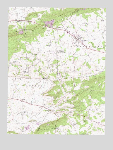
Honey Brook, PA USGS Topographic Map
Click on map above to begin viewing in our Map Viewer.

This topographic map contains these locations and features:
Feature Name Type Latitude Longitude GNIS ID View Map
BeartownPopulated PlaceN40.1115°W75.9774°1168976View Map
Beartown Post Office (historical)Post OfficeN40.1115°W75.9774°1214397View Map
Borough of Honey BrookCivilN40.0937°W75.9111°1215070View Map
Bridgeville ChurchChurchN40.1118°W75.9886°1170244View Map
Buchland SchoolSchoolN40.0784°W75.9663°1170507View Map
Buena VistaPopulated PlaceN40.0209°W75.9794°1170593View Map
CainsPopulated PlaceN40.0270°W75.9541°1170869View Map
Cains Post Office (historical)Post OfficeN40.0270°W75.9541°1214393View Map
CambridgePopulated PlaceN40.0815°W75.9374°1171143View Map
Cambridge Post Office (historical)Post OfficeN40.0815°W75.9374°1214396View Map
Cole HillPopulated PlaceN40.0132°W75.9677°1203306View Map
CompassPopulated PlaceN40.0226°W75.9424°1172273View Map
Compass SchoolSchoolN40.0262°W75.9386°1172274View Map
Honey BrookPopulated PlaceN40.0943°W75.9113°1177341View Map
Honey Brook AmbulanceBuildingN40.0948°W75.9132°2722294View Map
Honey Brook Borough Police DepartmentBuildingN40.0955°W75.9149°2777260View Map
Honey Brook Fire Company Station 33BuildingN40.0950°W75.9134°2653528View Map
Honey Brook Post OfficePost OfficeN40.0956°W75.9142°2779813View Map
Honey Brook QuarryMineN40.1247°W75.9000°2724961View Map
Indian Spring RunStreamN40.0195°W75.9772°1214233View Map
Lanchester LandfillLocaleN40.1111°W75.9464°2725964View Map
LappsLocaleN40.0184°W75.9797°1212335View Map
LimevillePopulated PlaceN40.0020°W75.9802°1179368View Map
MeadvillePopulated PlaceN40.0693°W75.9955°1212333View Map
Meadville SchoolSchoolN40.0704°W75.9927°1199143View Map
Mount Hope SchoolSchoolN40.0412°W75.9188°1181721View Map
Mount Pleasant SchoolSchoolN40.0548°W75.9497°1181831View Map
Mount Zion ChurchChurchN40.0823°W75.9602°1181917View Map
Mountain TopPopulated PlaceN40.1068°W75.9527°1204235View Map
NarvonPopulated PlaceN40.1029°W75.9777°1204257View Map
Narvon Post OfficePost OfficeN40.1080°W75.9779°2779789View Map
Old Road ChurchChurchN40.0329°W75.9811°1182932View Map
Pennsylvania Turnpike Interchange 13CrossingN40.0512°W75.9597°1196078View Map
Pequea ChurchChurchN40.0520°W75.9908°1183579View Map
Pequea Post Office (historical)Post OfficeN40.0348°W75.9938°1214394View Map
PhillipsvillePopulated PlaceN40.0012°W75.8972°1183679View Map
Pine Grove SchoolSchoolN40.0873°W75.9452°1183818View Map
Saint Johns ChurchChurchN40.0232°W75.9441°1186094View Map
Sandy Hill ChurchChurchN40.0095°W75.9158°1186945View Map
Sandy Hill SchoolSchoolN40.0143°W75.9011°1186946View Map
Seldomridge FarmLocaleN40.0561°W75.9997°2725597View Map
South HermitagePopulated PlaceN40.0598°W75.9808°1204688View Map
South Hermitage Post Office (historical)Post OfficeN40.0598°W75.9808°1214395View Map
State HillPopulated PlaceN40.0062°W75.9377°1188549View Map
SupleePopulated PlaceN40.0995°W75.8791°1204777View Map
Tel-Hai CampLocaleN40.0632°W75.8872°1189340View Map
The Baron HillsRangeN40.0529°W75.8797°1189386View Map
Township of Honey BrookCivilN40.0902°W75.8886°1216162View Map
Township of SalisburyCivilN40.0380°W75.9961°1216644View Map
Township of West CalnCivilN40.0237°W75.8866°1216188View Map
Waterloo SchoolSchoolN40.0295°W75.9533°1190679View Map
Welsh MountainSummitN40.1179°W75.9277°1193623View Map
White Hall SchoolSchoolN40.0545°W75.9841°1191277View Map
White HorsePopulated PlaceN40.0348°W75.9938°1193652View Map
White SchoolSchoolN40.1129°W75.8788°1213930View Map

Note: Coordinates in the location and feature list above are referenced to NAD83 datum.


Copyright (C) 2008-2024 Ryan Niemi / Sunset Dynamics ... All Rights Reserved