TopoQuest Logo
Do you find TopoQuest useful?
Help keep TopoQuest running and adding new maps/features by donating!
Bitcoin:  19c7KJd3qBynnjoSw5npx9KScwjBe4ifkT
Litecoin:  LXs6TkuXGGXo1vDsWCkWVdjQX94eUKd6ui
Home View Maps Find Maps Find Places Resources & Links


Hogum, Nevada Topographic Map

USGS Map Title: Hogum, NV
USGS Map MRC: 39114A4
DRG (GeoTIFF) Download: o39114a4.tif


Neighboring USGS Topographic Map Quads:


  Cave Mountain, NV  
39114B5
 

  South Bastian Spring, NV  
39114B4
 

  Sacramento Pass, NV  
39114B3
 

  Majors Place, NV  
39114A5
 

  Hogum, NV  
39114A4
 

  Windy Peak, NV  
39114A3
 

  North Spring Point, NV  
38114H5
 

  Baking Powder Flat, NV  
38114H4
 

  Wheeler Peak, NV  
38114H3


Map MRC Location:

N40°
W115°
N40°
W114°
H8 H7 H6 H5 H4 H3 H2 H1
G8 G7 G6 G5 G4 G3 G2 G1
F8 F7 F6 F5 F4 F3 F2 F1
E8 E7 E6 E5 E4 E3 E2 E1
D8 D7 D6 D5 D4 D3 D2 D1
C8 C7 C6 C5 C4 C3 C2 C1
B8 B7 B6 B5 B4 B3 B2 B1
A8 A7 A6 A5 A4 A3 A2 A1
N39°
W115°
N39°
W114°

Hogum, NV USGS 1:24K Topographic Map Preview:
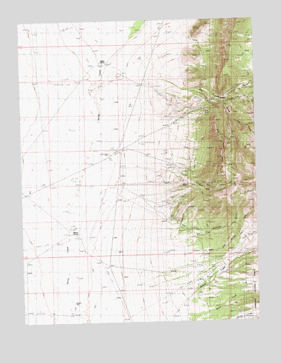
Hogum, NV USGS Topographic Map
Click on map above to begin viewing in our Map Viewer.

This topographic map contains these locations and features:
Feature Name Type Latitude Longitude GNIS ID View Map
Black Mule MineMineN39.0566°W114.3994°852836View Map
Cold Spring CanyonValleyN39.0261°W114.4058°859292View Map
Colorado GulchValleyN39.0305°W114.4142°859306View Map
Crystal Queen MineMineN39.0702°W114.4525°859432View Map
Dry GulchValleyN39.1038°W114.4300°859583View Map
Dry Gulch Pilot Knob MinesMineN39.0874°W114.4019°852835View Map
Grub GulchValleyN39.0961°W114.4063°859915View Map
HogumPopulated PlaceN39.0563°W114.4114°860008View Map
Hogum MinesMineN39.0558°W114.4094°852837View Map
Jacks GulchValleyN39.0849°W114.3886°860167View Map
Jacks SpringSpringN39.0762°W114.3755°860170View Map
Lassie Jean MineMineN39.0699°W114.4683°862825View Map
Layton SpringSpringN39.1071°W114.4546°860311View Map
Mary Ann CanyonValleyN39.0697°W114.4319°860489View Map
OsceolaPopulated PlaceN39.0905°W114.3856°860850View Map
Osceola MineMineN39.0938°W114.3958°862817View Map
Osceola Post Office (historical)Post OfficeN39.0927°W114.3919°864866View Map
Pilot Knob RidgeRidgeN39.0761°W114.3936°860945View Map
Serpent GulchValleyN39.0397°W114.4178°861318View Map
Swallow WellWellN39.0088°W114.4722°861644View Map
Willard CreekStreamN39.0111°W114.4092°862016View Map
Willard Creek RanchLocaleN39.0230°W114.3933°862816View Map
Willard SpringsSpringN39.0375°W114.4742°862017View Map

Note: Coordinates in the location and feature list above are referenced to NAD83 datum.


Copyright (C) 2008-2024 Ryan Niemi / Sunset Dynamics ... All Rights Reserved