TopoQuest Logo
Do you find TopoQuest useful?
Help keep TopoQuest running and adding new maps/features by donating!
Bitcoin:  19c7KJd3qBynnjoSw5npx9KScwjBe4ifkT
Litecoin:  LXs6TkuXGGXo1vDsWCkWVdjQX94eUKd6ui
Home View Maps Find Maps Find Places Resources & Links


Hillsboro, New Hampshire Topographic Map

USGS Map Title: Hillsboro, NH
USGS Map MRC: 43071A8
DRG (GeoTIFF) Download: o43071a8.tif


Neighboring USGS Topographic Map Quads:


  Washington, NH  
43072B1
 

  Hillsboro Upper Village, NH  
43071B8
 

  Henniker, NH  
43071B7
 

  Stoddard, NH  
43072A1
 

  Hillsboro, NH  
43071A8
 

  Deering, NH  
43071A7
 

  Dublin, NH  
42072H1
 

  Peterborough North, NH  
42071H8
 

  Greenfield, NH  
42071H7


Map MRC Location:

N44°
W72°
N44°
W71°
H8 H7 H6 H5 H4 H3 H2 H1
G8 G7 G6 G5 G4 G3 G2 G1
F8 F7 F6 F5 F4 F3 F2 F1
E8 E7 E6 E5 E4 E3 E2 E1
D8 D7 D6 D5 D4 D3 D2 D1
C8 C7 C6 C5 C4 C3 C2 C1
B8 B7 B6 B5 B4 B3 B2 B1
A8 A7 A6 A5 A4 A3 A2 A1
N43°
W72°
N43°
W71°

Hillsboro, NH USGS 1:24K Topographic Map Preview:
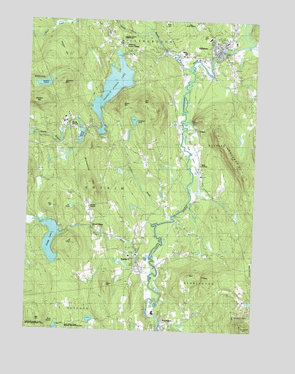
Hillsboro, NH USGS Topographic Map
Click on map above to begin viewing in our Map Viewer.

This topographic map contains these locations and features:
Feature Name Type Latitude Longitude GNIS ID View Map
Angus Lea Golf CourseLocaleN43.1065°W71.9123°1915225View Map
AntrimPopulated PlaceN43.0309°W71.9390°865248View Map
Antrim Census Designated PlaceCensusN43.0378°W71.9460°2378053View Map
Antrim CenterPopulated PlaceN43.0504°W71.9656°865249View Map
Antrim Elementary SchoolSchoolN43.0300°W71.9427°1915226View Map
Antrim Fire Department Station 2BuildingN43.0816°W71.9696°2605258View Map
Antrim Fire Department Station Headquarters and Emergency Medical ServicesBuildingN43.0377°W71.9530°2605327View Map
Antrim Girls Shelter SchoolSchoolN43.0290°W71.9373°2499758View Map
Antrim Police DepartmentBuildingN43.0294°W71.9376°2752815View Map
Antrim Post OfficePost OfficeN43.0294°W71.9370°1915227View Map
Antrim StationLocaleN43.0356°W71.9229°1915228View Map
Appleton CemeteryCemeteryN43.1041°W71.8862°865254View Map
Bagley PondLakeN43.0993°W71.9915°865320View Map
Ball HillSummitN43.0034°W71.9942°865361View Map
Beard BrookStreamN43.1126°W71.9254°865462View Map
Bell LedgesSummitN43.0212°W71.9006°865531View Map
BenningtonPopulated PlaceN43.0031°W71.9245°865548View Map
Bennington Census Designated PlaceCensusN43.0035°W71.9207°2629714View Map
Bennington Congregational ChurchChurchN43.0009°W71.9226°1915251View Map
Bennington Country Store Post OfficePost OfficeN43.0012°W71.9235°1915252View Map
Bennington Fire and RescueBuildingN43.0017°W71.9247°2605240View Map
Bennington Police DeptBuildingN43.0018°W71.9247°2752861View Map
Bible HillSummitN43.1240°W71.9251°865570View Map
Birchmere CampLocaleN43.0359°W71.9790°865599View Map
Butler CemeteryCemeteryN43.1049°W71.8881°865886View Map
Camp SachemLocaleN43.0359°W71.9892°865952View Map
Campbell MountainSummitN43.0990°W71.9812°865964View Map
Campbell PondReservoirN43.0844°W71.9415°865965View Map
Campbell Pond DamDamN43.0845°W71.9409°1774857View Map
Clinton VillagePopulated PlaceN43.0409°W71.9642°866214View Map
Cochran BrookStreamN43.0456°W71.9195°866234View Map
Contoocook Mills Industrial Site (historical)LocaleN43.1120°W71.8962°1915307View Map
CorkplainFlatN43.0712°W71.9087°866342View Map
Deering Fire and Rescue McCallister StationBuildingN43.0726°W71.9066°2605085View Map
Deering Fire and Rescue Murdough StationBuildingN43.0889°W71.8772°2605321View Map
Evas MarshSwampN43.0029°W71.9820°1915335View Map
Franklin Pierce LakeReservoirN43.0981°W71.9537°866966View Map
Gibson MountainSummitN43.0923°W71.9487°867053View Map
Great BridgeBridgeN43.1134°W71.8859°1915406View Map
Great BrookStreamN43.0256°W71.9284°867201View Map
Great Brook SchoolSchoolN43.0290°W71.9427°1915407View Map
Gregg LakeReservoirN43.0358°W71.9861°867254View Map
Gregg Lake DamDamN43.0384°W71.9779°1774855View Map
Hawthorne-Feather AirparkAirportN43.0627°W71.9040°873404View Map
Hedgehog HillRidgeN43.0690°W71.8876°867443View Map
HillsboroPopulated PlaceN43.1148°W71.8951°867498View Map
Hillsboro - Deering Elementary SchoolSchoolN43.1180°W71.9006°1915446View Map
Hillsboro - Deering High SchoolSchoolN43.1172°W71.9053°1915448View Map
Hillsboro - Deering Middle SchoolSchoolN43.1168°W71.9020°1915447View Map
Hillsboro Chamber of CommerceBuildingN43.1167°W71.8873°1915450View Map
Hillsboro Fire DepartmentBuildingN43.1149°W71.8967°2605074View Map
Hillsboro Lower VillagePopulated PlaceN43.1123°W71.9442°867501View Map
Hillsboro Police DeptBuildingN43.1123°W71.9096°2752986View Map
Hillsboro United Methodist ChurchChurchN43.1154°W71.8865°1915444View Map
Hillsboro-Deering Railroad Covered BridgeBridgeN43.1129°W71.8867°1915449View Map
Hillsborough Census Designated PlaceCensusN43.1156°W71.8968°2378071View Map
Hillsborough Post OfficePost OfficeN43.1148°W71.8965°1915443View Map
Hillsborough Town OfficesBuildingN43.1167°W71.8884°1915458View Map
Holt HillSummitN43.0501°W71.9854°867560View Map
HoltonPopulated PlaceN43.0812°W71.9079°867564View Map
Lily PondLakeN43.0497°W71.9747°868008View Map
Maple Avenue CemeteryCemeteryN43.1178°W71.9551°868249View Map
Maplewood CemeteryCemeteryN43.0400°W71.9353°868256View Map
Meetinghouse HillSummitN43.0609°W71.9681°868358View Map
Monadnock Power Station DamDamN43.0001°W71.9262°1775198View Map
Mount Calvary CemeteryCemeteryN43.0078°W71.9188°868590View Map
Nahor HillSummitN43.0179°W71.9548°868671View Map
North BranchPopulated PlaceN43.0806°W71.9773°868761View Map
North Branch RiverStreamN43.1076°W71.9098°868762View Map
Oxbow CampgroundLocaleN43.1059°W71.8867°1915644View Map
Paper Mill DamDamN43.0067°W71.9262°1775202View Map
Patten HillSummitN43.0320°W71.9759°869024View Map
Pierce Elementary SchoolSchoolN43.0023°W71.9236°2499753View Map
Pierce Power DamDamN43.0034°W71.9245°1775200View Map
Pine Hill CemeteryCemeteryN43.1203°W71.9581°869188View Map
Preston CemeteryCemeteryN43.1162°W71.8867°869360View Map
Riley MountainSummitN43.0926°W71.9384°869497View Map
Saint Marys Catholic ChurchChurchN43.1134°W71.9154°1915720View Map
Saint Marys CemeteryCemeteryN43.1246°W71.9067°869713View Map
Shedd BrookStreamN43.1209°W71.9342°869891View Map
Steel Pond DamDamN43.0801°W71.9679°1774820View Map
Steels PondReservoirN43.0791°W71.9708°870162View Map
Sulphur HillSummitN43.1109°W71.9815°870268View Map
Town of AntrimCivilN43.0534°W71.9830°873533View Map
Town of BenningtonCivilN43.0127°W71.9079°873543View Map
West DeeringPopulated PlaceN43.0648°W71.9048°870766View Map
WRCI-FM (Hillsboro)TowerN43.1148°W71.9384°873339View Map

Note: Coordinates in the location and feature list above are referenced to NAD83 datum.


Copyright (C) 2008-2024 Ryan Niemi / Sunset Dynamics ... All Rights Reserved