TopoQuest Logo
Do you find TopoQuest useful?
Help keep TopoQuest running and adding new maps/features by donating!
Bitcoin:  19c7KJd3qBynnjoSw5npx9KScwjBe4ifkT
Litecoin:  LXs6TkuXGGXo1vDsWCkWVdjQX94eUKd6ui
Home View Maps Find Maps Find Places Resources & Links


Hillister, Texas Topographic Map

USGS Map Title: Hillister, TX
USGS Map MRC: 30094F4
DRG (GeoTIFF) Download: o30094f4.tif


Neighboring USGS Topographic Map Quads:


  Chambliss Hill, TX  
30094G5
 

  Woodville, TX  
30094G4
 

  Birdwell Lake, TX  
30094G3
 

  Jacks Creek North, TX  
30094F5
 

  Hillister, TX  
30094F4
 

  Kirkpatrick Lake, TX  
30094F3
 

  Jacks Creek South, TX  
30094E5
 

  Warren, TX  
30094E4
 

  Hicksbaugh, TX  
30094E3


Map MRC Location:

N31°
W95°
N31°
W94°
H8 H7 H6 H5 H4 H3 H2 H1
G8 G7 G6 G5 G4 G3 G2 G1
F8 F7 F6 F5 F4 F3 F2 F1
E8 E7 E6 E5 E4 E3 E2 E1
D8 D7 D6 D5 D4 D3 D2 D1
C8 C7 C6 C5 C4 C3 C2 C1
B8 B7 B6 B5 B4 B3 B2 B1
A8 A7 A6 A5 A4 A3 A2 A1
N30°
W95°
N30°
W94°

Hillister, TX USGS 1:24K Topographic Map Preview:
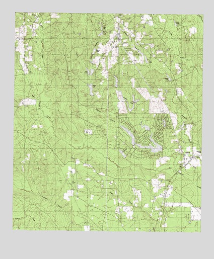
Hillister, TX USGS Topographic Map
Click on map above to begin viewing in our Map Viewer.

This topographic map contains these locations and features:
Feature Name Type Latitude Longitude GNIS ID View Map
Barclay LakeReservoirN30.7382°W94.4432°1351502View Map
Barclay Lake DamDamN30.7369°W94.4435°1861658View Map
Blair LakeReservoirN30.7448°W94.3938°1352389View Map
Boykin Lake Dam Number 1DamN30.7085°W94.4319°1861636View Map
Boykin Lake Number 1ReservoirN30.7110°W94.4326°1861637View Map
Boykin Lake Number 2ReservoirN30.7230°W94.4489°1861639View Map
Boykin Lake Number 2 DamDamN30.7235°W94.4485°1861638View Map
Camp UrlandLocaleN30.7452°W94.4405°1353684View Map
City of IvanhoeCivilN30.6800°W94.4154°2575704View Map
City of Ivanhoe NorthCivilN30.6810°W94.4251°2575705View Map
Clemmons LakeReservoirN30.7278°W94.4163°1862603View Map
Clemmons Lake DamDamN30.7269°W94.4152°1862602View Map
Cow Pasture Airport (historical)AirportN30.6252°W94.3933°1387711View Map
East Sawyers DamDamN30.7002°W94.4219°1861644View Map
East Sawyers LakeReservoirN30.7002°W94.4219°1861645View Map
Electro LakeReservoirN30.7283°W94.4474°1356897View Map
Electro Lake DamDamN30.7269°W94.4485°1861660View Map
Fellowship ChurchChurchN30.6494°W94.4563°1357273View Map
Harmony ChurchChurchN30.7249°W94.4935°1358810View Map
HillisterPopulated PlaceN30.6677°W94.3813°1359276View Map
Hillister Post OfficePost OfficeN30.6689°W94.3833°2731248View Map
Ivanhoe Volunteer Fire DepartmentBuildingN30.6800°W94.4169°2655714View Map
Justis CemeteryCemeteryN30.6602°W94.4455°1360475View Map
KVLL-AM (Woodville)TowerN30.7480°W94.4324°1385732View Map
Lake CamelotReservoirN30.6669°W94.4252°1863059View Map
Lake Camelot DamDamN30.6669°W94.4252°1863058View Map
Lake CharmaineReservoirN30.6743°W94.4084°1861647View Map
Lake Charmaine DamDamN30.6719°W94.4035°1861646View Map
Lake GalahadReservoirN30.6752°W94.4202°1861651View Map
Lake Galahad DamDamN30.6752°W94.4202°1861650View Map
Lake IvanhoeReservoirN30.6852°W94.3985°1863061View Map
Lake Ivanhoe DamDamN30.6852°W94.3985°1863060View Map
Lake TristanReservoirN30.6852°W94.4085°1861649View Map
Lake Tristan DamDamN30.6852°W94.4085°1861648View Map
Little Cypress CreekStreamN30.6958°W94.4788°1361331View Map
Magnus BranchStreamN30.6610°W94.3919°1362090View Map
Masterson LakeReservoirN30.6860°W94.3882°1362270View Map
Masterson Lake DamDamN30.6835°W94.3869°1861654View Map
Mount Pisgah CemeteryCemeteryN30.7380°W94.4133°1363303View Map
Phillips LakeReservoirN30.7137°W94.3976°1365148View Map
Phillips Lake DamDamN30.7119°W94.3969°1861656View Map
Reid LakeReservoirN30.7239°W94.4127°1366332View Map
Sawyers LakesReservoirN30.6948°W94.4228°1367808View Map
South Sawyers DamDamN30.6952°W94.4219°1861642View Map
South Sawyers LakeReservoirN30.6952°W94.4219°1861643View Map
Spurlock BranchStreamN30.6502°W94.3760°1369055View Map
Spurlock Branch ReservoirReservoirN30.7219°W94.4135°1861653View Map
Spurlock Branch Reservoir DamDamN30.7219°W94.4135°1861652View Map
Sutton LakeReservoirN30.7068°W94.4493°1369440View Map
Sutton Lake DamDamN30.7035°W94.4485°1861662View Map
Texas Forest Service Woodville OfficeBuildingN30.7427°W94.4311°2655592View Map
Timber LakesReservoirN30.6805°W94.4230°1369951View Map
Twin LakesReservoirN30.7149°W94.4501°1370351View Map
Twin Lakes DamDamN30.7152°W94.4502°1861668View Map
Urland LakeReservoirN30.7419°W94.4426°1370538View Map
West Sawyers DamDamN30.7002°W94.4252°1861640View Map
West Sawyers LakeReservoirN30.7020°W94.4280°1861641View Map
Williams CemeteryCemeteryN30.6494°W94.3994°1371561View Map
Woodville LookoutLocaleN30.7380°W94.4324°1371935View Map

Note: Coordinates in the location and feature list above are referenced to NAD83 datum.


Copyright (C) 2008-2024 Ryan Niemi / Sunset Dynamics ... All Rights Reserved