TopoQuest Logo
Do you find TopoQuest useful?
Help keep TopoQuest running and adding new maps/features by donating!
Bitcoin:  19c7KJd3qBynnjoSw5npx9KScwjBe4ifkT
Litecoin:  LXs6TkuXGGXo1vDsWCkWVdjQX94eUKd6ui
Home View Maps Find Maps Find Places Resources & Links


Hilldale, Missouri Topographic Map

USGS Map Title: Hilldale, MO
USGS Map MRC: 39092A5
DRG (GeoTIFF) Download: o39092a5.tif


Neighboring USGS Topographic Map Quads:


  Fayette, MO  
39092B6
 

  Burton, MO  
39092B5
 

  Harrisburg, MO  
39092B4
 

  New Franklin, MO  
39092A6
 

  Hilldale, MO  
39092A5
 

  Sturgeon SW, MO  
39092A4
 

  Boonville, MO  
38092H6
 

  Rocheport, MO  
38092H5
 

  Huntsdale, MO  
38092H4


Map MRC Location:

N40°
W93°
N40°
W92°
H8 H7 H6 H5 H4 H3 H2 H1
G8 G7 G6 G5 G4 G3 G2 G1
F8 F7 F6 F5 F4 F3 F2 F1
E8 E7 E6 E5 E4 E3 E2 E1
D8 D7 D6 D5 D4 D3 D2 D1
C8 C7 C6 C5 C4 C3 C2 C1
B8 B7 B6 B5 B4 B3 B2 B1
A8 A7 A6 A5 A4 A3 A2 A1
N39°
W93°
N39°
W92°

Hilldale, MO USGS 1:24K Topographic Map Preview:
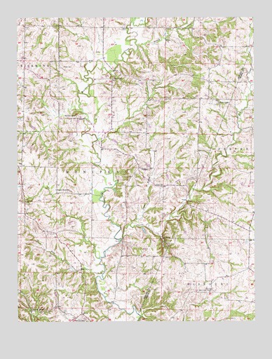
Hilldale, MO USGS Topographic Map
Click on map above to begin viewing in our Map Viewer.

This topographic map contains these locations and features:
Feature Name Type Latitude Longitude GNIS ID View Map
Arnett School (historical)SchoolN39.0983°W92.5244°743540View Map
Ashland ChurchChurchN39.0495°W92.6205°713436View Map
Big SpringSpringN39.0328°W92.5482°714220View Map
Big Spring ChurchChurchN39.0342°W92.5488°714224View Map
Caney BranchStreamN39.0395°W92.5657°715354View Map
Drake School (historical)SchoolN39.0328°W92.5672°743440View Map
HilldalePopulated PlaceN39.0631°W92.5613°740929View Map
Hourigan CemeteryCemeteryN39.0559°W92.5624°719889View Map
Hungry Mother CreekStreamN39.1231°W92.5649°719995View Map
Hunters CreekStreamN39.1136°W92.5616°720022View Map
Jackson School (historical)SchoolN39.0999°W92.5749°720219View Map
Landmark (historical)Populated PlaceN39.1131°W92.5171°740032View Map
Moniteau ChapelChurchN39.0848°W92.5938°722525View Map
Mount Arnold ChurchChurchN39.0139°W92.6238°743478View Map
Petersen Lake DamDamN39.0800°W92.6152°761439View Map
Pipes BranchStreamN39.0203°W92.5796°724425View Map
Prairie CreekStreamN39.0339°W92.5702°724836View Map
Rawlings School (historical)SchoolN39.0014°W92.5947°729377View Map
Ricketts CemeteryCemeteryN39.1047°W92.6010°725287View Map
Shallow Lake (historical)LakeN39.0031°W92.6166°738655View Map
Smith ChapelChurchN39.0898°W92.5188°726609View Map
Sulphur Springs ChurchChurchN39.0053°W92.6177°727276View Map
Thralls Prairie (historical)Populated PlaceN39.0131°W92.5552°759424View Map
Township of MoniteauCivilN39.0692°W92.5810°766778View Map
U.S. Salt SpringsSpringN39.0073°W92.5619°738656View Map
Union ChurchChurchN39.0592°W92.5627°743539View Map
Union School (historical)SchoolN39.0553°W92.5491°728040View Map
Walnut Grove CemeteryCemeteryN39.0125°W92.5235°728305View Map
Walnut Grove School (historical)SchoolN39.0098°W92.5168°759425View Map
Walnut Shade School (historical)SchoolN39.0542°W92.6049°728330View Map
Whites Store (historical)LocaleN39.0241°W92.6070°743543View Map
Wies Lake DamDamN39.0784°W92.5952°762189View Map
Wilhite (historical)Populated PlaceN39.0111°W92.5238°759426View Map

Note: Coordinates in the location and feature list above are referenced to NAD83 datum.


Copyright (C) 2008-2024 Ryan Niemi / Sunset Dynamics ... All Rights Reserved