TopoQuest Logo
Do you find TopoQuest useful?
Help keep TopoQuest running and adding new maps/features by donating!
Bitcoin:  19c7KJd3qBynnjoSw5npx9KScwjBe4ifkT
Litecoin:  LXs6TkuXGGXo1vDsWCkWVdjQX94eUKd6ui
Home View Maps Find Maps Find Places Resources & Links


Hildreth Peak, California Topographic Map

USGS Map Title: Hildreth Peak, CA
USGS Map MRC: 34119E5
DRG (GeoTIFF) Download: o34119e5.tif


Neighboring USGS Topographic Map Quads:


  Big Pine Mountain, CA  
34119F6
 

  Madulce Peak, CA  
34119F5
 

  Rancho Nuevo Creek, CA  
34119F4
 

  Little Pine Mountain, CA  
34119E6
 

  Hildreth Peak, CA  
34119E5
 

  Old Man Mountain, CA  
34119E4
 

  Santa Barbara, CA  
34119D6
 

  Carpinteria, CA  
34119D5
 

  White Ledge Peak, CA  
34119D4


Map MRC Location:

N35°
W120°
N35°
W119°
H8 H7 H6 H5 H4 H3 H2 H1
G8 G7 G6 G5 G4 G3 G2 G1
F8 F7 F6 F5 F4 F3 F2 F1
E8 E7 E6 E5 E4 E3 E2 E1
D8 D7 D6 D5 D4 D3 D2 D1
C8 C7 C6 C5 C4 C3 C2 C1
B8 B7 B6 B5 B4 B3 B2 B1
A8 A7 A6 A5 A4 A3 A2 A1
N34°
W120°
N34°
W119°

Hildreth Peak, CA USGS 1:24K Topographic Map Preview:
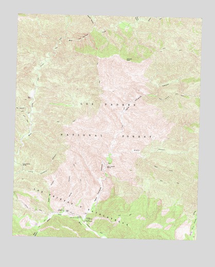
Hildreth Peak, CA USGS Topographic Map
Click on map above to begin viewing in our Map Viewer.

This topographic map contains these locations and features:
Feature Name Type Latitude Longitude GNIS ID View Map
Agua Caliente CanyonValleyN34.5086°W119.5796°269433View Map
Agua Caliente SpringSpringN34.5399°W119.5629°269435View Map
Agua Caliente TrailTrailN34.5800°W119.5185°269436View Map
Alamar CanyonValleyN34.6186°W119.5726°269454View Map
Big Caliente Debris DamDamN34.5419°W119.5618°1693385View Map
Big Caliente Recreation SiteLocaleN34.5411°W119.5640°276488View Map
Big Cliente Debris DamDamN34.5422°W119.5618°276489View Map
Blue CanyonValleyN34.5072°W119.6112°269922View Map
Diablo CanyonValleyN34.5469°W119.5596°270871View Map
East Fork Diablo CanyonValleyN34.5458°W119.5382°270989View Map
Hildreth PeakSummitN34.6003°W119.5512°271578View Map
Horse CanyonValleyN34.5139°W119.5912°271633View Map
Little Caliente SpringSpringN34.5403°W119.6204°272076View Map
Lower Caliente Recreation SiteLocaleN34.5325°W119.5637°276484View Map
Middle Santa Ynez CampgroundLocaleN34.5108°W119.5796°272449View Map
Mono Alamar TrailTrailN34.6011°W119.6029°272529View Map
Ogilvy RanchLocaleN34.5778°W119.6151°272767View Map
P-Bar FlatsFlatN34.5147°W119.5899°272827View Map
P-Bar Flats CampgroundLocaleN34.5150°W119.5910°272828View Map
Pendola CampgroundLocaleN34.5111°W119.5760°272918View Map
Pendola Debris DamDamN34.5133°W119.5760°1664721View Map
Pendola Guard StationLocaleN34.5094°W119.5762°272919View Map
Pie CanyonValleyN34.5680°W119.6171°272955View Map
Roblar CanyonValleyN34.6225°W119.5437°273303View Map
Roblar TrailTrailN34.6239°W119.5310°273305View Map
Rose CanyonValleyN34.5139°W119.5982°273349View Map
The NarrowsValleyN34.6114°W119.5868°250394View Map

Note: Coordinates in the location and feature list above are referenced to NAD83 datum.


Copyright (C) 2008-2024 Ryan Niemi / Sunset Dynamics ... All Rights Reserved