TopoQuest Logo
Do you find TopoQuest useful?
Help keep TopoQuest running and adding new maps/features by donating!
Bitcoin:  19c7KJd3qBynnjoSw5npx9KScwjBe4ifkT
Litecoin:  LXs6TkuXGGXo1vDsWCkWVdjQX94eUKd6ui
Home View Maps Find Maps Find Places Resources & Links


Helvetia, Arizona Topographic Map

USGS Map Title: Helvetia, AZ
USGS Map MRC: 31110G7
DRG (GeoTIFF) Download: o31110g7.tif


Neighboring USGS Topographic Map Quads:


  Sahuarita, AZ  
31110H8
 

  Corona De Tucson, AZ  
31110H7
 

  Mount Fagan, AZ  
31110H6
 

  Green Valley, AZ  
31110G8
 

  Helvetia, AZ  
31110G7
 

  Empire Ranch, AZ  
31110G6
 

  Mount Hopkins, AZ  
31110F8
 

  Mount Wrightson, AZ  
31110F7
 

  Sonoita, AZ  
31110F6


Map MRC Location:

N32°
W111°
N32°
W110°
H8 H7 H6 H5 H4 H3 H2 H1
G8 G7 G6 G5 G4 G3 G2 G1
F8 F7 F6 F5 F4 F3 F2 F1
E8 E7 E6 E5 E4 E3 E2 E1
D8 D7 D6 D5 D4 D3 D2 D1
C8 C7 C6 C5 C4 C3 C2 C1
B8 B7 B6 B5 B4 B3 B2 B1
A8 A7 A6 A5 A4 A3 A2 A1
N31°
W111°
N31°
W110°

Helvetia, AZ USGS 1:24K Topographic Map Preview:
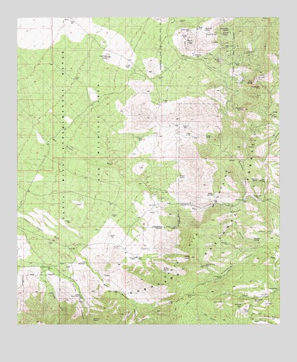
Helvetia, AZ USGS Topographic Map
Click on map above to begin viewing in our Map Viewer.

This topographic map contains these locations and features:
Feature Name Type Latitude Longitude GNIS ID View Map
Basin SpringSpringN31.8032°W110.7829°26022View Map
Bowman SpringSpringN31.7848°W110.7632°37182View Map
Box CanyonValleyN31.8018°W110.8079°26676View Map
Bulldozer MineMineN31.8737°W110.7981°37193View Map
Camp Cameron (historical)LocaleN31.7834°W110.7590°40514View Map
Casita SpringSpringN31.8748°W110.7593°41801View Map
Castle DomeSummitN31.7776°W110.7929°37211View Map
Cedar FlatFlatN31.7609°W110.7987°37216View Map
Cemetn DamDamN31.7765°W110.8118°41805View Map
Chavez SpringSpringN31.8682°W110.7804°37227View Map
Cooper World MineMineN31.8606°W110.7676°37247View Map
Copper Duke MineMineN31.8695°W110.7931°37248View Map
Curtice MineMineN31.8484°W110.7684°37262View Map
Deering SpringSpringN31.8089°W110.7611°28405View Map
Del Rio MineMineN31.8737°W110.8006°37268View Map
East TankReservoirN31.8276°W110.8340°41807View Map
Enzenberg WellWellN31.7693°W110.7793°37291View Map
Faber CanyonValleyN31.7726°W110.8640°28947View Map
Faber SpringSpringN31.7626°W110.8585°37295View Map
Florida CanyonValleyN31.7745°W110.8679°29068View Map
Florida DamDamN31.7584°W110.8443°37302View Map
Florida Work CenterLocaleN31.7612°W110.8454°37303View Map
Golden Gate MineMineN31.8015°W110.7615°37318View Map
Granite MountainSummitN31.7579°W110.7684°37320View Map
GreatervillePopulated PlaceN31.7640°W110.7501°29567View Map
Gunsight PassGapN31.8501°W110.7595°37330View Map
Hanna DamDamN31.8306°W110.7945°37331View Map
Harts ButteSummitN31.8481°W110.7634°37332View Map
Heavy Weight MineMineN31.8631°W110.7770°37335View Map
HelvetiaPopulated PlaceN31.8579°W110.7887°29884View Map
Helvetia CemeteryCemeteryN31.8512°W110.8086°37337View Map
Helvetia SpringSpringN31.8682°W110.7782°37338View Map
Huerfano ButteSummitN31.8590°W110.8326°30267View Map
Lopez PassGapN31.8554°W110.7595°41800View Map
M and D TankReservoirN31.8116°W110.8264°41806View Map
Melendrez PassGapN31.7656°W110.7968°31709View Map
Mill CanyonValleyN31.7968°W110.7743°37407View Map
Morning Star MineMineN31.7604°W110.7629°37415View Map
Mountain King MineMineN31.7737°W110.7868°37418View Map
Narragansett MineMineN31.8459°W110.7604°37428View Map
Old Dick MineMineN31.8576°W110.7790°37444View Map
Old Hickory WellWellN31.7737°W110.8618°37449View Map
Omega MineMineN31.8562°W110.7698°37451View Map
Paja Verde SpringSpringN31.7651°W110.7845°42953View Map
Peach KnobSummitN31.8642°W110.7936°2777785View Map
Proctor SpringSpringN31.8109°W110.7984°37479View Map
Red TankReservoirN31.8385°W110.8281°41799View Map
Robinson SpringSpringN31.7518°W110.8399°37489View Map
Ruelas SpringSpringN31.8270°W110.7915°37500View Map
Ruelas Spring Number Two and ThreeSpringN31.8445°W110.7743°37501View Map
Santa Rita Experimental RangeParkN31.8334°W110.8529°42718View Map
Santa Rita MountainsRangeN31.8259°W110.7748°34076View Map
Santa Rita RanchLocaleN31.7781°W110.8190°37519View Map
Sawmill Canyon WellWellN31.7637°W110.8279°37521View Map
Shamrod SpringSpringN31.8689°W110.7881°34306View Map
Sycamore CanyonValleyN31.8012°W110.7687°37544View Map
Tip Top MineMineN31.8676°W110.7951°37558View Map
Weigles ButteSummitN31.8376°W110.7676°37585View Map
West Sawmill CanyonValleyN31.7815°W110.8487°34106View Map
Willow SpringSpringN31.7722°W110.8063°36241View Map
Wisconsin MineMineN31.7826°W110.7787°37599View Map
Zackendorf SpringSpringN31.8698°W110.7748°37604View Map

Note: Coordinates in the location and feature list above are referenced to NAD83 datum.


Copyright (C) 2008-2024 Ryan Niemi / Sunset Dynamics ... All Rights Reserved