TopoQuest Logo
Do you find TopoQuest useful?
Help keep TopoQuest running and adding new maps/features by donating!
Bitcoin:  19c7KJd3qBynnjoSw5npx9KScwjBe4ifkT
Litecoin:  LXs6TkuXGGXo1vDsWCkWVdjQX94eUKd6ui
Home View Maps Find Maps Find Places Resources & Links


Avenal, California Topographic Map

USGS Map Title: Avenal, CA
USGS Map MRC: 36120A2
DRG (GeoTIFF) Download: o36120a2.tif


Neighboring USGS Topographic Map Quads:


  Coalinga, CA  
36120B3
 

  Guijarral Hills, CA  
36120B2
 

  Huron, CA  
36120B1
 

  Kreyenhagen Hills, CA  
36120A3
 

  Avenal, CA  
36120A2
 

  La Cima, CA  
36120A1
 

  The Dark Hole, CA  
35120H3
 

  Garza Peak, CA  
35120H2
 

  Kettleman Plain, CA  
35120H1


Map MRC Location:

N37°
W121°
N37°
W120°
H8 H7 H6 H5 H4 H3 H2 H1
G8 G7 G6 G5 G4 G3 G2 G1
F8 F7 F6 F5 F4 F3 F2 F1
E8 E7 E6 E5 E4 E3 E2 E1
D8 D7 D6 D5 D4 D3 D2 D1
C8 C7 C6 C5 C4 C3 C2 C1
B8 B7 B6 B5 B4 B3 B2 B1
A8 A7 A6 A5 A4 A3 A2 A1
N36°
W121°
N36°
W120°

Avenal, CA USGS 1:24K Topographic Map Preview:
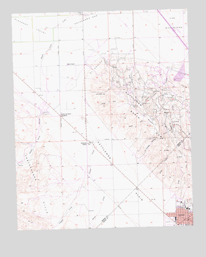
Avenal, CA USGS Topographic Map
Click on map above to begin viewing in our Map Viewer.

This topographic map contains these locations and features:
Feature Name Type Latitude Longitude GNIS ID View Map
Arroyo CortoStreamN36.0508°W120.1771°255280View Map
Arroyo CurvoStreamN36.0152°W120.1424°255282View Map
Arroyo EsquinadoStreamN36.0122°W120.1279°255286View Map
Arroyo LarguitoStreamN36.0238°W120.1582°255290View Map
Arroyo RectoStreamN36.0758°W120.2043°255301View Map
Arroyo SecoStreamN36.1072°W120.1643°255304View Map
AvenalPopulated PlaceN36.0041°W120.1290°1660285View Map
Avenal AirportAirportN36.0017°W120.1408°1653241View Map
Avenal Branch Kings County LibraryBuildingN36.0033°W120.1312°1809223View Map
Avenal District Hospital Ambulance ServiceBuildingN36.0133°W120.1341°2662175View Map
Avenal Elementary SchoolSchoolN36.0045°W120.1385°1809227View Map
Avenal High SchoolSchoolN36.0095°W120.1296°1809228View Map
Avenal HospitalHospitalN36.0133°W120.1339°1809226View Map
Avenal Police DepartmentBuildingN36.0133°W120.1339°2755902View Map
Canoas CreekStreamN36.0680°W120.2060°255414View Map
El HocicoRidgeN36.0916°W120.1926°254083View Map
El PerroSummitN36.0391°W120.1368°1660600View Map
El PitónSummitN36.0430°W120.1451°1660601View Map
El PradoFlatN36.0627°W120.1560°254089View Map
Elephant HillSummitN36.0652°W120.1413°1660610View Map
Floyd Rice ParkParkN36.0088°W120.1268°1809249View Map
Garza CreekStreamN36.0269°W120.1854°242640View Map
Kettleman StationLocaleN36.0488°W120.1979°1654684View Map
Kings County Fire Department Station 12 AvenalBuildingN36.0032°W120.1304°2623734View Map
La Cañada SimadaValleyN36.0394°W120.1635°255527View Map
La LomeraRidgeN36.0583°W120.1399°255534View Map
La LunetaSummitN36.0769°W120.1877°255536View Map
Polvadero GapGapN36.1233°W120.1996°254164View Map
Reef-Sunset Middle SchoolSchoolN36.0116°W120.1385°1809259View Map
Starkey and Erwin RanchLocaleN36.0650°W120.2163°249883View Map
Sunrise High SchoolSchoolN36.0105°W120.1299°1809261View Map
Surprise ArroyoStreamN36.0811°W120.1418°254317View Map
The WashboardFlatN36.1166°W120.1343°255745View Map
Weeth RanchLocaleN36.0944°W120.2113°251283View Map
Zapato Chino CanyonValleyN36.0666°W120.2315°251903View Map

Note: Coordinates in the location and feature list above are referenced to NAD83 datum.


Copyright (C) 2008-2024 Ryan Niemi / Sunset Dynamics ... All Rights Reserved