TopoQuest Logo
Do you find TopoQuest useful?
Help keep TopoQuest running and adding new maps/features by donating!
Bitcoin:  19c7KJd3qBynnjoSw5npx9KScwjBe4ifkT
Litecoin:  LXs6TkuXGGXo1vDsWCkWVdjQX94eUKd6ui
Home View Maps Find Maps Find Places Resources & Links


Harpers Ferry, Iowa Topographic Map

USGS Map Title: Harpers Ferry, IA
USGS Map MRC: 43091B2
DRG (GeoTIFF) Download: o43091b2.tif


Neighboring USGS Topographic Map Quads:


  Church, IA  
43091C3
 

  Lansing, IA  
43091C2
 

  Ferryville, WI  
43091C1
 

  Waterville, IA  
43091B3
 

  Harpers Ferry, IA  
43091B2
 

  Eastman, WI  
43091B1
 

  Giard, IA  
43091A3
 

  Prairie du Chien, WI  
43091A2
 

  Bridgeport, WI  
43091A1


Map MRC Location:

N44°
W92°
N44°
W91°
H8 H7 H6 H5 H4 H3 H2 H1
G8 G7 G6 G5 G4 G3 G2 G1
F8 F7 F6 F5 F4 F3 F2 F1
E8 E7 E6 E5 E4 E3 E2 E1
D8 D7 D6 D5 D4 D3 D2 D1
C8 C7 C6 C5 C4 C3 C2 C1
B8 B7 B6 B5 B4 B3 B2 B1
A8 A7 A6 A5 A4 A3 A2 A1
N43°
W92°
N43°
W91°

Harpers Ferry, IA USGS 1:24K Topographic Map Preview:
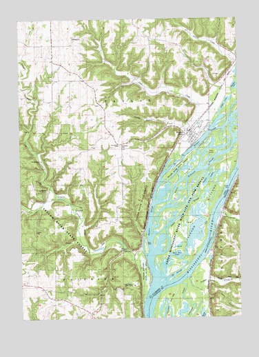
Harpers Ferry, IA USGS Topographic Map
Click on map above to begin viewing in our Map Viewer.

This topographic map contains these locations and features:
Feature Name Type Latitude Longitude GNIS ID View Map
Allamakee Post Office (historical)Post OfficeN43.1500°W91.1501°1948826View Map
Andy Mountain CampgroundLocaleN43.1944°W91.1640°1948919View Map
Big Missouri LakeLakeN43.1261°W91.1642°2729946View Map
Billys SloughGutN43.1958°W91.1357°2746963View Map
CharmePopulated PlaceN43.1678°W91.1379°1577542View Map
City of Harpers FerryCivilN43.2009°W91.1520°2394301View Map
Cota CreekStreamN43.1925°W91.1585°455650View Map
Delphey IslandIslandN43.1930°W91.1526°455875View Map
Du Charme CreekStreamN43.1703°W91.1352°1564134View Map
EldergrovePopulated PlaceN43.2397°W91.2199°464532View Map
Eldergrove Post Office (historical)Post OfficeN43.2397°W91.2199°1948814View Map
Grover PlotCemeteryN43.1333°W91.1834°1948934View Map
Gun LakeLakeN43.1780°W91.1682°2729945View Map
Harpers FerryPopulated PlaceN43.2005°W91.1532°457276View Map
Harpers FerryLocaleN43.2033°W91.1521°1948863View Map
Harpers Ferry BluffviewLocaleN43.2022°W91.1546°1948864View Map
Harpers Ferry CemeteryCemeteryN43.1930°W91.1576°1948961View Map
Harpers Ferry City LibraryBuildingN43.2005°W91.1515°1948918View Map
Harpers Ferry City ParkParkN43.2000°W91.1501°1948980View Map
Harpers Ferry Post OfficePost OfficeN43.2005°W91.1515°1948917View Map
Harpers Ferry Rescue SquadBuildingN43.2011°W91.1514°2599790View Map
Harpers Ferry Volunteer Fire DepartmentBuildingN43.2011°W91.1514°2577243View Map
Harpers SloughChannelN43.2019°W91.1435°457277View Map
Indian HollowValleyN43.1331°W91.1431°1566916View Map
Jackson IslandIslandN43.1733°W91.1462°457892View Map
Japan SloughChannelN43.1722°W91.1549°1825192View Map
Johnsons PortLocaleN43.1316°W91.1807°463984View Map
Joyce LakeLakeN43.2141°W91.1326°1825199View Map
Lark Post Office (historical)Post OfficeN43.1708°W91.2496°1948808View Map
Little Paint CreekStreamN43.1747°W91.2301°458493View Map
Little Paint Creek Public Hunting AreaParkN43.2203°W91.2451°463777View Map
Luster Heights Work CampLocaleN43.1389°W91.1857°1825197View Map
Martelle LakeLakeN43.2216°W91.1255°1825205View Map
McDonald SloughChannelN43.1861°W91.1496°1825190View Map
Mud Hen LakeLakeN43.1478°W91.1652°1825194View Map
Mud Hen Lake Wildlife Management AreaParkN43.1514°W91.1612°1948773View Map
Murray IslandIslandN43.1816°W91.1571°459414View Map
Nobles IslandParkN43.1569°W91.1793°1948862View Map
Off SloughLakeN43.1436°W91.1612°1825195View Map
Paint CreekStreamN43.1316°W91.1807°459990View Map
Picatee CreekStreamN43.1420°W91.1543°1571308View Map
Ryan IslandIslandN43.1933°W91.1415°460872View Map
Sioux CouleeValleyN43.1684°W91.1341°1574198View Map
Spaulding CemeteryCemeteryN43.1337°W91.1830°1948935View Map
Springs Branch CreekStreamN43.2053°W91.1565°461922View Map
Taylor LakesLakeN43.1833°W91.1411°1825191View Map
Township of TaylorCivilN43.2102°W91.1742°468781View Map
Waukon JunctionLocaleN43.1533°W91.1882°1948793View Map
Waukon JunctionPopulated PlaceN43.1533°W91.1882°464795View Map
Waukon Junction Post Office (historical)Post OfficeN43.1533°W91.1882°1948794View Map
Waukon Junction Wildlife Management AreaParkN43.1444°W91.1807°1825196View Map
Willsons Ford Post Office (historical)Post OfficeN43.1875°W91.2460°1948792View Map
Yellow River State ForestParkN43.1550°W91.2435°463242View Map
Yellow River State Forest TrailTrailN43.1730°W91.2201°1948962View Map

Note: Coordinates in the location and feature list above are referenced to NAD83 datum.


Copyright (C) 2008-2024 Ryan Niemi / Sunset Dynamics ... All Rights Reserved