TopoQuest Logo
Do you find TopoQuest useful?
Help keep TopoQuest running and adding new maps/features by donating!
Bitcoin:  19c7KJd3qBynnjoSw5npx9KScwjBe4ifkT
Litecoin:  LXs6TkuXGGXo1vDsWCkWVdjQX94eUKd6ui
Home View Maps Find Maps Find Places Resources & Links


Harbor Beach, Michigan Topographic Map

USGS Map Title: Harbor Beach, MI
USGS Map MRC: 43082G6
DRG (GeoTIFF) Download: o43082g6.tif


Neighboring USGS Topographic Map Quads:


  Redman, MI  
43082H7
 

  Port Hope, MI  
43082H6


  Bad Axe SE, MI  
43082G7
 

  Harbor Beach, MI  
43082G6


  Minden City, MI  
43082F7
 

  Ruth, MI  
43082F6
 

  Forestville, MI  
43082F5


Map MRC Location:

N44°
W83°
N44°
W82°
H8 H7 H6 H5 H4 H3 H2 H1
G8 G7 G6 G5 G4 G3 G2 G1
F8 F7 F6 F5 F4 F3 F2 F1
E8 E7 E6 E5 E4 E3 E2 E1
D8 D7 D6 D5 D4 D3 D2 D1
C8 C7 C6 C5 C4 C3 C2 C1
B8 B7 B6 B5 B4 B3 B2 B1
A8 A7 A6 A5 A4 A3 A2 A1
N43°
W83°
N43°
W82°

Harbor Beach, MI USGS 1:24K Topographic Map Preview:
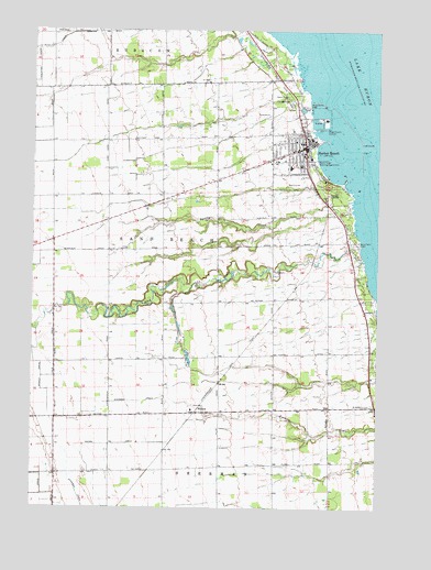
Harbor Beach, MI USGS Topographic Map
Click on map above to begin viewing in our Map Viewer.

This topographic map contains these locations and features:
Feature Name Type Latitude Longitude GNIS ID View Map
Bathing Beach ParkParkN43.8406°W82.6474°620748View Map
Booms DrainCanalN43.7667°W82.7205°621723View Map
City of Harbor BeachCivilN43.8453°W82.6544°1626433View Map
Coulston DrainCanalN43.8614°W82.7497°1618126View Map
Crane PointCapeN43.8364°W82.6369°1623099View Map
Eastern Huron Ambulance ServiceBuildingN43.8416°W82.6640°2662104View Map
Faith Bible Baptist ChurchChurchN43.8467°W82.6639°2548437View Map
First Baptist ChurchChurchN43.8447°W82.6528°2548439View Map
First Presbyterian ChurchChurchN43.8439°W82.6556°2548441View Map
Frank Murphy Historical MarkerParkN43.8439°W82.6514°2548587View Map
Frank Murphy MuseumBuildingN43.8436°W82.6514°2548410View Map
Harbor BeachHarborN43.8417°W82.6416°1617039View Map
Harbor BeachPopulated PlaceN43.8447°W82.6513°627752View Map
Harbor Beach Community HospitalHospitalN43.8425°W82.6521°2548436View Map
Harbor Beach Fire DepartmentBuildingN43.8461°W82.6519°2627001View Map
Harbor Beach Golf CourseLocaleN43.8350°W82.6528°2548427View Map
Harbor Beach High SchoolSchoolN43.8392°W82.6569°2548435View Map
Harbor Beach LightLocaleN43.8458°W82.6324°1618422View Map
Harbor Beach MarinaLocaleN43.8558°W82.6499°1618418View Map
Harbor Beach Medical CenterHospitalN43.8406°W82.6644°2548434View Map
Harbor Beach Police DepartmentBuildingN43.8411°W82.6628°2548433View Map
Harbor Beach Post OfficePost OfficeN43.8472°W82.6522°2548431View Map
Harbor Beach Power PlantLocaleN43.8517°W82.6497°1618419View Map
Harbor Beach Public LibraryBuildingN43.8453°W82.6511°2548428View Map
Harbor Beach Resort AssociationLocaleN43.8367°W82.6433°1618202View Map
Harbor Beach Station (historical)LocaleN43.8444°W82.6503°2548429View Map
Harbor Beach United Methodist ChurchChurchN43.8414°W82.6528°2548443View Map
Harbor of RefugeHarborN43.8497°W82.6383°1618417View Map
HelenaPopulated PlaceN43.7747°W82.6908°628063View Map
Helena Post Office (historical)Post OfficeN43.7747°W82.6908°2548578View Map
Helena Station (historical)LocaleN43.7750°W82.6903°2548473View Map
Lighthouse Assembly of God ChurchChurchN43.8481°W82.6653°2548438View Map
Morrison DrainCanalN43.8133°W82.7474°632722View Map
North ParkParkN43.8558°W82.6563°633620View Map
North Park CampgroundsLocaleN43.8567°W82.6581°2548432View Map
Our Lady of Lake Huron Catholic ChurchChurchN43.8400°W82.6528°2548442View Map
Our Lady of Lake Huron Roman Catholic CemeteryCemeteryN43.8203°W82.6347°2548556View Map
Our Lady of Lake Huron SchoolSchoolN43.8397°W82.6533°2548430View Map
Reorganized Church of Jesus Christ of Latter Day SaintsChurchN43.8408°W82.6589°2548444View Map
Rock Falls CemeteryCemeteryN43.8197°W82.6321°636078View Map
Rock Falls CreekStreamN43.8150°W82.6291°636079View Map
Rock Falls Post Office (historical)Post OfficeN43.8244°W82.6361°2548512View Map
Saint Anthony Catholic ChurchChurchN43.7747°W82.6919°2548445View Map
Saint Anthony CemeteryCemeteryN43.7772°W82.6266°636543View Map
Sherman DrainCanalN43.7747°W82.7269°637762View Map
Sigel Post Office (historical)Post OfficeN43.8200°W82.7431°2548508View Map
Smith DrainCanalN43.7542°W82.7463°638151View Map
South Pier LightLocaleN43.8458°W82.6324°1618421View Map
Spring CreekStreamN43.8320°W82.6333°638551View Map
Sucker CreekStreamN43.7717°W82.6252°1618545View Map
Township of Sand BeachCivilN43.8173°W82.6783°1627039View Map
Vale DrainCanalN43.7914°W82.7422°1615441View Map
Wade SchoolSchoolN43.8747°W82.7388°1615652View Map
Waterworks ParkParkN43.8553°W82.6505°1615865View Map
Winkle DrainCanalN43.7842°W82.7466°1616633View Map
Zion Lutheran ChurchChurchN43.8461°W82.6558°2548440View Map

Note: Coordinates in the location and feature list above are referenced to NAD83 datum.


Copyright (C) 2008-2024 Ryan Niemi / Sunset Dynamics ... All Rights Reserved