TopoQuest Logo
Do you find TopoQuest useful?
Help keep TopoQuest running and adding new maps/features by donating!
Bitcoin:  19c7KJd3qBynnjoSw5npx9KScwjBe4ifkT
Litecoin:  LXs6TkuXGGXo1vDsWCkWVdjQX94eUKd6ui
Home View Maps Find Maps Find Places Resources & Links


Gualala, California Topographic Map

USGS Map Title: Gualala, CA
USGS Map MRC: 38123G5
DRG (GeoTIFF) Download: o38123g5.tif


Neighboring USGS Topographic Map Quads:


  Point Arena, CA  
38123H6
 

  Eureka Hill, CA  
38123H5
 

  Zeni Ridge, CA  
38123H4
 

  Saunders Reef, CA  
38123G6
 

  Gualala, CA  
38123G5
 

  McGuire Ridge, CA  
38123G4


  Stewarts Point, CA  
38123F4


Map MRC Location:

N39°
W124°
N39°
W123°
H8 H7 H6 H5 H4 H3 H2 H1
G8 G7 G6 G5 G4 G3 G2 G1
F8 F7 F6 F5 F4 F3 F2 F1
E8 E7 E6 E5 E4 E3 E2 E1
D8 D7 D6 D5 D4 D3 D2 D1
C8 C7 C6 C5 C4 C3 C2 C1
B8 B7 B6 B5 B4 B3 B2 B1
A8 A7 A6 A5 A4 A3 A2 A1
N38°
W124°
N38°
W123°

Gualala, CA USGS 1:24K Topographic Map Preview:
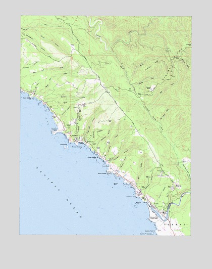
Gualala, CA USGS Topographic Map
Click on map above to begin viewing in our Map Viewer.

This topographic map contains these locations and features:
Feature Name Type Latitude Longitude GNIS ID View Map
Anchor BayPopulated PlaceN38.8027°W123.5778°1657928View Map
Anchor Bay Census Designated PlaceCensusN38.8127°W123.5703°2628706View Map
Anderson RanchLocaleN38.7763°W123.5414°1652982View Map
Anderson Ranch (historical)LocaleN38.8541°W123.6156°1652983View Map
Big GulchValleyN38.7766°W123.5420°219191View Map
Bourn CemeteryCemeteryN38.7860°W123.5547°2755387View Map
Bourn CemeteryCemeteryN38.7857°W123.5553°219709View Map
Bourns GulchValleyN38.7863°W123.5536°254655View Map
Bourns LandingLocaleN38.7849°W123.5628°1658117View Map
Bourns RockIslandN38.7788°W123.5572°254656View Map
Bowers FieldLocaleN38.7835°W123.5231°219715View Map
Butler RanchLocaleN38.8019°W123.5639°1652999View Map
China GulchValleyN38.7646°W123.5278°221037View Map
China GulchValleyN38.8677°W123.6200°221038View Map
Coast Life Support DistrictBuildingN38.7701°W123.5285°2662274View Map
Collins LandingLocaleN38.7944°W123.5695°1658302View Map
Cooks BeachBeachN38.7896°W123.5611°221488View Map
Craig RanchLocaleN38.8610°W123.6220°1653011View Map
Doty CreekStreamN38.8205°W123.5336°222538View Map
Elk PrairieFlatN38.7930°W123.5050°223120View Map
Everson RanchLocaleN38.8371°W123.5911°1653021View Map
Ferguson GulchValleyN38.8032°W123.5820°223448View Map
Fish RockPopulated PlaceN38.8049°W123.5853°1658539View Map
Fish Rock BeachBeachN38.8032°W123.5820°223537View Map
Fish Rock CemeteryCemeteryN38.8037°W123.5770°2755386View Map
Fish Rock GulchValleyN38.8030°W123.5800°223538View Map
Fish RocksIslandN38.7999°W123.5936°223539View Map
Fish Rocks ArchArchN38.8006°W123.5944°2710002View Map
Fleming CreekStreamN38.8385°W123.5478°223598View Map
Fleming RidgeRidgeN38.8474°W123.5283°223602View Map
Fox GulchValleyN38.8302°W123.6153°223786View Map
Getchell GulchValleyN38.7980°W123.5720°224137View Map
Glennen GulchValleyN38.7905°W123.5620°224224View Map
GualalaPopulated PlaceN38.7657°W123.5281°224701View Map
Gualala PointCapeN38.7524°W123.5267°224702View Map
Gualala Point IslandIslandN38.7507°W123.5289°224704View Map
Gualala Point Regional ParkParkN38.7549°W123.5220°224703View Map
Gualala Post OfficePost OfficeN38.7673°W123.5291°2760037View Map
Gualala RiverStreamN38.7685°W123.5339°253221View Map
Hall GulchValleyN38.8680°W123.6200°224807View Map
Havens AnchorageBayN38.8007°W123.5858°225024View Map
Havens NeckCapeN38.8091°W123.5992°225025View Map
Johnson RanchLocaleN38.7966°W123.5578°1653052View Map
Little North Fork Gualala RiverStreamN38.7910°W123.5100°227313View Map
Lofty Redwoods AirportAirportN38.8622°W123.5935°1653217View Map
Log Cabin CreekStreamN38.8138°W123.5250°227468View Map
McNamees RanchLocaleN38.8255°W123.6070°1653071View Map
Ocean Ridge AirportAirportN38.8024°W123.5303°1653502View Map
Quinliven GulchValleyN38.8019°W123.5775°253805View Map
Reimert RanchLocaleN38.8360°W123.5653°1653100View Map
Riser RanchLocaleN38.7916°W123.5283°1653103View Map
Robinson GulchValleyN38.7710°W123.5372°255041View Map
Robinson PointCapeN38.7721°W123.5408°231695View Map
Robinson ReefBarN38.7671°W123.5408°231696View Map
Roseman CreekStreamN38.8257°W123.6097°231899View Map
Sail RockIslandN38.8244°W123.6125°254353View Map
Saint Orres CreekStreamN38.7924°W123.5642°232234View Map
Saint Orres GulchValleyN38.7924°W123.5631°252207View Map
Seaside SchoolSchoolN38.7924°W123.5614°232767View Map
Signal Port (historical)Populated PlaceN38.8291°W123.6156°1666816View Map
Signal Port CreekStreamN38.8285°W123.6161°233113View Map
Smith RanchLocaleN38.8735°W123.5781°1653113View Map
South Coast Fire DistrictBuildingN38.7697°W123.5291°2622203View Map
South Coast Fire Protection DistrictBuildingN38.7977°W123.5366°2622236View Map
South Fork Garcia RiverStreamN38.8563°W123.5631°235007View Map
Steens LandingLocaleN38.8282°W123.6189°1659864View Map
Triplett GulchValleyN38.8130°W123.5995°236555View Map
Wildwood RanchLocaleN38.8335°W123.5308°237818View Map
Wilsons FieldFlatN38.7838°W123.5564°237998View Map
Wilsons Field (historical)AirportN38.7877°W123.5547°1653503View Map

Note: Coordinates in the location and feature list above are referenced to NAD83 datum.


Copyright (C) 2008-2024 Ryan Niemi / Sunset Dynamics ... All Rights Reserved