TopoQuest Logo
Do you find TopoQuest useful?
Help keep TopoQuest running and adding new maps/features by donating!
Bitcoin:  19c7KJd3qBynnjoSw5npx9KScwjBe4ifkT
Litecoin:  LXs6TkuXGGXo1vDsWCkWVdjQX94eUKd6ui
Home View Maps Find Maps Find Places Resources & Links


Greenway, Arkansas Topographic Map

USGS Map Title: Greenway, AR
USGS Map MRC: 36090C2
DRG (GeoTIFF) Download: o36090c2.tif


Neighboring USGS Topographic Map Quads:


  Pollard, AR  
36090D3
 

  Piggott, AR  
36090D2
 

  Campbell, MO  
36090D1
 

  Rector, AR  
36090C3
 

  Greenway, AR  
36090C2
 

  Kennett North, MO  
36090C1
 

  Mounds, AR  
36090B3
 

  Senath, MO  
36090B2
 

  Kennett South, MO  
36090B1


Map MRC Location:

N37°
W91°
N37°
W90°
H8 H7 H6 H5 H4 H3 H2 H1
G8 G7 G6 G5 G4 G3 G2 G1
F8 F7 F6 F5 F4 F3 F2 F1
E8 E7 E6 E5 E4 E3 E2 E1
D8 D7 D6 D5 D4 D3 D2 D1
C8 C7 C6 C5 C4 C3 C2 C1
B8 B7 B6 B5 B4 B3 B2 B1
A8 A7 A6 A5 A4 A3 A2 A1
N36°
W91°
N36°
W90°

Greenway, AR USGS 1:24K Topographic Map Preview:
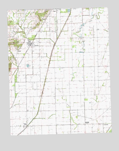
Greenway, AR USGS Topographic Map
Click on map above to begin viewing in our Map Viewer.

This topographic map contains these locations and features:
Feature Name Type Latitude Longitude GNIS ID View Map
Calls ChurchChurchN36.3426°W90.1562°47287View Map
Calls School (historical)SchoolN36.3426°W90.1568°82614View Map
City of GreenwayCivilN36.3410°W90.2222°2403754View Map
GreenwayPopulated PlaceN36.3412°W90.2204°57847View Map
Greenway Fire StationBuildingN36.3379°W90.2202°2116506View Map
Hammett (historical)Populated PlaceN36.3142°W90.2418°62504View Map
Hampton SloughStreamN36.2803°W90.1407°49814View Map
Hargrave CornerPopulated PlaceN36.2592°W90.2293°57883View Map
Hays School (historical)SchoolN36.3606°W90.2143°82632View Map
Holly Island ChurchChurchN36.2598°W90.1345°50230View Map
Holly Island CommunityPopulated PlaceN36.2592°W90.1582°82812View Map
Middle SloughStreamN36.2540°W90.1751°51940View Map
MitchellPopulated PlaceN36.3370°W90.2345°58197View Map
Payne CreekStreamN36.3067°W90.2426°53237View Map
Phifer School (historical)SchoolN36.3159°W90.1748°82656View Map
Piggott CemeteryCemeteryN36.3737°W90.2012°62510View Map
Piggott Industrial ParkLocaleN36.3728°W90.1868°62511View Map
Pleasant Valley ChurchChurchN36.3020°W90.1404°53618View Map
Pleasant Valley School (historical)SchoolN36.3020°W90.1398°82657View Map
Quick CreekStreamN36.3406°W90.1909°53862View Map
RhynePopulated PlaceN36.3581°W90.1395°58484View Map
Slough Drainage DitchCanalN36.3053°W90.2043°54914View Map
Township of East Oak Bluff-Blue CaneCivilN36.2547°W90.2261°2063361View Map
Township of Haywood (historical)CivilN36.3334°W90.2168°63720View Map
Township of South Saint FrancisCivilN36.3670°W90.1762°2063365View Map
Union Grove Church (historical)ChurchN36.2667°W90.2298°82672View Map
Union Grove School (historical)SchoolN36.2740°W90.2290°82673View Map
Union Home ChurchChurchN36.2723°W90.1759°82827View Map
Vincent School (historical)SchoolN36.2731°W90.1759°82674View Map
Walnut Grove Church (historical)ChurchN36.3312°W90.2432°82676View Map
Walnut Grove School (historical)SchoolN36.3312°W90.2432°82677View Map
Winston CemeteryCemeteryN36.3464°W90.2384°82828View Map

Note: Coordinates in the location and feature list above are referenced to NAD83 datum.


Copyright (C) 2008-2024 Ryan Niemi / Sunset Dynamics ... All Rights Reserved