TopoQuest Logo
Do you find TopoQuest useful?
Help keep TopoQuest running and adding new maps/features by donating!
Bitcoin:  19c7KJd3qBynnjoSw5npx9KScwjBe4ifkT
Litecoin:  LXs6TkuXGGXo1vDsWCkWVdjQX94eUKd6ui
Home View Maps Find Maps Find Places Resources & Links


Grantsville, Utah Topographic Map

USGS Map Title: Grantsville, UT
USGS Map MRC: 40112E4
DRG (GeoTIFF) Download: o40112e4.tif


Neighboring USGS Topographic Map Quads:


  Flux, UT  
40112F5


  North Willow Canyon, UT  
40112E5
 

  Grantsville, UT  
40112E4
 

  Tooele, UT  
40112E3
 

  Deseret Peak East, UT  
40112D5
 

  South Mountain, UT  
40112D4
 

  Stockton, UT  
40112D3


Map MRC Location:

N41°
W113°
N41°
W112°
H8 H7 H6 H5 H4 H3 H2 H1
G8 G7 G6 G5 G4 G3 G2 G1
F8 F7 F6 F5 F4 F3 F2 F1
E8 E7 E6 E5 E4 E3 E2 E1
D8 D7 D6 D5 D4 D3 D2 D1
C8 C7 C6 C5 C4 C3 C2 C1
B8 B7 B6 B5 B4 B3 B2 B1
A8 A7 A6 A5 A4 A3 A2 A1
N40°
W113°
N40°
W112°

Grantsville, UT USGS 1:24K Topographic Map Preview:
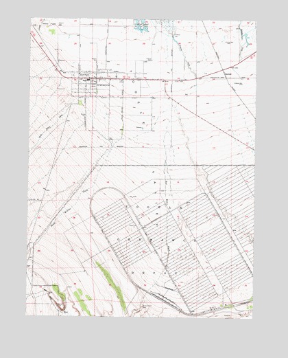
Grantsville, UT USGS Topographic Map
Click on map above to begin viewing in our Map Viewer.

This topographic map contains these locations and features:
Feature Name Type Latitude Longitude GNIS ID View Map
Box Elder WashValleyN40.5836°W112.4233°1439077View Map
City of GrantsvilleCivilN40.6148°W112.4777°2410648View Map
First Baptist ChurchChurchN40.5994°W112.4752°1450592View Map
GrantsvillePopulated PlaceN40.5999°W112.4644°1428338View Map
Grantsville City CemeteryCemeteryN40.6013°W112.4769°1435610View Map
Grantsville Elementary SchoolSchoolN40.5984°W112.4680°1435613View Map
Grantsville Fire DepartmentBuildingN40.6008°W112.4691°2627110View Map
Grantsville Fort Historic MarkerParkN40.6019°W112.4733°1428339View Map
Grantsville High SchoolSchoolN40.5963°W112.4584°1435611View Map
Grantsville Junior High SchoolSchoolN40.5911°W112.4647°1435612View Map
Grantsville Police DepartmentBuildingN40.6001°W112.4462°2730375View Map
Grantsville Post OfficePost OfficeN40.6003°W112.4647°1455303View Map
MarshallPopulated PlaceN40.6024°W112.3936°1437633View Map
Mountain West Ambulance GrantsvilleBuildingN40.6000°W112.4455°2768466View Map
North Willow CreekStreamN40.5916°W112.4761°1443992View Map
South Willow CanyonValleyN40.5819°W112.4305°1445937View Map
South Willow CreekStreamN40.5977°W112.4080°1445938View Map
The Church of Jesus Christ of Latter Day SaintsChurchN40.5916°W112.4438°1450721View Map
The Church of Jesus Christ of Latter Day SaintsChurchN40.5972°W112.4780°1450758View Map
The Church of Jesus Christ of Latter Day SaintsChurchN40.6019°W112.4536°1450759View Map
The Church of Jesus Christ of Latter Day SaintsChurchN40.5949°W112.4677°1450760View Map
Tooele Army DepotMilitaryN40.5284°W112.4075°2512356View Map

Note: Coordinates in the location and feature list above are referenced to NAD83 datum.


Copyright (C) 2008-2024 Ryan Niemi / Sunset Dynamics ... All Rights Reserved