TopoQuest Logo
Do you find TopoQuest useful?
Help keep TopoQuest running and adding new maps/features by donating!
Bitcoin:  19c7KJd3qBynnjoSw5npx9KScwjBe4ifkT
Litecoin:  LXs6TkuXGGXo1vDsWCkWVdjQX94eUKd6ui
Home View Maps Find Maps Find Places Resources & Links


Granite Peak, Colorado Topographic Map

USGS Map Title: Granite Peak, CO
USGS Map MRC: 37107D4
DRG (GeoTIFF) Download: o37107d4.tif


Neighboring USGS Topographic Map Quads:


  Columbine Pass, CO  
37107E5
 

  Emerald Lake, CO  
37107E4
 

  Granite Lake, CO  
37107E3
 

  Vallecito Reservoir, CO  
37107D5
 

  Granite Peak, CO  
37107D4
 

  Bear Mountain, CO  
37107D3
 

  Ludwig Mountain, CO  
37107C5
 

  Baldy Mountain, CO  
37107C4
 

  Devil Mountain, CO  
37107C3


Map MRC Location:

N38°
W108°
N38°
W107°
H8 H7 H6 H5 H4 H3 H2 H1
G8 G7 G6 G5 G4 G3 G2 G1
F8 F7 F6 F5 F4 F3 F2 F1
E8 E7 E6 E5 E4 E3 E2 E1
D8 D7 D6 D5 D4 D3 D2 D1
C8 C7 C6 C5 C4 C3 C2 C1
B8 B7 B6 B5 B4 B3 B2 B1
A8 A7 A6 A5 A4 A3 A2 A1
N37°
W108°
N37°
W107°

Granite Peak, CO USGS 1:24K Topographic Map Preview:
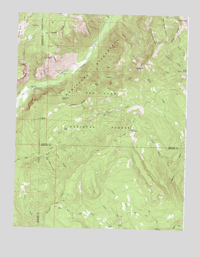
Granite Peak, CO USGS Topographic Map
Click on map above to begin viewing in our Map Viewer.

This topographic map contains these locations and features:
Feature Name Type Latitude Longitude GNIS ID View Map
Bear Trap CanyonValleyN37.4166°W107.4775°184050View Map
Clear CreekStreamN37.3766°W107.4213°184047View Map
Coyote Basin SpringSpringN37.4508°W107.4662°184056View Map
Graham PeakSummitN37.4972°W107.3762°202973View Map
Granite PeakSummitN37.4689°W107.4114°184058View Map
Granite Peak RanchLocaleN37.4564°W107.4909°184059View Map
Grassy PointSummitN37.4383°W107.4817°184055View Map
Holbrook MineMineN37.4836°W107.4753°1734950View Map
Indian CreekStreamN37.4594°W107.4878°184037View Map
Lake CreekStreamN37.4983°W107.4328°184036View Map
Little Mosca CreekStreamN37.4075°W107.3831°184052View Map
Lost CanyonValleyN37.4744°W107.4474°184060View Map
Moon LakeLakeN37.4333°W107.4737°188043View Map
Poison CanyonValleyN37.4177°W107.4748°184051View Map
Pole CreekStreamN37.3769°W107.4201°184048View Map
Red CreekStreamN37.3769°W107.4351°184046View Map
Rocky BasinLakeN37.4327°W107.4610°184053View Map
Runlett PeakSummitN37.4739°W107.4789°184062View Map
Sin CreekStreamN37.3756°W107.3937°184049View Map
Slide MountainSummitN37.4325°W107.4156°184054View Map
The NotchGapN37.4592°W107.4428°184057View Map
Three Sisters PeaksSummitN37.4861°W107.3995°184061View Map
Tuckerville (historical)Populated PlaceN37.4925°W107.4853°184063View Map
West Prong Red CreekStreamN37.3825°W107.4417°184045View Map

Note: Coordinates in the location and feature list above are referenced to NAD83 datum.


Copyright (C) 2008-2024 Ryan Niemi / Sunset Dynamics ... All Rights Reserved