TopoQuest Logo
Do you find TopoQuest useful?
Help keep TopoQuest running and adding new maps/features by donating!
Bitcoin:  19c7KJd3qBynnjoSw5npx9KScwjBe4ifkT
Litecoin:  LXs6TkuXGGXo1vDsWCkWVdjQX94eUKd6ui
Home View Maps Find Maps Find Places Resources & Links


Grand Ronde, Oregon Topographic Map

USGS Map Title: Grand Ronde, OR
USGS Map MRC: 45123A5
DRG (GeoTIFF) Download: o45123a5.tif


Neighboring USGS Topographic Map Quads:


  Niagara Creek, OR  
45123B6
 

  Springer Mountain, OR  
45123B5
 

  Stony Mountain, OR  
45123B4
 

  Midway, OR  
45123A6
 

  Grand Ronde, OR  
45123A5
 

  Sheridan, OR  
45123A4
 

  Warnicke Creek, OR  
44123H6
 

  Laurel Mountain, OR  
44123H5
 

  Socialist Valley, OR  
44123H4


Map MRC Location:

N46°
W124°
N46°
W123°
H8 H7 H6 H5 H4 H3 H2 H1
G8 G7 G6 G5 G4 G3 G2 G1
F8 F7 F6 F5 F4 F3 F2 F1
E8 E7 E6 E5 E4 E3 E2 E1
D8 D7 D6 D5 D4 D3 D2 D1
C8 C7 C6 C5 C4 C3 C2 C1
B8 B7 B6 B5 B4 B3 B2 B1
A8 A7 A6 A5 A4 A3 A2 A1
N45°
W124°
N45°
W123°

Grand Ronde, OR USGS 1:24K Topographic Map Preview:
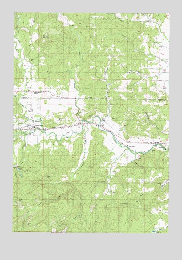
Grand Ronde, OR USGS Topographic Map
Click on map above to begin viewing in our Map Viewer.

This topographic map contains these locations and features:
Feature Name Type Latitude Longitude GNIS ID View Map
Agency CreekStreamN45.0746°W123.6218°1162808View Map
Andersons AirfieldAirportN45.0554°W123.6123°1153957View Map
Bailey ReservoirReservoirN45.0297°W123.5218°1157401View Map
Brush LakeSwampN45.0354°W123.6219°1138722View Map
Burns ReservoirReservoirN45.0724°W123.5211°1153283View Map
Butler (historical)LocaleN45.0665°W123.5762°1163374View Map
Butler Post Office (historical)Post OfficeN45.0665°W123.5762°1164990View Map
Carter CreekStreamN45.0159°W123.5432°1638182View Map
Confederated Tribes of Grand RondeBuildingN45.0753°W123.6179°2661456View Map
Cosper CreekStreamN45.0637°W123.5704°1162919View Map
Cow CreekStreamN45.0571°W123.6112°1140277View Map
Doane CreekStreamN45.0498°W123.5001°1162944View Map
Folk CreekStreamN45.0157°W123.5323°1142289View Map
Fort HillSummitN45.0662°W123.5654°1142320View Map
Fort Hill Census Designated PlaceCensusN45.0670°W123.5605°2629773View Map
Fort Hill Census Designated PlacePopulated PlaceN45.0607°W123.5554°1142319View Map
Fort Yamhill (historical)MilitaryN45.0664°W123.5642°1851689View Map
Gold CreekLocaleN45.0493°W123.5343°1163013View Map
Gold CreekStreamN45.0465°W123.5312°1163014View Map
Grand RondePopulated PlaceN45.0601°W123.6093°1142904View Map
Grand Ronde AgencyPopulated PlaceN45.0798°W123.6118°1142905View Map
Grand Ronde Census Designated PlaceCensusN45.0738°W123.6210°2408316View Map
Grand Ronde Post OfficePost OfficeN45.0605°W123.6089°1165334View Map
Grand Ronde Sanitary DistrictLocaleN45.0597°W123.6062°2660726View Map
Holmes CemeteryCemeteryN45.0979°W123.6123°1143677View Map
Hussey CemeteryCemeteryN45.0526°W123.5332°1163376View Map
Indian CemeteryCemeteryN45.0193°W123.6137°1163375View Map
Indian CreekStreamN45.1204°W123.5165°1163065View Map
Klees CreekStreamN45.0640°W123.5554°1144663View Map
Lady CreekStreamN45.0446°W123.5276°1163090View Map
Lafollett CreekStreamN45.0176°W123.5454°1144741View Map
Little Rowell CreekStreamN45.0240°W123.5759°1145245View Map
Mendenhall AirstripAirportN45.1167°W123.5042°2645961View Map
Mountain Springs Ranch DamDamN45.0009°W123.5129°1158837View Map
Mountain Springs Ranch ReservoirReservoirN45.0009°W123.5129°1158836View Map
Mule Tail CreekStreamN45.0234°W123.5487°1146645View Map
Ornoname 9 DamDamN45.0548°W123.6179°1163796View Map
Rock CreekStreamN45.0565°W123.5998°1148583View Map
Rogue RiverStreamN45.0640°W123.6126°1148699View Map
Rowell CreekStreamN45.0596°W123.5698°1163235View Map
Saint Michaels Catholic ChurchChurchN45.0803°W123.6131°2508987View Map
Spirit MountainSummitN45.1109°W123.6001°1150130View Map
Spirit Mountain Rodeo GroundsLocaleN45.0745°W123.6167°2661501View Map
Suttner ReservoirReservoirN45.0419°W123.5450°1163377View Map
Tindle CreekStreamN45.1084°W123.5007°1163305View Map
Valley JunctionPopulated PlaceN45.0621°W123.5721°1163320View Map
West Valley Fire District SubstationBuildingN45.0601°W123.6089°2576617View Map
Willamina DivisionCivilN45.0324°W123.5777°1938154View Map
Willamina Middle School at Grand RondeSchoolN45.0615°W123.6080°2496482View Map

Note: Coordinates in the location and feature list above are referenced to NAD83 datum.


Copyright (C) 2008-2024 Ryan Niemi / Sunset Dynamics ... All Rights Reserved