TopoQuest Logo
Do you find TopoQuest useful?
Help keep TopoQuest running and adding new maps/features by donating!
Bitcoin:  19c7KJd3qBynnjoSw5npx9KScwjBe4ifkT
Litecoin:  LXs6TkuXGGXo1vDsWCkWVdjQX94eUKd6ui
Home View Maps Find Maps Find Places Resources & Links


Gatlinburg, Tennessee Topographic Map

USGS Map Title: Gatlinburg, TN
USGS Map MRC: 35083F5
DRG (GeoTIFF) Download: o35083f5.tif


Neighboring USGS Topographic Map Quads:


  Walden Creek, TN  
35083G6
 

  Pigeon Forge, TN  
35083G5
 

  Richardson Cove, TN  
35083G4
 

  Wear Cove, TN  
35083F6
 

  Gatlinburg, TN  
35083F5
 

  Mount Le Conte, TN  
35083F4
 

  Thunderhead Mountain, NC  
35083E6
 

  Silers Bald, NC  
35083E5
 

  Clingmans Dome, NC  
35083E4


Map MRC Location:

N36°
W84°
N36°
W83°
H8 H7 H6 H5 H4 H3 H2 H1
G8 G7 G6 G5 G4 G3 G2 G1
F8 F7 F6 F5 F4 F3 F2 F1
E8 E7 E6 E5 E4 E3 E2 E1
D8 D7 D6 D5 D4 D3 D2 D1
C8 C7 C6 C5 C4 C3 C2 C1
B8 B7 B6 B5 B4 B3 B2 B1
A8 A7 A6 A5 A4 A3 A2 A1
N35°
W84°
N35°
W83°

Gatlinburg, TN USGS 1:24K Topographic Map Preview:
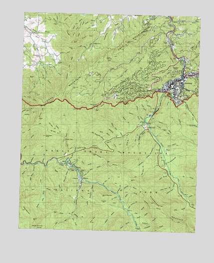
Gatlinburg, TN USGS Topographic Map
Click on map above to begin viewing in our Map Viewer.

This topographic map contains these locations and features:
Feature Name Type Latitude Longitude GNIS ID View Map
Agana BranchStreamN35.6781°W83.5591°1304774View Map
Arrowhead BranchStreamN35.6468°W83.5557°1275910View Map
Ash Hopper BranchStreamN35.6876°W83.5382°1275931View Map
Banner CemeteryCemeteryN35.7329°W83.5215°1276267View Map
Banner ChurchChurchN35.7390°W83.5160°1304949View Map
Banner School (historical)SchoolN35.7395°W83.5185°1323345View Map
Baskins CreekStreamN35.7134°W83.5127°1276429View Map
Bearpen GapGapN35.6306°W83.6149°1276654View Map
Bearwallow BranchStreamN35.6545°W83.5816°1276661View Map
Bearwallow GapGapN35.7337°W83.5521°1276668View Map
Bearwallow HollowValleyN35.7491°W83.5520°1276669View Map
Beech BranchStreamN35.7406°W83.5193°1276804View Map
Bent FieldFlatN35.7251°W83.5157°1277028View Map
Big BranchStreamN35.6565°W83.5141°1277255View Map
Big HollowValleyN35.6447°W83.5552°1305217View Map
Big Medicine BranchStreamN35.6470°W83.5554°1305220View Map
Bill Deadening BranchStreamN35.6762°W83.5657°1277457View Map
Billy HollowValleyN35.7295°W83.5801°1277474View Map
Blanket CreekStreamN35.6631°W83.6138°1277667View Map
Blanket MountainSummitN35.6260°W83.6116°1277668View Map
Briar KnobSummitN35.7201°W83.5077°1278312View Map
Brushy RidgeRidgeN35.7363°W83.5892°1278717View Map
Buckberry BranchStreamN35.7087°W83.5229°1278843View Map
Buckeye KnobSummitN35.7116°W83.6189°1278859View Map
Bullhead BranchStreamN35.6773°W83.5277°1278967View Map
Burnt MountainSummitN35.6444°W83.5663°1279103View Map
Burton Ogle CemeteryCemeteryN35.6633°W83.5166°2775231View Map
Camp Le ConteLocaleN35.6626°W83.5888°1652464View Map
Campbell LeadRidgeN35.7121°W83.5362°1279463View Map
Caney High TopSummitN35.7250°W83.5663°1279576View Map
Carr BranchStreamN35.6806°W83.5416°1279713View Map
Cataract BranchStreamN35.6876°W83.5382°1305725View Map
Catron BranchStreamN35.6640°W83.5899°1279905View Map
Chalet VillagePopulated PlaceN35.7076°W83.5449°1280195View Map
Cherry BranchStreamN35.6345°W83.5877°1305875View Map
Cherry GapGapN35.6348°W83.6002°1305878View Map
Chinquapin KnobSummitN35.6790°W83.6077°1280489View Map
Chinquapin RidgeRidgeN35.6951°W83.6096°1280492View Map
Clabo RidgeRidgeN35.7356°W83.5858°1280576View Map
Cliff BranchStreamN35.7248°W83.5146°1280721View Map
Cole CemeteryCemeteryN35.6564°W83.5149°1645396View Map
Cove MountainSummitN35.6967°W83.6098°1281422View Map
Cove Mountain TrailTrailN35.6990°W83.5654°1281425View Map
Covemont ChurchChurchN35.7201°W83.6146°1306145View Map
Covemont School (historical)SchoolN35.7204°W83.6146°1323355View Map
Critter BranchStreamN35.6593°W83.5196°1281629View Map
Crooked Arm RidgeRidgeN35.7089°W83.5924°1281661View Map
Crowson CemeteryCemeteryN35.7409°W83.6235°1306209View Map
Cucumber GapGapN35.6406°W83.5652°1281803View Map
Dan HollowValleyN35.7460°W83.5846°1282008View Map
Double Gourd BranchStreamN35.6915°W83.5346°1282691View Map
Dry Pond BranchStreamN35.6954°W83.5302°1283010View Map
Dudley BluffCliffN35.7262°W83.5099°1283058View Map
Dudley CreekStreamN35.7262°W83.5124°1283062View Map
ElkmontPopulated PlaceN35.6537°W83.5804°1283655View Map
Elkmont - Wonderland CemeteryCemeteryN35.6658°W83.5853°1645404View Map
Elkmont CampgroundLocaleN35.6588°W83.5827°2775215View Map
Elkmont Group CampgroundLocaleN35.6597°W83.5864°2775214View Map
Elkmont Ranger StationLocaleN35.6595°W83.5863°1283657View Map
Evans Chapel CemeteryCemeteryN35.6879°W83.5370°1645409View Map
Fighting CreekStreamN35.6904°W83.5374°1284251View Map
Fighting Creek CemeteryCemeteryN35.6807°W83.5576°1645407View Map
Fighting Creek GapGapN35.6718°W83.5807°1284252View Map
First Baptist ChurchChurchN35.7129°W83.5132°1323362View Map
First BranchStreamN35.6348°W83.5452°1284291View Map
First United Methodist ChurchChurchN35.7115°W83.5168°1323365View Map
Flat BranchStreamN35.7495°W83.5224°1284366View Map
Flint Rock BranchStreamN35.6651°W83.5382°1284490View Map
Fox Hole BranchStreamN35.6512°W83.5660°1284778View Map
GatlinburgPopulated PlaceN35.7143°W83.5102°1647737View Map
Gatlinburg Church of ChristChurchN35.7059°W83.5154°1323372View Map
Gatlinburg Fire Department Station 2BuildingN35.7084°W83.5162°2654367View Map
Gatlinburg Fire Department Station 3BuildingN35.7056°W83.5576°2654393View Map
Gatlinburg Presbyterian ChurchChurchN35.7087°W83.5163°1323373View Map
Gatlinburg Space NeedleTowerN35.7107°W83.5183°2761349View Map
Gatlinburg Welcome CenterBuildingN35.7338°W83.5219°2775216View Map
Grassy BranchStreamN35.7051°W83.5191°1306505View Map
Greystone HeightsPopulated PlaceN35.7173°W83.5157°1286254View Map
Groundhog BranchStreamN35.6273°W83.5410°1286348View Map
Henderson BranchStreamN35.6290°W83.5421°1287376View Map
Hickory Flats BranchStreamN35.6793°W83.5529°1287580View Map
Hickory King BranchStreamN35.6568°W83.5160°1287611View Map
Holston Assembly Grounds (historical)LocaleN35.7001°W83.5127°1323378View Map
Holy BranchStreamN35.7073°W83.5246°1288179View Map
Holy ButtSummitN35.6986°W83.5517°1288180View Map
Huskey BranchStreamN35.6384°W83.5513°1288855View Map
Huskey GapGapN35.6540°W83.5466°1288856View Map
Huskey Grove BranchStreamN35.7470°W83.5207°1288857View Map
Huskey Grove CemeteryCemeteryN35.7493°W83.5021°1645427View Map
Huskey Grove ChurchChurchN35.7470°W83.5038°1306601View Map
I N Trentham CemeteryCemeteryN35.6908°W83.5328°1645487View Map
Jakes CreekStreamN35.6551°W83.5821°1303472View Map
Jakes Creek TrailTrailN35.6293°W83.5941°1269685View Map
Jay Bird BranchStreamN35.6801°W83.5974°1289311View Map
Jim Carr Mill (historical)LocaleN35.6581°W83.5199°1323380View Map
Joe HollowValleyN35.7268°W83.5824°1289467View Map
John HollowValleyN35.7424°W83.5582°1289484View Map
King Branch CampsiteLocaleN35.6479°W83.6099°1652093View Map
King Hollow BranchStreamN35.7243°W83.6129°1290226View Map
King Hollow SpringSpringN35.7252°W83.6128°1290227View Map
Kiver BranchStreamN35.6512°W83.6093°1290344View Map
Laurel BranchStreamN35.6656°W83.5993°1290693View Map
Laurel FallsFallsN35.6775°W83.5932°1290738View Map
Laurel Falls TrailTrailN35.6715°W83.5907°1290741View Map
Le Conte CreekStreamN35.7095°W83.5227°1652453View Map
Levi Trentham CemeteryCemeteryN35.6523°W83.5828°2775267View Map
Long BranchStreamN35.7243°W83.5074°1291901View Map
Long HollowValleyN35.7458°W83.5157°1291952View Map
Lower Fighting Creek CemeteryCemeteryN35.6881°W83.5387°1645438View Map
Maloney PointSummitN35.6747°W83.5736°1292548View Map
Mannis BranchStreamN35.6626°W83.6204°1292592View Map
Medicine Branch Bluff CampsiteLocaleN35.6476°W83.5382°1652100View Map
Meigs MountainSummitN35.6364°W83.6232°1293553View Map
Middle RidgeRidgeN35.7015°W83.5669°1293691View Map
Mids BranchStreamN35.6595°W83.5846°1293718View Map
Mids GapGapN35.6645°W83.5638°1293719View Map
Mill Creek GapGapN35.7073°W83.5893°1293856View Map
Millsap BranchStreamN35.6629°W83.6088°1293994View Map
Millsap Picnic GroundsLocaleN35.6651°W83.6038°1323395View Map
Mount HarrisonSummitN35.6979°W83.5706°1287028View Map
Mountain Mall Shopping CenterLocaleN35.7131°W83.5135°1323396View Map
Mynatt ParkParkN35.7009°W83.5157°1295192View Map
N S McCarter CemeteryCemeteryN35.6867°W83.5421°2775282View Map
Newt ProngStreamN35.6331°W83.5877°1295705View Map
Norton CreekStreamN35.7393°W83.5235°1295985View Map
Norton Creek RanchPopulated PlaceN35.7168°W83.5763°1313002View Map
Old Sugarlands CemeteryCemeteryN35.6684°W83.5162°2775290View Map
Our Saviour Lutheran ChurchChurchN35.7048°W83.5166°1323403View Map
Ownby CemeteryCemeteryN35.7076°W83.5265°1306872View Map
Ownby HollowValleyN35.7439°W83.5737°1296616View Map
Painter BranchStreamN35.7026°W83.5188°1306875View Map
Park Plaza Shopping CenterLocaleN35.7106°W83.5216°1323404View Map
Parton BranchStreamN35.6781°W83.5588°1296904View Map
Phils ViewSummitN35.6948°W83.5845°1297372View Map
Phoebe BranchStreamN35.6431°W83.5538°1306894View Map
Pi Beta Phi Elementary SchoolSchoolN35.7118°W83.5121°1323407View Map
Pine Knot BranchStreamN35.6654°W83.5902°1269852View Map
Pinestand RidgeRidgeN35.7459°W83.5955°1297598View Map
Piney ButtSummitN35.7226°W83.5345°1297614View Map
Piney SpurSummitN35.7071°W83.6165°1297655View Map
Poplar BranchStreamN35.6687°W83.6249°1298172View Map
Ramp CreekStreamN35.6456°W83.5049°1298875View Map
Rattlebox BranchStreamN35.6629°W83.6171°1306944View Map
Raven DenSummitN35.7336°W83.5897°1298967View Map
Red Bird BranchStreamN35.6826°W83.5982°1299038View Map
Road Turn BranchStreamN35.6509°W83.5160°1306955View Map
Roaring ForkStreamN35.7168°W83.5118°1299568View Map
Roberts BranchStreamN35.7281°W83.5410°1299615View Map
Rocky RidgeRidgeN35.6837°W83.6164°1299929View Map
Rymel BranchStreamN35.7370°W83.6199°1300381View Map
Saint Marys Catholic ChurchChurchN35.7079°W83.5182°1323417View Map
Sawmill BranchStreamN35.6876°W83.5382°1300829View Map
Second BranchStreamN35.6334°W83.5443°1301014View Map
Seng BranchStreamN35.7215°W83.5513°1301058View Map
Shandy HollowValleyN35.7446°W83.5557°1313008View Map
Shields BranchStreamN35.6626°W83.6057°1270057View Map
Shinbone RidgeRidgeN35.7353°W83.5848°1270101View Map
Slick Limb BranchStreamN35.6615°W83.5896°1270509View Map
Sloan RidgeRidgeN35.7397°W83.5947°1270539View Map
Spring BranchStreamN35.6809°W83.5502°1271048View Map
Starkey GapGapN35.7295°W83.5899°1271264View Map
Starkey HollowValleyN35.7253°W83.6001°1271265View Map
StarkeytownPopulated PlaceN35.7329°W83.5766°1314334View Map
Steep BranchStreamN35.6459°W83.5071°1271312View Map
Sugar BranchStreamN35.6701°W83.5241°1313012View Map
Sugar Camp BranchStreamN35.7223°W83.6121°1271641View Map
Sugar Maple BranchStreamN35.6620°W83.6163°1303901View Map
Sugar Orchard BranchStreamN35.6373°W83.5479°1271700View Map
Sugarland BranchStreamN35.6776°W83.5279°1271722View Map
Sugarland Mountain TrailTrailN35.6562°W83.5488°1271724View Map
Sugarlands Utility Area (historical)LocaleN35.6370°W83.5207°1323435View Map
Sugarlands Visitor CenterBuildingN35.6856°W83.5366°1303908View Map
Tanager BranchStreamN35.6801°W83.5974°1272073View Map
The SugarlandsFlatN35.6670°W83.5188°1272447View Map
Third BranchStreamN35.6318°W83.5435°1272456View Map
Thirst BranchStreamN35.6740°W83.5235°1304065View Map
Trotter CampLocaleN35.7151°W83.5771°1272902View Map
Tulip BranchStreamN35.6468°W83.5835°1304188View Map
Twin Creeks Government Headquarters (historical)BuildingN35.6865°W83.5018°1323439View Map
Twin Creeks Uplands Research LaboratoryBuildingN35.6873°W83.5016°1273118View Map
Twomile BranchStreamN35.6926°W83.5321°1273140View Map
Twomile LeadRidgeN35.6767°W83.5054°1273141View Map
Upland BranchStreamN35.6815°W83.5479°1273286View Map
Valley View CemeteryCemeteryN35.7381°W83.6168°1645491View Map
Valley View ChurchChurchN35.7381°W83.6177°1304288View Map
Vance Newman CemeteryCemeteryN35.6635°W83.5241°2775310View Map
Village Shopping CenterLocaleN35.7098°W83.5204°1323442View Map
Watercrease BranchStreamN35.6968°W83.5079°1273891View Map
Waterdog BranchStreamN35.6340°W83.5879°1304407View Map
Wear CoveValleyN35.7232°W83.5984°1304426View Map
Whistlepig BranchStreamN35.6784°W83.5571°1274314View Map
White Oak Flats CemeteryCemeteryN35.7118°W83.5146°1645499View Map
Windmill Towne Shopping CenterLocaleN35.7159°W83.5102°1323448View Map
WVTN-FM (Gatlinburg)TowerN35.6968°W83.6099°1640062View Map

Note: Coordinates in the location and feature list above are referenced to NAD83 datum.


Copyright (C) 2008-2024 Ryan Niemi / Sunset Dynamics ... All Rights Reserved