TopoQuest Logo
Do you find TopoQuest useful?
Help keep TopoQuest running and adding new maps/features by donating!
Bitcoin:  19c7KJd3qBynnjoSw5npx9KScwjBe4ifkT
Litecoin:  LXs6TkuXGGXo1vDsWCkWVdjQX94eUKd6ui
Home View Maps Find Maps Find Places Resources & Links


Frijoles, New Mexico Topographic Map

USGS Map Title: Frijoles, NM
USGS Map MRC: 35106G3
DRG (GeoTIFF) Download: o35106g3.tif


Neighboring USGS Topographic Map Quads:


  Valle Toledo, NM  
35106H4
 

  Guaje Mountain, NM  
35106H3
 

  Puye, NM  
35106H2
 

  Bland, NM  
35106G4
 

  Frijoles, NM  
35106G3
 

  White Rock, NM  
35106G2
 

  Canada, NM  
35106F4
 

  Cochiti Dam, NM  
35106F3
 

  Montoso Peak, NM  
35106F2


Map MRC Location:

N36°
W107°
N36°
W106°
H8 H7 H6 H5 H4 H3 H2 H1
G8 G7 G6 G5 G4 G3 G2 G1
F8 F7 F6 F5 F4 F3 F2 F1
E8 E7 E6 E5 E4 E3 E2 E1
D8 D7 D6 D5 D4 D3 D2 D1
C8 C7 C6 C5 C4 C3 C2 C1
B8 B7 B6 B5 B4 B3 B2 B1
A8 A7 A6 A5 A4 A3 A2 A1
N35°
W107°
N35°
W106°

Frijoles, NM USGS 1:24K Topographic Map Preview:
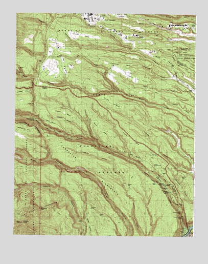
Frijoles, NM USGS Topographic Map
Click on map above to begin viewing in our Map Viewer.

This topographic map contains these locations and features:
Feature Name Type Latitude Longitude GNIS ID View Map
Alamo Springs TrailTrailN35.8039°W106.3573°903051View Map
Bandelier National MonumentParkN35.7789°W106.3317°928874View Map
Bandelier National Monument Historical MarkerParkN35.7884°W106.3011°932967View Map
Bandelier National Monument Interagency Fire BaseBuildingN35.7953°W106.2760°2657938View Map
Bandelier Weather StationLocaleN35.7884°W106.3028°931770View Map
Bandelier WildernessReserveN35.7609°W106.3235°937171View Map
Bland Frijoles TrailTrailN35.7870°W106.3570°903914View Map
Boundary PeakSummitN35.7647°W106.3570°904028View Map
Burnt MesaSummitN35.8103°W106.3161°904224View Map
Caņon de los FrijolesValleyN35.7564°W106.2572°924758View Map
Caņon de ValleValleyN35.8306°W106.3039°918111View Map
Corral HillSummitN35.7786°W106.2970°905373View Map
Dome Lookout TowerTowerN35.7572°W106.3709°928916View Map
Escobas MesaSummitN35.8197°W106.3420°906182View Map
FrijolesPopulated PlaceN35.7789°W106.2711°938814View Map
FrijolesLocaleN35.7795°W106.2711°936803View Map
Frijoles MesaSummitN35.8053°W106.2947°906408View Map
Frijoles MesaSummitN35.8256°W106.3089°906409View Map
Frijoles Pueblo RuinsLocaleN35.7839°W106.2761°2038474View Map
Frijoles Stone Lions TrailTrailN35.7778°W106.3367°906412View Map
Frijolito RuinsLocaleN35.7795°W106.2770°906413View Map
Juniper CampgroundLocaleN35.7961°W106.2800°2038523View Map
Los Alamos CountyCivilN35.8694°W106.3074°1702366View Map
Los Alamos Fire Department Station 5BuildingN35.8476°W106.3554°2657892View Map
Los Alamos National LaboratoryReserveN35.8334°W106.2509°916039View Map
Lower Frijoles FallsFallsN35.7609°W106.2589°908274View Map
Mesita de Los AlamosSummitN35.8686°W106.2600°908651View Map
Mesita del BueySummitN35.8497°W106.2734°908652View Map
Mesita del PotrilloSummitN35.8384°W106.2895°908653View Map
Pajarito MesaSummitN35.8509°W106.2939°909444View Map
Ponderosa Group CampgroundLocaleN35.8289°W106.3564°928350View Map
Pueblo of the Stone LionsLocaleN35.7620°W106.3164°936805View Map
Punta de la VentanaSummitN35.7770°W106.3561°898690View Map
Rainbow HouseLocaleN35.7756°W106.2686°2038641View Map
Ramon Vigil GrantCivilN35.8297°W106.2992°909977View Map
Rito de los FrijolesStreamN35.7559°W106.2572°918325View Map
Sacred Area San Ildefonso Indian ReservationLocaleN35.8517°W106.2578°2038816View Map
Saint Peters DomeSummitN35.7572°W106.3709°910536View Map
Stone Lions ShrineLocaleN35.7653°W106.3223°928821View Map
Threemile CanyonValleyN35.8395°W106.2659°911687View Map
Threemile MesaSummitN35.8464°W106.3034°911688View Map
Twomile CanyonValleyN35.8536°W106.2961°911943View Map
Twomile MesaSummitN35.8634°W106.3286°911944View Map
Tyuonyi RuinLocaleN35.7822°W106.2745°2038734View Map
Upper Frijoles CrossingPopulated PlaceN35.8153°W106.3614°911987View Map
Upper Frijoles FallsFallsN35.7634°W106.2597°928833View Map
Water Canyon TrailTrailN35.8417°W106.3745°916084View Map

Note: Coordinates in the location and feature list above are referenced to NAD83 datum.


Copyright (C) 2008-2024 Ryan Niemi / Sunset Dynamics ... All Rights Reserved