TopoQuest Logo
Do you find TopoQuest useful?
Help keep TopoQuest running and adding new maps/features by donating!
Bitcoin:  19c7KJd3qBynnjoSw5npx9KScwjBe4ifkT
Litecoin:  LXs6TkuXGGXo1vDsWCkWVdjQX94eUKd6ui
Home View Maps Find Maps Find Places Resources & Links


Fraker Mountain, Wyoming Topographic Map

USGS Map Title: Fraker Mountain, WY
USGS Map MRC: 43106G8
DRG (GeoTIFF) Download: o43106g8.tif


Neighboring USGS Topographic Map Quads:


  Beartrap Meadows, WY  
43107H1
 

  Packsaddle Canyon, WY  
43106H8
 

  The Horn, WY  
43106H7
 

  Tabletop, WY  
43107G1
 

  Fraker Mountain, WY  
43106G8
 

  Mayoworth, WY  
43106G7
 

  Turk Springs, WY  
43107F1
 

  Barnum, WY  
43106F8
 

  Red Fork Powder River, WY  
43106F7


Map MRC Location:

N44°
W107°
N44°
W106°
H8 H7 H6 H5 H4 H3 H2 H1
G8 G7 G6 G5 G4 G3 G2 G1
F8 F7 F6 F5 F4 F3 F2 F1
E8 E7 E6 E5 E4 E3 E2 E1
D8 D7 D6 D5 D4 D3 D2 D1
C8 C7 C6 C5 C4 C3 C2 C1
B8 B7 B6 B5 B4 B3 B2 B1
A8 A7 A6 A5 A4 A3 A2 A1
N43°
W107°
N43°
W106°

Fraker Mountain, WY USGS 1:24K Topographic Map Preview:
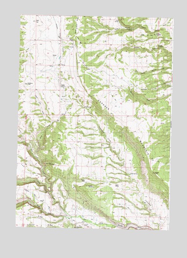
Fraker Mountain, WY USGS Topographic Map
Click on map above to begin viewing in our Map Viewer.

This topographic map contains these locations and features:
Feature Name Type Latitude Longitude GNIS ID View Map
Arch CreekStreamN43.7911°W106.9853°1584924View Map
Arndt RanchLocaleN43.8464°W106.9653°1584939View Map
Bald KnobSummitN43.7755°W106.9192°1585068View Map
Beartrap CreekStreamN43.7708°W106.9728°1585290View Map
Brock CowcampLocaleN43.8177°W106.9612°1585940View Map
Cash CanyonValleyN43.8689°W106.9059°1586421View Map
Cash HillSummitN43.8711°W106.8795°1596784View Map
Cash SpringSpringN43.8705°W106.9201°1586422View Map
Donaldson SpringSpringN43.8683°W106.9087°1587714View Map
Eagles TrapSummitN43.7836°W106.8873°1588008View Map
Fraker MountainSummitN43.7752°W106.9420°1588711View Map
Fraker PassGapN43.7775°W106.9445°1588712View Map
Gardner MountainSummitN43.7922°W106.8906°1588810View Map
Gobblers KnobSummitN43.8347°W106.9934°1588945View Map
Lookout RidgeRidgeN43.7508°W106.9770°1591007View Map
Mackenzie HillSummitN43.7505°W106.9503°1591153View Map
Middle SpringSpringN43.7825°W106.9078°1591556View Map
Middle SpringSpringN43.8333°W106.9656°1591557View Map
Norris Graves RanchLocaleN43.7561°W106.9570°1592088View Map
North Fork Red Fork Powder RiverStreamN43.7566°W106.9539°1592206View Map
Perry CabinLocaleN43.8108°W106.8934°1592675View Map
Pole PatchSlopeN43.8472°W106.9467°1592934View Map
Red HillSummitN43.8719°W106.9876°1593296View Map
Snow Cave RidgeRidgeN43.8677°W106.9545°1594514View Map
South Fork Red Fork Powder RiverStreamN43.7566°W106.9539°1594675View Map
South Red HillSummitN43.8586°W106.8870°1594723View Map
The ArchLocaleN43.8114°W106.9689°1595399View Map
The CrevassesValleyN43.7739°W106.9637°1595412View Map
The SlipGapN43.8600°W106.9570°1595472View Map
The VCapeN43.7830°W106.9912°1595479View Map
Trough SpringSpringN43.8213°W106.9467°1595714View Map
V RidgeRidgeN43.7566°W106.9798°1595896View Map
Wolf Den DrawValleyN43.8116°W106.9720°1596576View Map

Note: Coordinates in the location and feature list above are referenced to NAD83 datum.


Copyright (C) 2008-2024 Ryan Niemi / Sunset Dynamics ... All Rights Reserved