TopoQuest Logo
Do you find TopoQuest useful?
Help keep TopoQuest running and adding new maps/features by donating!
Bitcoin:  19c7KJd3qBynnjoSw5npx9KScwjBe4ifkT
Litecoin:  LXs6TkuXGGXo1vDsWCkWVdjQX94eUKd6ui
Home View Maps Find Maps Find Places Resources & Links


Fort Mudge, Georgia Topographic Map

USGS Map Title: Fort Mudge, GA
USGS Map MRC: 31082A2
DRG (GeoTIFF) Download: o31082a2.tif


Neighboring USGS Topographic Map Quads:


  Waycross East, GA  
31082B3
 

  Hoboken West, GA  
31082B2
 

  Hoboken East, GA  
31082B1
 

  Waycross SE, GA  
31082A3
 

  Fort Mudge, GA  
31082A2
 

  Winokur, GA  
31082A1
 

  Dinner Pond, GA  
30082H3
 

  Double Lakes, GA  
30082H2
 

  Newell, GA  
30082H1


Map MRC Location:

N32°
W83°
N32°
W82°
H8 H7 H6 H5 H4 H3 H2 H1
G8 G7 G6 G5 G4 G3 G2 G1
F8 F7 F6 F5 F4 F3 F2 F1
E8 E7 E6 E5 E4 E3 E2 E1
D8 D7 D6 D5 D4 D3 D2 D1
C8 C7 C6 C5 C4 C3 C2 C1
B8 B7 B6 B5 B4 B3 B2 B1
A8 A7 A6 A5 A4 A3 A2 A1
N31°
W83°
N31°
W82°

Fort Mudge, GA USGS 1:24K Topographic Map Preview:
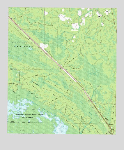
Fort Mudge, GA USGS Topographic Map
Click on map above to begin viewing in our Map Viewer.

This topographic map contains these locations and features:
Feature Name Type Latitude Longitude GNIS ID View Map
Altman PondLakeN31.0919°W82.2023°310505View Map
Beaver Dam SwampSwampN31.0211°W82.1332°310986View Map
Boat Landing IslandIslandN31.0116°W82.1782°311589View Map
Christmas LakeLakeN31.0133°W82.1901°312664View Map
Corncob IslandIslandN31.0474°W82.1437°312997View Map
Cowhouse IslandIslandN31.0452°W82.2079°313064View Map
Dark ThickSwampN31.0955°W82.1525°313311View Map
Finger LakeLakeN31.0177°W82.1948°314127View Map
Fort MudgePopulated PlaceN31.0644°W82.1865°331755View Map
Green SwampSwampN31.0238°W82.1582°314858View Map
Gum SloughGutN31.0397°W82.1512°314976View Map
Johns PondLakeN31.0566°W82.1485°316143View Map
Kitchens LandingLocaleN31.0419°W82.2248°332155View Map
Marys LakeLakeN31.0020°W82.1647°317768View Map
Maul Hammock PrairieSwampN31.0261°W82.2343°317803View Map
Ohio LakeLakeN31.0186°W82.2064°319927View Map
Picnic LakeLakeN31.0088°W82.1851°320480View Map
Poke BaySwampN31.0519°W82.2082°345244View Map
Pond LakeLakeN31.0036°W82.1932°320993View Map
RacepondPopulated PlaceN31.0030°W82.1296°332778View Map
Wide SloughLakeN31.0731°W82.2194°325249View Map

Note: Coordinates in the location and feature list above are referenced to NAD83 datum.


Copyright (C) 2008-2024 Ryan Niemi / Sunset Dynamics ... All Rights Reserved