TopoQuest Logo
Do you find TopoQuest useful?
Help keep TopoQuest running and adding new maps/features by donating!
Bitcoin:  19c7KJd3qBynnjoSw5npx9KScwjBe4ifkT
Litecoin:  LXs6TkuXGGXo1vDsWCkWVdjQX94eUKd6ui
Home View Maps Find Maps Find Places Resources & Links


Fort Connah, Montana Topographic Map

USGS Map Title: Fort Connah, MT
USGS Map MRC: 47114D1
DRG (GeoTIFF) Download: o47114d1.tif


Neighboring USGS Topographic Map Quads:


  Lower Crow Reservoir, MT  
47114E2
 

  Ronan, MT  
47114E1
 

  Piper-Crow Pass, MT  
47113E8
 

  Charlo, MT  
47114D2
 

  Fort Connah, MT  
47114D1
 

  Mount Calowahcan, MT  
47113D8
 

  Ravalli, MT  
47114C2
 

  Saint Ignatius, MT  
47114C1
 

  Saint Marys Lake, MT  
47113C8


Map MRC Location:

N48°
W115°
N48°
W114°
H8 H7 H6 H5 H4 H3 H2 H1
G8 G7 G6 G5 G4 G3 G2 G1
F8 F7 F6 F5 F4 F3 F2 F1
E8 E7 E6 E5 E4 E3 E2 E1
D8 D7 D6 D5 D4 D3 D2 D1
C8 C7 C6 C5 C4 C3 C2 C1
B8 B7 B6 B5 B4 B3 B2 B1
A8 A7 A6 A5 A4 A3 A2 A1
N47°
W115°
N47°
W114°

Fort Connah, MT USGS 1:24K Topographic Map Preview:
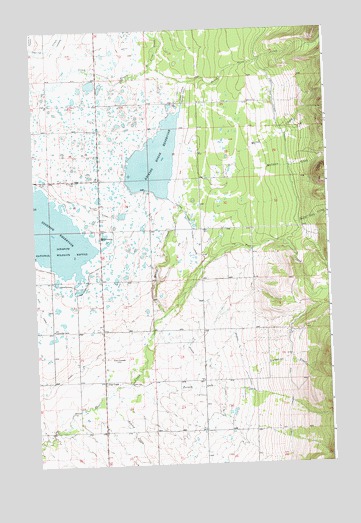
Fort Connah, MT USGS Topographic Map
Click on map above to begin viewing in our Map Viewer.

This topographic map contains these locations and features:
Feature Name Type Latitude Longitude GNIS ID View Map
19N19W05DAA_01 WellWellN47.4347°W114.0329°822900View Map
19N19W06CCCB01 WellWellN47.4291°W114.0751°822856View Map
19N19W07CCA_01 WellWellN47.4155°W114.0701°822773View Map
19N19W09DBBD01 WellWellN47.4199°W114.0209°822793View Map
19N19W20BBA_01 WellWellN47.3980°W114.0501°822657View Map
19N19W20BBAA01 WellWellN47.3988°W114.0493°822663View Map
19N19W20CCC_01 WellWellN47.3849°W114.0534°822591View Map
19N19W21CBCD01 WellWellN47.3883°W114.0315°822608View Map
19N20W01BBC_01 WellWellN47.4402°W114.0959°822946View Map
19N20W01DAA_01 WellWellN47.4341°W114.0768°822898View Map
19N20W13CCA_01 WellWellN47.4019°W114.0929°822682View Map
19N20W14BBA_01 WellWellN47.4141°W114.1109°822764View Map
19N20W14BBB_01 WellWellN47.4133°W114.1173°822757View Map
19N20W14CDD_01 WellWellN47.4052°W114.1087°822697View Map
19N20W15DAAA01 WellWellN47.4055°W114.1190°822699View Map
19N20W22AAAB01 WellWellN47.3988°W114.1201°822664View Map
19N20W24CDDA01 WellWellN47.3855°W114.0915°822596View Map
19N20W26ADD_01 WellWellN47.3830°W114.0976°822580View Map
19N20W26BAB_01 WellWellN47.3835°W114.1107°822581View Map
20N19W16BDCB01 WellWellN47.4074°W114.0273°822717View Map
20N19W19DAA_01 WellWellN47.4780°W114.0557°823284View Map
20N19W19DAD_01 WellWellN47.4769°W114.0546°823276View Map
20N19W19DDA_01 WellWellN47.4744°W114.0557°823260View Map
20N19W20ADDD01 WellWellN47.4794°W114.0337°823295View Map
20N19W21BDA_01 WellWellN47.4816°W114.0229°823309View Map
20N19W21BDD_01 WellWellN47.4808°W114.0221°823306View Map
20N19W31ACD_01 WellWellN47.4499°W114.0601°823008View Map
20N19W32DCC_01 WellWellN47.4430°W114.0412°822959View Map
20N20W14CAD_01 WellWellN47.4913°W114.1093°823369View Map
20N20W15ADDD01 WellWellN47.4933°W114.1190°823374View Map
20N20W22AAD_01 WellWellN47.4830°W114.1187°823317View Map
20N20W25CCC_01 WellWellN47.4580°W114.0954°823090View Map
20N20W26CCBD01 WellWellN47.4591°W114.1165°823108View Map
AllentownPopulated PlaceN47.4405°W114.0965°768211View Map
Ashley CreekStreamN47.3949°W114.0965°779168View Map
Eagle Pass CreekStreamN47.4438°W114.0140°782765View Map
Fort ConnahLocaleN47.4055°W114.0882°794936View Map
Fort Connah Historical MarkerParkN47.4055°W114.0968°1797054View Map
Kicking HorsePopulated PlaceN47.4605°W114.0751°1867339View Map
Kicking Horse Census Designated PlaceCensusN47.4568°W114.0717°2408480View Map
Kicking Horse DamDamN47.4541°W114.0778°795654View Map
Kicking Horse Feeder CanalCanalN47.4483°W114.0615°773021View Map
Kicking Horse ReservoirReservoirN47.4624°W114.0731°795655View Map
Leon Community CenterBuildingN47.4141°W114.1179°773302View Map
Leon Post Office (historical)Post OfficeN47.3994°W114.1084°1796910View Map
Leon School (historical)SchoolN47.3994°W114.1084°1796911View Map
Mission Mountain Wilderness Historical MarkerParkN47.4466°W114.0968°1797053View Map
Mollman CreekStreamN47.4180°W114.0704°778820View Map
Ninepipe National Wildlife RefugeParkN47.4410°W114.1212°768074View Map
Ninepipe ReservoirReservoirN47.4427°W114.1188°774648View Map
North Crow CreekStreamN47.4894°W114.0743°788082View Map
Poison Oak CreekStreamN47.3955°W114.0934°789036View Map
Post CreekPopulated PlaceN47.3991°W114.0968°775396View Map
Post G CanalCanalN47.4333°W114.0848°775400View Map
Ronan B CanalCanalN47.4997°W114.1240°775921View Map
South Crow CreekStreamN47.4894°W114.0746°790894View Map
Valentine CreekStreamN47.4022°W114.0371°792669View Map

Note: Coordinates in the location and feature list above are referenced to NAD83 datum.


Copyright (C) 2008-2024 Ryan Niemi / Sunset Dynamics ... All Rights Reserved