TopoQuest Logo
Do you find TopoQuest useful?
Help keep TopoQuest running and adding new maps/features by donating!
Bitcoin:  19c7KJd3qBynnjoSw5npx9KScwjBe4ifkT
Litecoin:  LXs6TkuXGGXo1vDsWCkWVdjQX94eUKd6ui
Home View Maps Find Maps Find Places Resources & Links


Ferris Creek, California Topographic Map

USGS Map Title: Ferris Creek, CA
USGS Map MRC: 40120A3
DRG (GeoTIFF) Download: o40120a3.tif


Neighboring USGS Topographic Map Quads:


  Stony Ridge, CA  
40120B4
 

  Milford, CA  
40120B3
 

  Herlong, CA  
40120B2
 

  Squaw Valley Peak, CA  
40120A4
 

  Ferris Creek, CA  
40120A3
 

  McKesick Peak, CA  
40120A2
 

  Crocker Mountain, CA  
39120H4
 

  Dixie Mountain, CA  
39120H3
 

  Frenchman Lake, CA  
39120H2


Map MRC Location:

N41°
W121°
N41°
W120°
H8 H7 H6 H5 H4 H3 H2 H1
G8 G7 G6 G5 G4 G3 G2 G1
F8 F7 F6 F5 F4 F3 F2 F1
E8 E7 E6 E5 E4 E3 E2 E1
D8 D7 D6 D5 D4 D3 D2 D1
C8 C7 C6 C5 C4 C3 C2 C1
B8 B7 B6 B5 B4 B3 B2 B1
A8 A7 A6 A5 A4 A3 A2 A1
N40°
W121°
N40°
W120°

Ferris Creek, CA USGS 1:24K Topographic Map Preview:
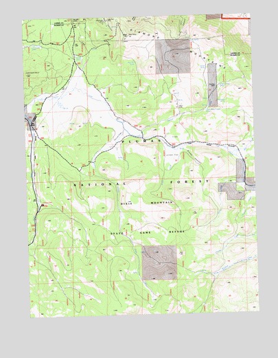
Ferris Creek, CA USGS Topographic Map
Click on map above to begin viewing in our Map Viewer.

This topographic map contains these locations and features:
Feature Name Type Latitude Longitude GNIS ID View Map
Artray CreekStreamN40.0607°W120.2574°256337View Map
Bird CreekStreamN40.0668°W120.2635°257082View Map
Black MountainSummitN40.1171°W120.3180°257135View Map
Black Mountain SpringSpringN40.1057°W120.3141°257140View Map
Conklin Park CampgroundLocaleN40.0471°W120.3674°258642View Map
Dooley CreekStreamN40.0749°W120.3133°259486View Map
Downing CabinLocaleN40.0955°W120.2710°259520View Map
Downing Cabin SpringSpringN40.0963°W120.2674°259521View Map
Eagle Rock MineMineN40.1235°W120.3291°259679View Map
Ferris CreekStreamN40.0780°W120.3210°260090View Map
Ferris FlatFlatN40.0743°W120.3247°260091View Map
Granite SpringSpringN40.1085°W120.3466°260764View Map
Grey Goose MineMineN40.1232°W120.3308°260888View Map
Horseshoe SpringSpringN40.0880°W120.2663°261535View Map
Johnson HillSummitN40.1018°W120.3708°1656102View Map
Johnson Mill SpringSpringN40.1138°W120.3702°261983View Map
Jordan CreekStreamN40.0699°W120.2966°262017View Map
Jordan FlatFlatN40.0666°W120.2952°262020View Map
Juniper SpringSpringN40.1032°W120.2760°262056View Map
Otis SpringSpringN40.1147°W120.2842°264412View Map
Plinco MineMineN40.0866°W120.2919°264850View Map
Plinco Sheep Troughs SpringSpringN40.0855°W120.2769°264851View Map
Robinson CreekStreamN40.0518°W120.2522°265461View Map
State Game Refuge One-PParkN40.0263°W120.3027°267697View Map

Note: Coordinates in the location and feature list above are referenced to NAD83 datum.


Copyright (C) 2008-2024 Ryan Niemi / Sunset Dynamics ... All Rights Reserved