TopoQuest Logo
Do you find TopoQuest useful?
Help keep TopoQuest running and adding new maps/features by donating!
Bitcoin:  19c7KJd3qBynnjoSw5npx9KScwjBe4ifkT
Litecoin:  LXs6TkuXGGXo1vDsWCkWVdjQX94eUKd6ui
Home View Maps Find Maps Find Places Resources & Links


Enoree, South Carolina Topographic Map

USGS Map Title: Enoree, SC
USGS Map MRC: 34081F8
DRG (GeoTIFF) Download: o34081f8.tif


Neighboring USGS Topographic Map Quads:


  Reidville, SC  
34082G1
 

  Moore, SC  
34081G8
 

  Glenn Springs, SC  
34081G7
 

  Woodruff, SC  
34082F1
 

  Enoree, SC  
34081F8
 

  Cross Anchor, SC  
34081F7
 

  Laurens North, SC  
34082E1
 

  Ora, SC  
34081E8
 

  Philson Crossroads, SC  
34081E7


Map MRC Location:

N35°
W82°
N35°
W81°
H8 H7 H6 H5 H4 H3 H2 H1
G8 G7 G6 G5 G4 G3 G2 G1
F8 F7 F6 F5 F4 F3 F2 F1
E8 E7 E6 E5 E4 E3 E2 E1
D8 D7 D6 D5 D4 D3 D2 D1
C8 C7 C6 C5 C4 C3 C2 C1
B8 B7 B6 B5 B4 B3 B2 B1
A8 A7 A6 A5 A4 A3 A2 A1
N34°
W82°
N34°
W81°

Enoree, SC USGS 1:24K Topographic Map Preview:
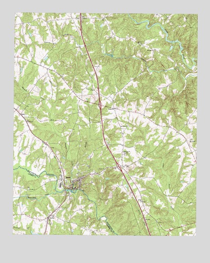
Enoree, SC USGS Topographic Map
Click on map above to begin viewing in our Map Viewer.

This topographic map contains these locations and features:
Feature Name Type Latitude Longitude GNIS ID View Map
Aiken BranchStreamN34.7485°W81.8970°1220142View Map
Antioch ChurchChurchN34.6887°W81.9904°1220220View Map
Antioch School (historical)SchoolN34.6815°W81.9857°1248088View Map
Beaver Dam School (historical)SchoolN34.6504°W81.9898°1234744View Map
Beaverdam ChurchChurchN34.6504°W81.9893°1245020View Map
Beaverdam CreekStreamN34.6493°W81.9698°1245013View Map
Bethany Church (historical)ChurchN34.6849°W81.8865°1248110View Map
Buckhead CreekStreamN34.6260°W81.9298°1221080View Map
Casey Pearson School (historical)SchoolN34.7146°W81.9668°1248176View Map
Cavins School (historical)SchoolN34.7487°W81.9612°1248178View Map
Cedar Grove ChurchChurchN34.6715°W81.9243°1245699View Map
Cedar Shoals ChurchChurchN34.6868°W81.9220°1221467View Map
Crows (historical)Populated PlaceN34.7035°W81.9537°1248233View Map
EnoreePopulated PlaceN34.6565°W81.9651°1247676View Map
Enoree BridgeBridgeN34.6501°W81.9640°1222295View Map
Enoree Census Designated PlaceCensusN34.6593°W81.9609°2629824View Map
Enoree DivisionCivilN34.6741°W81.9092°1938261View Map
Enoree Fire DepartmentBuildingN34.6546°W81.9647°2578166View Map
Enoree StationLocaleN34.6565°W81.9665°1248033View Map
EvinsvillePopulated PlaceN34.6837°W81.8879°1248244View Map
Freewill ChurchChurchN34.6623°W81.9379°1222560View Map
Grace Recreation PondReservoirN34.6251°W81.9837°1237900View Map
Hannah CreekStreamN34.6635°W81.9587°1245901View Map
Harrelson BranchStreamN34.7426°W81.8993°1223051View Map
Hedden PondReservoirN34.6275°W81.9590°1240202View Map
Hedden Pond Dam D-2981DamN34.6268°W81.9598°1240201View Map
Hills BridgeBridgeN34.7343°W81.8904°1248321View Map
HillsvillePopulated PlaceN34.6626°W81.9665°1248322View Map
Hobbysville Fire DepartmentBuildingN34.6966°W81.9280°2578174View Map
HobbyvillePopulated PlaceN34.6968°W81.9315°1246004View Map
Hobbyville School (historical)SchoolN34.6943°W81.9176°1248325View Map
Horseshoe BendBendN34.7243°W81.8776°1248335View Map
Interchange 35CrossingN34.7474°W81.9545°1228181View Map
Interchange 38CrossingN34.6987°W81.9409°1228182View Map
Interchange 41CrossingN34.6637°W81.9276°1228183View Map
KilgorePopulated PlaceN34.6929°W81.9954°1223729View Map
LanfordPopulated PlaceN34.6335°W81.9748°1246292View Map
Lanford Baptist ChurchChurchN34.6360°W81.9732°1234864View Map
Lanhams School (historical)SchoolN34.7382°W81.9323°1248357View Map
Laytons Store (historical)LocaleN34.6929°W81.9112°1248362View Map
Liberty Ridge School (historical)SchoolN34.6712°W81.9259°1248369View Map
Ligons BridgeBridgeN34.6557°W81.9701°1234880View Map
Littlefield ChurchChurchN34.7043°W81.9059°1248377View Map
McKees Mill (historical)LocaleN34.6507°W81.9598°1248394View Map
Miles Store (historical)LocaleN34.6912°W81.9293°1248403View Map
Mount Alexander ChurchChurchN34.7479°W81.9523°1248416View Map
Mountain ShoalRapidsN34.6495°W81.9592°1248429View Map
Mountain Shoals PlantationLocaleN34.6535°W81.9651°1248430View Map
New Hope ChurchChurchN34.7293°W81.9051°1224994View Map
New Prospect ChurchChurchN34.6793°W81.8793°1225019View Map
New Prospect School (historical)SchoolN34.6818°W81.8840°1248444View Map
Patterson ChapelChurchN34.6523°W81.9720°1234931View Map
South Carolina Noname 30012 DamDamN34.6285°W81.9998°1237898View Map
Southern Aero Sports AirportAirportN34.6284°W81.8982°1251885View Map
T B Pierce Pond Dam D-3389DamN34.7318°W81.8915°1240414View Map
Tabernacle ChurchChurchN34.7332°W81.9148°1227014View Map
Trinity ChurchChurchN34.6443°W81.9120°1227210View Map
Trinity School (historical)SchoolN34.6526°W81.9151°1248638View Map
Triple Tree AirportAirportN34.6748°W81.9959°2650823View Map
Twomile CreekStreamN34.6498°W81.9573°1227270View Map
Unity Baptist Church CemeteryCemeteryN34.7469°W81.9575°1808606View Map
Unity ChurchChurchN34.7474°W81.9576°1248646View Map
Vise BranchStreamN34.7457°W81.9134°1227349View Map
W H Tiller Junior Pond Dam D-3388DamN34.7418°W81.9415°1240413View Map
W Hudson Pond Dam D-3387DamN34.7251°W81.9765°1240412View Map
Waldrop CrossroadsPopulated PlaceN34.6640°W81.9248°1248657View Map
Willis Grove School (historical)SchoolN34.7210°W81.9745°1248693View Map
Wofford BranchStreamN34.7493°W81.8976°1227672View Map
WSSL-FM (Gray Court)TowerN34.7229°W81.9859°1252492View Map

Note: Coordinates in the location and feature list above are referenced to NAD83 datum.


Copyright (C) 2008-2024 Ryan Niemi / Sunset Dynamics ... All Rights Reserved