TopoQuest Logo
Do you find TopoQuest useful?
Help keep TopoQuest running and adding new maps/features by donating!
Bitcoin:  19c7KJd3qBynnjoSw5npx9KScwjBe4ifkT
Litecoin:  LXs6TkuXGGXo1vDsWCkWVdjQX94eUKd6ui
Home View Maps Find Maps Find Places Resources & Links


Eminence, Missouri Topographic Map

USGS Map Title: Eminence, MO
USGS Map MRC: 37091B3
DRG (GeoTIFF) Download: o37091b3.tif


Neighboring USGS Topographic Map Quads:


  Round Spring, MO  
37091C4
 

  The Sinks, MO  
37091C3
 

  Midridge, MO  
37091C2
 

  Alley Spring, MO  
37091B4
 

  Eminence, MO  
37091B3
 

  Powder Mill Ferry, MO  
37091B2
 

  Bartlett, MO  
37091A4
 

  Winona, MO  
37091A3
 

  Stegall Mountain, MO  
37091A2


Map MRC Location:

N38°
W92°
N38°
W91°
H8 H7 H6 H5 H4 H3 H2 H1
G8 G7 G6 G5 G4 G3 G2 G1
F8 F7 F6 F5 F4 F3 F2 F1
E8 E7 E6 E5 E4 E3 E2 E1
D8 D7 D6 D5 D4 D3 D2 D1
C8 C7 C6 C5 C4 C3 C2 C1
B8 B7 B6 B5 B4 B3 B2 B1
A8 A7 A6 A5 A4 A3 A2 A1
N37°
W92°
N37°
W91°

Eminence, MO USGS 1:24K Topographic Map Preview:
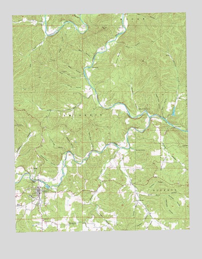
Eminence, MO USGS Topographic Map
Click on map above to begin viewing in our Map Viewer.

This topographic map contains these locations and features:
Feature Name Type Latitude Longitude GNIS ID View Map
Asher BranchStreamN37.2345°W91.3018°713428View Map
Bald Knob HollowValleyN37.1712°W91.3183°713592View Map
Barn HollowValleyN37.1899°W91.2682°713657View Map
Barn HollowValleyN37.2238°W91.3170°713658View Map
Bay BranchStreamN37.2378°W91.3499°713750View Map
Bee BluffCliffN37.2378°W91.2951°739895View Map
Bee Bluff School (historical)SchoolN37.2428°W91.2954°760064View Map
Bethany ChapelChurchN37.1423°W91.2876°714014View Map
Big CreekStreamN37.2482°W91.3263°748830View Map
Bunch CemeteryCemeteryN37.2300°W91.3115°715037View Map
Buttin RockCliffN37.1545°W91.3629°715135View Map
Cave HollowValleyN37.2132°W91.3233°715520View Map
Cedar Pole HollowValleyN37.1913°W91.2724°715615View Map
Chilton CemeteryCemeteryN37.1550°W91.3483°715786View Map
City of EminenceCivilN37.1509°W91.3587°2394687View Map
Colwil DamDamN37.1917°W91.2618°763648View Map
Colwil LakeReservoirN37.1928°W91.2601°763649View Map
Conley HollowValleyN37.1420°W91.2867°716195View Map
Coot ChuteRapidsN37.1817°W91.2504°736235View Map
Coot MountainSummitN37.1725°W91.2515°716292View Map
Coppermine HollowValleyN37.1625°W91.3437°716304View Map
Dark HollowValleyN37.2156°W91.3241°716671View Map
De Weese SchoolSchoolN37.1306°W91.3199°747791View Map
Despain HollowValleyN37.1348°W91.2790°749631View Map
Dry HollowValleyN37.2075°W91.3189°717122View Map
Dugan HollowValleyN37.2415°W91.3405°717159View Map
Ebb and Flow SpringSpringN37.1948°W91.2851°717373View Map
EminencePopulated PlaceN37.1506°W91.3576°717575View Map
Eminence Lookout TowerTowerN37.1867°W91.3735°755173View Map
Eminence Post OfficePost OfficeN37.1441°W91.3585°2782697View Map
Eminence Rural Fire DepartmentBuildingN37.1429°W91.3596°2620393View Map
Fursman SpringSpringN37.1712°W91.2879°718299View Map
Grassy CreekStreamN37.2459°W91.3512°718719View Map
Hay HollowValleyN37.1375°W91.3170°750266View Map
Hog Cave HollowValleyN37.1448°W91.2680°719672View Map
Jacks ForkLocaleN37.1834°W91.2668°735969View Map
Jacks ForkStreamN37.1900°W91.2774°750476View Map
Jerktail LandingLocaleN37.2306°W91.3085°758568View Map
Jerktail MountainSummitN37.2228°W91.2998°720307View Map
Junction FerryPopulated PlaceN37.1900°W91.2679°740976View Map
Kelsaw HollowValleyN37.1691°W91.2643°720523View Map
Lick Log HollowValleyN37.1704°W91.3385°721043View Map
Little Shawnee CreekStreamN37.1725°W91.2924°750799View Map
Little Shawnee School (historical)SchoolN37.1570°W91.2932°747794View Map
Lower Grassy CemeteryCemeteryN37.2448°W91.3529°721641View Map
Matthews BranchStreamN37.1884°W91.2654°721978View Map
McCabe HollowValleyN37.1686°W91.3321°722029View Map
Mill HollowValleyN37.2478°W91.2941°722350View Map
Missouri Department of Conservation District Forester OfficeBuildingN37.1698°W91.3537°736232View Map
Missouri Department of Conservation Forestry Ozark Regional Field Fire Facility Office EminenceBuildingN37.1629°W91.3547°2620626View Map
New Eminence CemeteryCemeteryN37.1295°W91.3571°723192View Map
Nichols HollowValleyN37.1456°W91.2816°723361View Map
Odell HollowValleyN37.1312°W91.2764°751408View Map
Prairie HollowValleyN37.1849°W91.2632°724861View Map
Prairie Hollow SchoolSchoolN37.1634°W91.2593°747793View Map
Saint Sylvester ChurchChurchN37.1317°W91.3554°725904View Map
Shannon County Sheriff's OfficeBuildingN37.1485°W91.3582°2752537View Map
Shawnee CreekStreamN37.1728°W91.3004°752100View Map
Shawnee Creek CampsiteLocaleN37.1731°W91.2915°736233View Map
Slater SpringSpringN37.1298°W91.3318°726536View Map
Slick Rock HollowValleyN37.1458°W91.2868°726548View Map
Storys CreekStreamN37.1578°W91.3693°727158View Map
Sutton CreekStreamN37.2039°W91.3154°727350View Map
Sutton Creek SchoolSchoolN37.1939°W91.3182°747792View Map
Thompson CreekStreamN37.1934°W91.2796°727602View Map
Tip Top MountainSummitN37.2419°W91.3084°727676View Map
Township of Buckeye (historical)CivilN37.1439°W91.2529°767396View Map
Township of EminenceCivilN37.1861°W91.2897°767398View Map
Twin RocksIslandN37.2192°W91.3201°727930View Map
Two Rivers River AccessLocaleN37.1920°W91.2685°736234View Map
Werfield HollowValleyN37.1450°W91.2655°728511View Map
West EminencePopulated PlaceN37.1403°W91.3746°728548View Map
Williams CemeteryCemeteryN37.2431°W91.3240°728884View Map

Note: Coordinates in the location and feature list above are referenced to NAD83 datum.


Copyright (C) 2008-2024 Ryan Niemi / Sunset Dynamics ... All Rights Reserved